Waterway wandering: England’s prettiest canal walks
Take it slow and savour these pockets of tranquility.
Weaving their way across England’s landscape, canals are perhaps the epitome of the Slow Travel movement. Whether you take to the waters or remain with two feet firmly on the towpath, these tranquil waterways encourage you to slow down, savour your surroundings and reconnect with nature.
So, if you’re looking for ways to pack in your daily dose of exercise and get some fresh air while you’re at it, why not consider one of these picturesque canal walks?
Kennet & Avon Canal
Passing through the gorge-like and forested Limpley Stoke Valley, the Kennet and Avon Canal attracts visitors with its stirring Cotswolds’ backdrop. Indeed, explorers of the area are spoilt for choice, with the entire length of the canal and its towpath between Bradford-on-Avon and Bath accessible to boaters, cyclists and walkers.
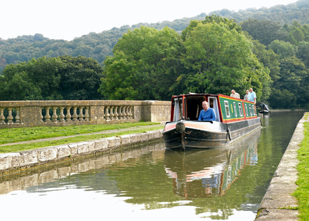
Within a matter of three miles, the canal boasts two aqueducts – the Avoncliff and Dundas – carrying water sky high over the railway and the Avon. Both notable feats of engineering, their existence stopped the requirement for numerous locks and makes a boat journey much less arduous.
Recommended walk: Brassknocker Basin and the two aqueducts
Those not walking from Bath or Bradford-on-Avon can park in the small car park at the Brassknocker Basin to reach the Dundas Aqueduct. This is where the former Somerset Coal Canal joins with the Kennet and Avon, a link to carry ‘black gold’ from the Somerset coalfields to Bath and Bristol.
The Dundas aqueduct, with its smooth balustrading above the river, is visible from the basin. Representing beauty in industrial design, it was built in the 18th century from Bath stone. Continue along the towpath for approximately three miles to reach Avoncliff – the second aqueduct – and then circle back to complete the looped walk.
Bridgewater & Taunton Canal
Although no longer linked to any other waterway, the Bridgwater and Taunton Canal, which extends for 14 miles between the River Parrett in Bridgwater and the River Tone in Taunton, was built in 1827 as part of a more ambitious scheme to link Bristol with south Devon.
Although it was an important artery for the transportation of goods, particularly coal and iron from South Wales, the canal’s importance dwindled and commercial traffic ceased in 1907.
These days, the towpath makes for excellent walking and cycling (it’s part of the River Parrett Trail and National Cycle Route 3), with numerous access points along its length – useful if you don’t fancy starting in either Taunton or Bridgewater Docks.
Along the canal, you won’t fail to notice the occasional pill box; these were part of the so-called Taunton Stop Line, a World War II defensive frontier that ran from an area just north of Bridgewater in Somerset to Seaton in south Devon – some 50 miles in total.
Recommended walk: Somerset Space Walk
Somewhat randomly, the towpath is intermittently lined with scale models of the solar system, an installation entitled the Somerset Space Walk. Kids in particular will have fun identifying the various planets.
The sun lies at the halfway point, Maunsel Lock, itself a convenient spot to pause and take in your surroundings. There’s plentiful wildlife here too – if your luck’s in, you may even spot herons or kingfishers.
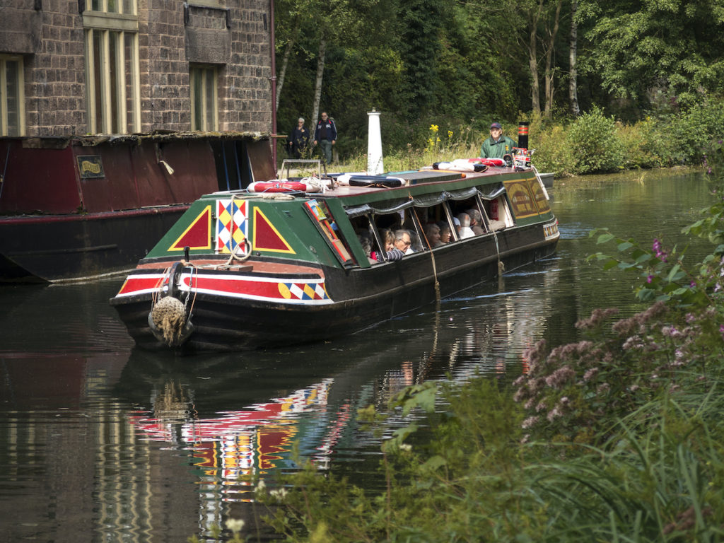
Leeds & Liverpool Canal
The Leeds and Liverpool Canal is a big draw in the Yorkshire town of Skipton, whether you’re chugging along it on a narrowboat, strolling beside it on the towpath or just watching other people chug or stroll.
The most attractive bit of the canal is a small dead-end offshoot called the Spring Branch that curls around the back of Skipton Castle giving walking access to Skipton Woods. This is well worth a potter, especially in the spring when the carpets of wild garlic and bluebells beneath the trees are at their peak.
Recommended walk: Skipton to Saltaire
If you fancy more than a short stroll, this longer walk (approximately 15 ½ miles) from the lively market town of Skipton to the 19th-century World Heritage Site of Saltaire is just the ticket. The canal towpath passes through tranquil woodland, productive farmland, local villages and – most remarkably of all – Britain’s steepest flight of Locks, Five Rise Locks at Bingley.
Additionally, just after the village of Low Bradley, you will pass a poignant memorial to seven Polish airmen who were killed when their Wellington bomber crashed nearby in 1943.
Grand Union Canal
Stretching for 137 miles from Birmingham to London, the Grand Union Canal was initially built so as to provide a direct link between England’s capital and its industrial heartlands.
It runs south across the Aylesbury Plain until massive engineering works take it up the steep Chiltern escarpment near Tring. To feed the 56 locks at this stretch several reservoirs were needed, with pumping engines to lift the water to the summit.
The section of the canal that runs through the Chilterns is a quiet stretch – good for walkers. You can likely find flowering rush, yellow water-lily and spurge-laurel, while herons are commons and mandarin ducks are often seen.
Recommended walk: Watford to Kings Langley
‘Danger Crocodiles’, improbably announces a sign to deter swimmers by a lock-keeper’s cottage on this fascinating canal walk close to the M25 which takes in a king’s burial place as well as a Star Wars film location – and even a replica Loch Ness Monster.
It might seem off-putting that the walk passes right under the M25, but once you get used to the background noise the motorway’s monumental presence is actually a striking feature of the route.
Cromford Canal
At the height of the Industrial Revolution, barges plied this Peak District canal stacked high with coal and limestone. Nowadays this sleepy backwater filled with plants and waterweed is the domain of coots, little grebes and moorhens.
The canal once extended almost 15 miles to the Erewash Canal through four tunnels and 14 locks, but now ends just beyond Ambergate, a stretch of five miles. Today the industrial monuments that line the canal route blend comfortably with this wildlife oasis, an SSSI (Site of Special Scientific Interest).
Recommended walk: High Peak Junction
From the canal end at Cromford Wharf, you can walk the two-mile towpath to High Peak Junction, where you meet the end of the High Peak Trail as it drops down the inclined plane to meet the canal.
The picnic tables that line the grassy verge beside the canal are a prime spot for observing river life, from the swing bridge operator to the canal boat and waterfowl that drift past. You might even spot one of the water voles that inhabit the canal banks below.
Macclesfield Canal
Wandering along the Macclesfield Canal towpath, it’s hard to believe the waterway almost faced closure in the 1960s. Nowadays it’s busy with narrowboats, ramblers and strollers, particularly in the summer months.
Past Macclesfield’s scruffy riverside development, the corridor of green is only interrupted by old snake bridges and the occasional marina. At Higher Poynton, canal boats sit cheek by jowl with whimsical and romantic names. It’s a place where life goes by very slowly indeed – and its infectious, watching the boats plough the waterway.
Recommended walk: Middlewood Way
It may not have the drama of the Peak District National Park’s dismantled railways, but this ten-mile traffic-free trail for walkers, horseriders and cyclists, with the Macclesfield Canal and Peak District on one side and the Cheshire Plains farmlands on the other, is very pleasant.
This route is largely flat, making it perfect if you’re after a gentle stroll rather than a more taxing climb. You can download a copy of the Middlewood Way leaflet, which also includes details of the canal path.
More information
If you’re eager to discover more canal walks in your local area, take a look at our comprehensive Slow Travel guides: