Get yourself out of the car, off the tarmac and under the skin of this wonderful place. You will feel cares and troubles drain away as you stride the fells, ride a steam train or snooze under canvas.
Mike Bagshaw, author of Slow Travel Yorkshire Dales: the Bradt Guide
It should come as no surprise that the Yorkshire Dales was one of the first areas of England and Wales to be designated as a national park. To its many friends and advocates (a diverse group of people that includes myself) though, it is more than just a national park; it is a national treasure.
What makes it so special is its distinctive character. Pick a view from any fellside up or down the nearest valley and you could not mistake it for anywhere else in the country. Even the villages, with their wide sheep-grazed greens and sturdy old buildings, have a unique ‘dalesness’ about them.
Limestone is the key to this distinction; the fells are rooted on it, climbers climb upon it, walkers stride over it, cavers crawl through it, and naturalists marvel at the flora that thrives on the soil produced by it. It even makes up the fabric of our edifices – houses, barns, cairns and, of course, those famous dry-stone walls are all made from it.
Whatever your reason for visiting the Dales, whether it is to scale one or more of the Three Peaks, steam through on the Settle to Carlisle Railway, cheer on the Tour de France cyclists, or enjoy a relaxing short break in a remote farmhouse, you’ll be sure to have a memorable stay.
Bradt on Britain – our Slow Travel approach
Bradt’s coverage of Britain’s regions makes ‘Slow Travel’ its focus. To us, Slow Travel means ditching the tourist ticklists – deciding not to try to see ‘too much’ – and instead taking time to get properly under the skin of a special region. You don’t have to travel at a snail’s pace: you just have to allow yourself to savour the moment, appreciate the local differences that create a sense of place, and celebrate its food, people and traditions.
or more inforamtion, check out our guide to the Yorkshire Dales:
Food and drink in the Yorkshire Dales
Agriculturally, the Yorkshire Dales is primarily a pastoral region, so it’s no surprise that the best-known local produce originates from cattle or sheep. Milk from local dairy herds that isn’t drunk (by calves or humans) has, for hundreds of years, been the main ingredient of a variety of local cheeses that often take the name of their valley of production. Wensleydale is by far the most well known but Coverdale, Swaledale and Ribblesdale all have their own distinct recipes, and a trio of artisan dairies are still making the proper stuff.
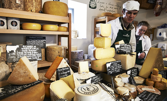
The Wensleydale Creamery is in Hawes, as is the much smaller Ribblesdale Cheese Company, while Reeth in Swaledale is the home of Lacey’s Cheese. Beginners courses in cheesemaking can be done at Ribblesdale and Lacey’s and also at the Courtyard Dairy near Austwick, which also boasts a wonderful cheese shop and museum. One other excellent cheese shop deserving a mention is the Churchmouse at Barbon.
A local Dales dairy product less traditional Yorkshire than cheese, but just as popular, is ice cream. Delicious farm-produced ice cream can be slurped at Sedbergh, Bolton Abbey, Richmond and Risplith.
Not all the cattle in the Dales belong to dairy herds; higher up the fellsides beef cattle predominate and the best limestone beef can be bought direct from the producers at Town End Farm in Malhamdale, Whaitber Farm near Ingleton and Springhill Farm near Masham. When it comes to meat though, it’s lamb and mutton for which this part of the country is famed – there are nearly half a million sheep here, after all. Every Dales town or village butcher will sell locally reared lamb, and maybe mutton if you’re lucky, but there is something satisfying about buying it direct from the farm itself and that’s just what you can do at: Gillgate Farm, Askrigg, Hazel Brow Farm, Reeth, Heber Farm, Buckden and Unthank Farm, Constable Burton.
Great quality fish can also be found in the Dales, rainbow trout from Kilnsey Trout Farm and, perhaps surprisingly so far from the coast, fresh sea fish at the Grantley Arms, Nidderdale. Notable seafood restaurants are The Fleece, Addingham, the Wensleydale Heifer, West Witton and the aforementioned Grantley Arms. For top-quality restaurant food across the board it’s hard to argue with the judges at Michelin for awarding a star to the Yorke Arms at Ramsgill.
The climate of the Yorkshire Dales doesn’t lend itself to wine or cider production, so beer tends to be the tipple of choice, with 16 breweries operating in the area. They range from household names like the Theakstons and Black Sheep breweries of Masham down to barn-behind-the-pub micro-breweries like the wonderful Dark Horse Brewery in Hetton.
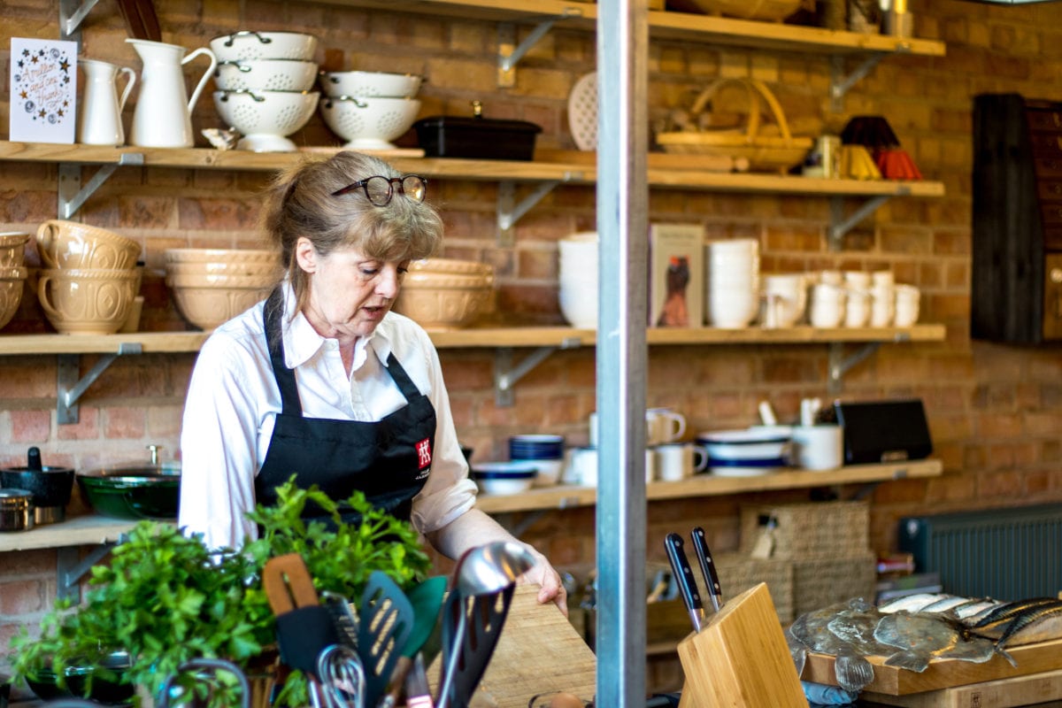
Learning how to cook like the experts has become very popular in recent years and two venues here offer cookery schools all year round: Bettys in Harrogate and Swinton Park near Masham.
Travel to the Yorkshire Dales
Getting there and around
Car-free travel
Most people get here and travel around within the area by car. However, a growing number of visitors to the Dales are doing it without their cars. Car-free travel is at the root of the Slow mindset. And, planned well and done properly, can be a really liberating experience. The national park authority are very supportive of this idea – not surprisingly, they want more people in the park but fewer cars, so they have a whole section of their website devoted to encouraging this.
By train
As you would expect from a mountainous region, railways tend to skirt the edges, getting you to outlying towns and villages like Skipton, Settle, Clapham, Richmond, Northallerton, Harrogate and Knaresborough, but not into the interior. The one glorious exception is the Settle to Carlisle line, which ploughs straight through the middle of the Dales, giving access to Horton in Ribblesdale, Dentdale, Garsdale/Wensleydale heads and Kirkby Stephen.
A couple of short, private railways add to the picture, but because they are not fully linked to the National Rail system, they are not of huge use to car-free travellers. To be fair though, the operators of the Embsay line are working hard to join it up to Skipton, as are the Wensleydale Railway Association to Northallerton.
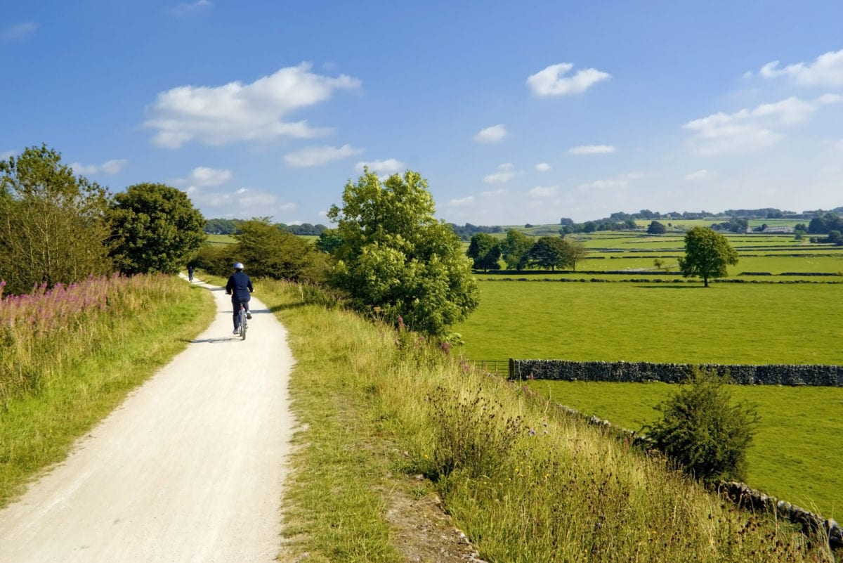
We could moan at length about the inadequacies of our National Rail system (and I often do) but one aspect they need hearty congratulations for is the free transport of bikes rule. This facility opens up so many doors for cyclists, who either don’t own a car or are tired of doing circular routes back to the hire shop. Using the train to gain altitude and save your legs is a good ploy; you could for instance, take your bike on the train to Ribblehead and freewheel back to Settle or Clapham via Ingleton. Likewise, Dent Station gives a nice quiet run down to Sedbergh and Oxenhome Station beyond. Garsdale Station allows a similar downhill trip to Kirby Stephen.
By bus
Without a bike in tow you also have the bus network at your disposal (some buses advertise bike transport but as there is a limit of three per bus you can’t rely on it).There’s a handy summary of services under ‘Visit the Dales’ on www.yorkshiredales.org.uk. Peripheral towns usually have very good bus links to the outside, especially if they have no railway station.
All the other smaller places up the Dales are served by the Dales Explorer Bus. Almost every hamlet gets a visit at some time, even if it is just once a week in summer, like poor old Scar House in Nidderdale. Many routes operate weekdays, and all year round, but quite a few extra leisure services are put on for the summer months (Easter to October). And these are usually only Sundays and bank holidays.
Various fare concessions are out there, and probably the best on offer is the Dales Rover Ticket, giving you unlimited bus journeys for the day within the Dales, and deals from many local businesses like cafés, pubs, B&Bs and attractions. If they display a ‘Dales Bus Discount Scheme’ sticker you will get some freebee or other, even if it’s only a cup of tea.
By boat
Unless you count the rowing boats on the River Nidd at Knaresborough, the Leeds and Liverpool Canal at Skipton is the one and only boating venue in the Dales, but it does offer a variety of options. You can join half-hour or one-hour trips in and around town, or hire a boat for a day, weekend or entire week. Westwards is the more rural and unspoilt direction to sail from Skipton, but even this choice turns away from the Dales and into the lowlands on its journey towards Lancashire; a tour of farm country – nice and certainly Slow, if tame.
By bike
The Yorkshire Dales has always been a popular destination for road cyclists, many pedalling along the two well-established touring routes that pass through the region. The Way of the Roses route, coast to coast from Morecambe to Bridlington, traverses the region from west to east, while the Pennine Cycleway does the same from south to north on its way between Derby and Berwick-upon-Tweed (the routes cross at Settle). Another very popular loop entirely within the area is the Yorkshire Dales Cycleway. It is designed to be started and finished at Skipton but as it is circular it can, of course, be initiated anywhere along its length. An optional extra 20-mile section was added in 2016 to sample the new part of the national park in the west. The Park has produced a handy little pamphlet, Cycling in the Yorkshire Dales National Park, to introduce these routes but by far the best source of information is their website.
 Hundreds of cyclists take part in the extremely successful Tour de Yorkshire every year © Nidderdale Chamber of Trade/Kirsty Shepherd
Since 2014 there has been something of a cycling revolution in Yorkshire which has boosted participation even more. It all stems from the massively successful leg of the Tour de France which took place in the county during two mad days in July 2014. The first ‘Yorkshire’ day was a 110-mile pedal starting in Leeds, travelling up most of Wharfedale and down most of Wensleydale, with a brief visit to Swaledale before finishing at Harrogate. Many die-hard amateur bikers have ridden the whole of the original route but the ‘Cycle the Dales’ people at the national park have come up with a great 80-mile circular route from Grassington, called Tour de France in the Dales, which includes the best of the original without its long ‘A’ road sections.
Such was the impact of ‘Le Grand Depart’ that Welcome to Yorkshire have been inspired to recreate it every year since, but over three or four days in late spring. The original two-day Tour was restricted to the Dales and Pennines but the new ‘Tour de Yorkshire’ zooms along different Yorkshire routes every year. The long-term impact of all this has been astounding, with hundreds more people taking to their bikes to go to work, keep fit or just have fun with the family. This is great news for the cycling visitor to the region because bike-hire venues and cycle shops are popping up all over the place. Not only that, other providers like B&Bs, cafés and pubs have realised that it’s worth their while to be as bike-friendly as possible. Everyone’s a winner!
What to see and do in the Yorkshire Dales

The riverside site of Bolton Abbey ranks as one of the most awe-inspiring positions for an abbey anywhere © Anneka, Shutterstock
Craven and Wharfdale
This southernmost part of the Yorkshire Dales only just makes it into North Yorkshire, and its closeness to the big cities of Leeds and Bradford makes it probably the most visited region in the national park. Three rivers drain south here: the Ribble, which then escapes westwards into Lancashire, the Aire, and the longest of the Dales watercourses, the Wharfe.
Wharfedale’s corridor-like nature sets it apart from the other Yorkshire Dales, that and the river that created it. If forced into a choice, I would have to plump for the Wharfe as my favourite Yorkshire river. Its deep, clear pools, strids, riffles and cascades provide unsurpassed variety of watery landscape, and arguably the richest wildlife in all of the national park. Craven, the wild acres of high land to the west of Wharfedale, is a geological wonderland of all things limestone: pot-holes, ‘clint and grike’ pavements, disappearing rivers, collapsed caverns and amphitheatres – it’s all here, and at its most spectacular around Malham.
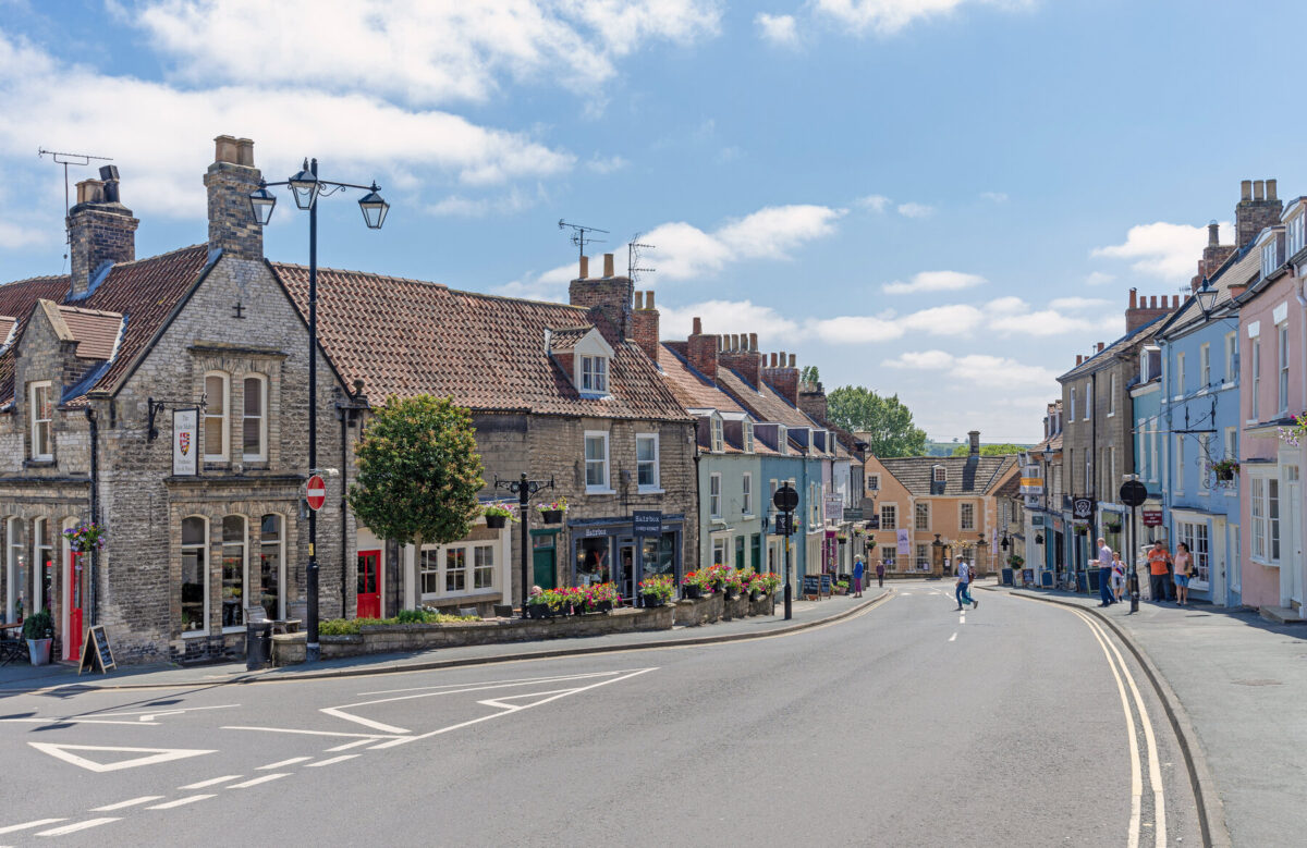
While for the most part the individual dales of the Yorkshire Dales fit into easily identifiable chunks of scenery, the Craven district is a strangely nebulous idea with no neatly defined edges. I take it as stretching from the River Ribble in the west, handy as ‘Ribble’ means boundary in Anglo-Saxon, to the catchment of the Wharfe in the east. The small town of Settle sits along the east bank of the Ribble with the frivolously named Giggleswick on the opposite side. Behind Settle the land rises steeply at the start of well over 100 square miles of wild upland dominated by carboniferous limestone.
Further upstream, Wharfedale heads between the high fells beyond the twin villages of Kilnsey and Conistone, splitting into the two arms of Littondale and Langstrothdale which then wrap around the top of Craven in a cosy embrace. Usually, as you head up a hillcountry valley, settlements become sparser and smaller; Wharfedale does not deviate from this norm, and beyond Grassington there is nothing even remotely resembling a town.
 Knaresborough perches on the steep bank above the River Nidd © Prakich Treetasayuth, Shutterstock
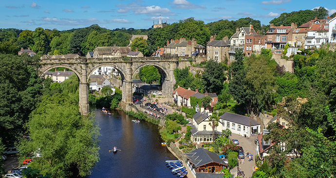
Nidderdale, Harrogate & around
Swaledale, Wensleydale or Wharfedale would, I’m sure, be the first to be mentioned if someone was asked to name one of the Yorkshire Dales in a pub quiz. But Nidderdale? It tends to play second or even third fiddle to the better-known dales. It isn’t actually in the area designated as the Yorkshire Dales National Park at all. Hence the main throng of tourists tends to bypass Nidderdale, heading straight for the national park: in Nidderdale, the absence of visitors is almost tangible.
It is indeed strange that Nidderdale hasn’t been included within the park boundary. The spectacular countryside around the dale is designated as an Area of Outstanding Natural Beauty. The hills that fall across the border between national park and AONB status are the same hills making up the same landscape. Yet Nidderdale is a game of two halves. To the northwest, and closest to the Yorkshire Dales National Park, lies Upper Nidderdale. It’s an area that becomes increasingly rugged and remote the further back along the valley you go. It pulls you like a magnet, drawing you further into its midst, tempting you with an ever-changing panorama at every turn, rise and fall. With only one small road that leads to nowhere, the hills of Little Whernside and its giant neighbour Great Whernside creating a wall between Nidderdale and Coverdale, there is no through traffic, unless you happen to be on foot or on horseback. A string of pearly reservoirs line the route of the River Nidd from the foot of its source, Great Whernside. These watering holes, quenching the thirst of residents in far-flung Bradford, are interspersed with tiny hamlets. The place is so remote that a good guess would be required as to why anyone should have set up camp here years ago but now they have, it’s easy to understand – for its quality of life that surpasses many others.
Further east, Nidderdale bottoms out, the hills recede and the land flattens. At least, the undulations are less undulating, the distance between villages decreases and the land becomes more cultivated. It’s not until you reach Knaresborough, a good 30 miles from the river’s source (and even longer if you stretched out the Nidd’s meandering tendencies into a pencil-straight line), that you get any serious habitation although the elegant town of Harrogate, joined at the hip with Knaresborough on its eastern side, now sprawls further north and west towards the edge of Nidderdale AONB with a plethora of housing developments.
Past Knaresborough, the Nidd continues for a few more meandering miles east before it disappears for good, its waters mingling with those of the more northerly Swale and Ure to form the mightier Ouse. The Nidderdale AONB also swallows up the most southeasterly section of Wensleydale. Like its counterpart of Upper Nidderdale, the land furthest west begins harsh and inhospitable on top of Masham Moor before it drops down to greener pastures, great swathes of estate forests and a web of tiny tributaries that gurgle towards the Ure.
Swaledale
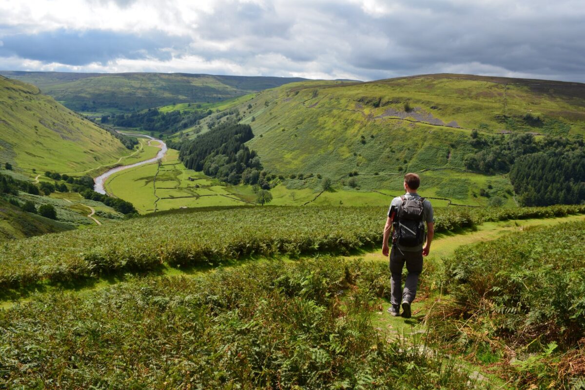
The Yorkshire Dales vary in character, with each valley possessing its own unique quirks, but Swaledale always seems to me more different than the others. It is a dale apart, with much more of a northern feel to it: place names are almost all unadulterated Norse, woods are few and far between, and people almost as thin on the ground. Swaledale is the least populated of the Dales, with no towns at all above Richmond, and no main roads. It is quiet and wild and for those reasons alone is many people’s favourite.
For the past thousand years Swaledale’s economy and landscape has been shaped by two things, sheep and lead. The lack of trees is down to historical forest clearance for grazing but doesn’t come close to the devastation wrought by the huge lead-mining industry of the 18th and 19th centuries. Most of the Yorkshire Dales still bear the scars of this former activity, but Swaledale more than most.
The dale takes its name from the River Swale which bubbles into life high on the flanks of High Pike Hill, but only earns its name down in the valley, just above the village of Keld. It careers downhill, leaping over waterfalls at every opportunity, past the villages of Muker and Gunnerside and catching its breath a little at Reeth. This is the largest village and unofficial capital of Upper Swaledale and Arkengarthdale, sitting as it does at the point where the two valleys meet. During the next nine miles, the river gets its second wind, speeding up and racing on through the rapids at Marrick Priory to arrive in style at Town Falls in Richmond below the walls of the castle.

The Cumbrian corner
The northwestern corner of the Yorkshire Dales National Park is made up of three separate upland massifs, each with a very different character: the Howgill Fells, Baugh and Wild Boar Fells, and the Westmorland Scars. Most of the watercourses here drain southwestwards into the River Lune but in the north the beautiful River Eden flows in the opposite direction through Kirkby Stephen on its way towards Carlisle and the Solway Firth.
Although all of the land in this area falls within the recently extended national park, in a quirk of local government border setting, virtually none of it is Yorkshire soil. It was part of the old county of Westmorland and is now administered by Cumbria County Council.
As well as being the newest part of the national park, the Cumbrian corner is without doubt the quietest. Even at the peak of the tourist season when thousands of people are queueing to climb the Three Peaks and Wensleydale’s tea shops are bursting at the seams, it is still possible to stride along Mallerstang Edge or explore the flora of Great Asby Scar National Nature Reserve without seeing another person all day.

Three Peaks Country
Some of the highest land in Yorkshire lies on the western side of the Yorkshire Dales (which actually stray into Cumbria), where the rivers Dee, Skirfare, Greta and Ribble bubble into life. It is an area dominated by three great, brooding hills, Whernside, Ingleborough and Pen-y-ghent, that collectively give this area its unofficial name. Ironically, none of these flat-topped heights could remotely be called a peak but a much-tramped long-distance challenge walk linking the three coined the name and it has stuck.
The legendary walking-book author Alfred Wainwright, in his 1970 guide Walks in Limestone Country, said of the area: ‘This is a region unique, without a counterpart, but its charms are shyly hidden. Those who seek and find them are often enslaved, yet few visitors come looking.’ He would probably be astonished and appalled at the numbers of visitors that do come now, but his observation that a little bit of searching can reveal enchanting hidden places still holds true. Some of my first real exploring as a schoolboy was done here, and the hidden places that I discovered then have left indelible marks, and remain very special to me.
This is not as uniform a region as the eastern Dales, but an area of borders, watersheds and transformations. Even before the 1974 county boundary changes bit off a huge chunk of the North Riding and called it Cumbria, Lancashire was never far away, and the local Yorkshire accent has a distinct ‘lanky’ twang to it. Most of the rivers flow west, to join the Lune, and eventually Morecambe Bay; and where the limestone runs out, the hills develop a distinctly Lake District feel to them.
Wensleydale
‘This is in most places waste, solitary, unpleasant, unsightly, mute and still.’ Poor old William Camden didn’t much enjoy his visit to Wensleydale in 1590. We tend to place more value on wilderness today, so much so that this valley is one of the most popular tourist destinations in Yorkshire, and in peak holiday season at least you would have to work hard to find the ‘solitary, mute and still’ elements. The main valley is the longest of the Yorkshire Dales, and, oddly, named after one of its smaller villages rather than its river, the Ure. The busy A684 runs most of its length, linking the bustling towns of Hawes, Leyburn, Middleham and Bedale, and honeypot villages of Bainbridge and Aysgarth. Wensleydale has a fascinating history and bags of charm; a visit to the museum at Hawes can give you an excellent insight into the area’s past, and traditions from quieter times.
To escape the crowds try heading away from the valley-bottom roads, up the fell-sides or into one of the tributary side valleys like Coverdale, Bishopdale or Raydale. Alternatively, visit the main valley at off-peak times, especially after heavy rain when its many waterfalls are at their most spectacular.
Related articles
This mini road trip packs in plenty of fascinating history and gorgeous scenery.
This is not a place geared to mass tourism, but that is exactly where its attraction lies.
Leave the car behind and explore Britain’s highways, byways and coastal pathways on two wheels.
A local’s guide to the region’s best rambles.
Take it slow and savour these pockets of tranquility.
How this new cookery school is putting Malton on the map.
These are some of our favourite green spaces to wander in England.