Oman’s UNESCO World Heritage Sites
With infrastructure and trade routes dating back thousands of years, it comes as no surprise that Oman has claimed five inscriptions on the UNESCO World Heritage List.
Oman is home to some of the most impressive UNESCO sites in the Middle East. Every one a must-visit, these spots demonstrate ancient Omani innovation and their penchant for building striking architecture in dramatic landscapes.
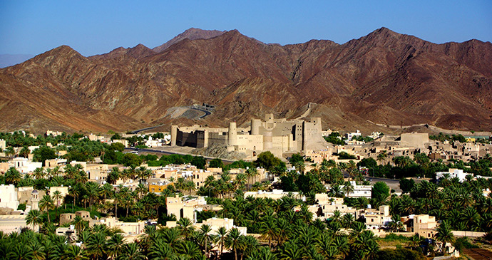
Bahla Fort
Rising majestically above oasis palms, Bahla Fort is Oman’s largest fortification, with archaeological remains dating back a mind-boggling 5,000 years. With its lofty hall, the main citadel in the southeast of the fort is the oldest area, perhaps dating from the late 13th century and the Al Nabhani dynasty. There are some attractive plaster decorations increasing the impression of faded grandeur. Excellent views can be had from the upper rooms, though the drops below some of the steps, which have no side barrier, mean care must be taken when exploring here.
UNESCO described it as ‘a monument of global importance’ when it was listed as a World Heritage Site. The UNESCO restoration project began in 1988 and work finally finished in summer 2012. This restoration task was enormous and the state of disrepair so advanced that when they began work, the first two years were spent clearing rubble. A dearth of old photos (pre-1960) also meant that they were unsure of what the original looked like in some parts. The oldest-known photo was taken by a British colonel, S B Miles, in 1885 and showed two incredibly tall wind towers, probably the tallest towers ever constructed in Oman. As is unfortunately the norm in Oman, there is no information in the fort.
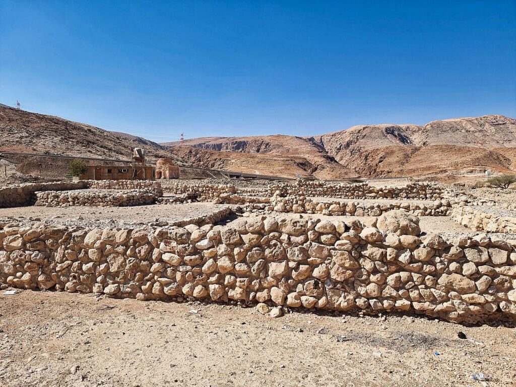
Bat, Al-Khutm and Al Ayn
The impressive megalithic towers and ‘beehive’ tombs of Bat, Al Ayn, and Al-Khutm date back to around 2700BC. The tower referred to as Al-Khutm, is set on a small rocky outcrop immediately to the south of the road and just to the east of Al Wahrah. This is the most recently excavated of these major towers, albeit partially.
Bat is renowned for its megalithic stone towers. Several have been excavated, most notably two towers called Qasr A’Rojoom 1145 and Qasr Al Khafaji 1146. Qasr A’Rojoom (also Kasr Al Rojoom) lies just to the south of the graded track below some restored tombs, most notably a white limestone- faced one that sits on the slope of a low hill. The well-crafted cone-shaped stones of this white limestone-faced tomb, are similar to the ones purloined from the location by British forces.
Al Ayn, which has 21 tombs lined in a row on the crest of a low hill of chert, the material that was used to build the tombs. Dating from the early to middle 3rd millennium BC, these tombs were not a burial place for a single individual; rather each was eventually used for dozens of people, as archaeologists have found from remains within the tombs.
Land of Frankincense
The Land of Frankincense refers to each of the instrumental elements that allowed the frankincense trade to flourish in the southern Dhofar region over 2000 years ago. Frankincense was used in religious rites and for medicinal purposes in most civilisations throughout the ancient world, and was arguably the first commodity to lead to the whole idea of international trade routes.
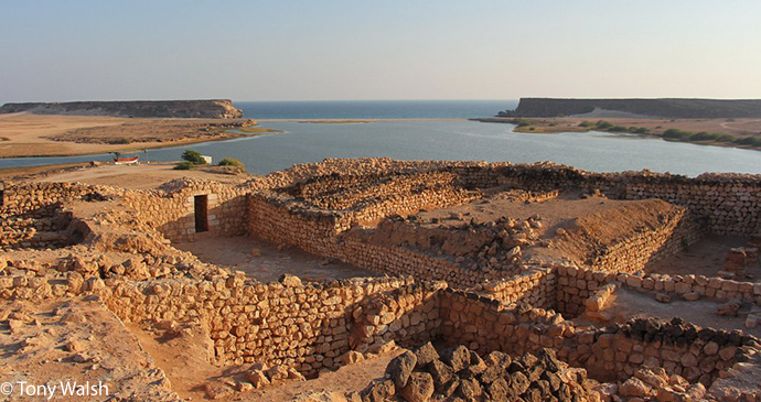
The sites include the frankincense trees of Wadi Dawkah and the archaeological sites at Al Balid and Samharam/Khawr Rawri. These extant ruins are from the 10th to 15th centuries, when the city was settled as a port for exporting frankincense and Arab horses, although archaeological finds date the origins of this ancient city to the early Islamic period, and even earlier. Within Al Balid is one of Oman’s more interesting museums, the Museum of the Frankincense Land, which includes two main halls (one historical, the other maritime).
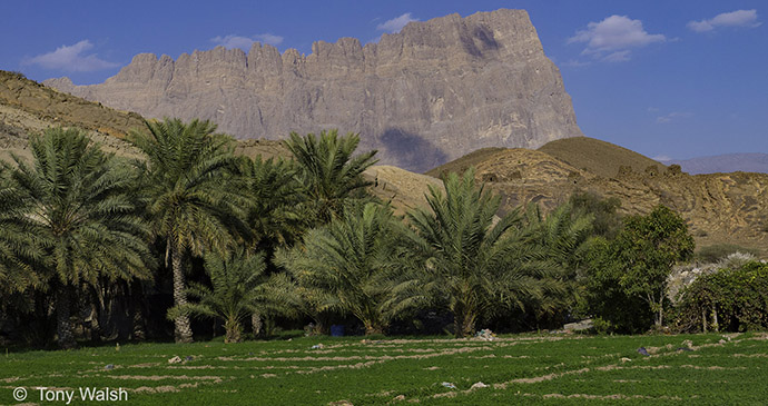
Aflaj irrigation systems
Previously believed to have been introduced by the Persians in pre-Islamic times, the falaj is a manmade water channel that leads from the water’s source to the fields where irrigation is required. Today there is increasing evidence that, at the very least, aflaj (the plural of falaj) developed independently in Oman. The earliest evidence is reported by the Hajar Project team, which dates a falaj near Bisya, southwest of Bahla, to around 3000BC.
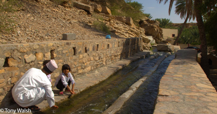
In many village communities the falaj is still, but only just, part of the essential way of life, and one of the standard exchanges for a visitor on arrival at a neighbouring village might be ‘And how are the aflaj?’ ‘Full, Inshallah.’ However, times are changing and knowledge and skills of how to manage a falaj are rapidly disappearing as Oman’s economy moves away from agriculture and into a system based on industry and services.
Ancient city of Qalhat
In medieval times Qalhat was one of the key ports in Arabia and the Arabian Sea, but today the ancient town is a ruin and the new settlement hardly more than a village. The town was the second city of the Kingdom of Hormuz from at least the early 13th century, and may have been the original settlement of the rulers of Hormuz.
Throughout its extensive history, the city has been affected by numerous tragedies. First, an earthquake destroyed many of the city’s fine buildings at the end of the 15th century. Then in 1507 the Portuguese arrived in Oman and ransacked Qurayyat and Muscat. The following year they attacked Qalhat, killing many of the local population and burning all the ships and buildings. Qalhat was completely devastated and the survivors fled the city.
The town’s archaeology is spread over an area of about 4km², with its prominent mausoleum to the north and the city wall to the south. Most of the major buildings are in the north, lying between the mausoleum and the sea. The mausoleum had some consolidation work undertaken during 2020, part of the gradual archaeological work of the site. It will be difficult to picture Qalhat as the bustling port town it once was, until more excavation work is undertaken.