The grandest of Montenegro’s deep-blue inlets, the stunning Boka (‘inlet’) Kotorska is renowned for its spectacular scenery and cultural heritage, including the UNESCO-listed old city of Kotor.
The entire length of the Boka Kotorska is 15 nautical miles or 28km, stretching from Meljine, just east of Herceg Novi, to Kotor. The road, which follows the northern coastline through Bijela, Risan, Perast and Dobrota, covers the same journey in a little more than 40km of beautiful scenery. Whether or not you consider yourself a driving aficionado, there is no better way to see this gorgeous stretch of Montenegrin coast than by car.
Herceg Novi to Risan
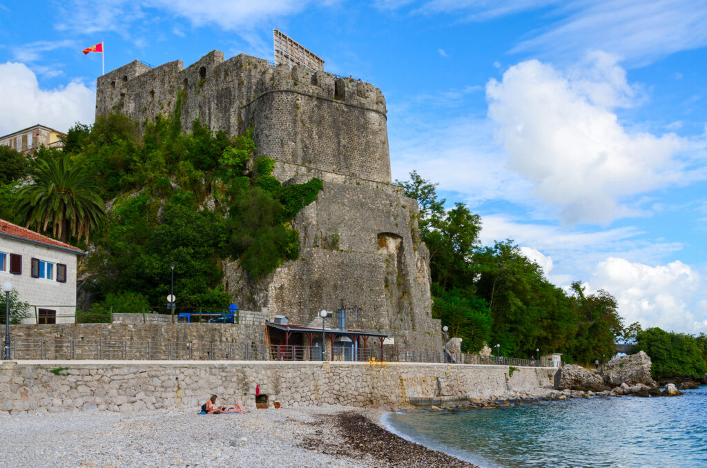
The route begins in Herceg Novi. Tumbling down a steep hillside at the mouth of the Gulf of Kotor, this picturesque coastal town was once a favourite holiday haunt for the bourgeoisie of 19th-century Vienna. Having spent a few days exploring its charming Old Town, walking the Šetalište Pet Danica (seafront promenade) and marvelling at the Savina Monastery, it is time to commence your journey along the Boka Kotorska.
Leaving Herceg Novi, the gulfside road winds its way through several small villages towards Kamenari, a staging post for the narrow Verige channel. There’s no real reason to stop at any of these places, though there is the odd interesting spot. In Kumbor village, 6km east of Herceg Novi, the remains of a 17th-century Turkish fort are still detectable on the Cape, and in Đenovići a Greek settlement, Stoli, existed in ancient times. Baošići also dates from early times and a plaque denotes where the French novelist Pierre Loti stayed in 1880. He came as a naval officer, fell in love and later wrote a short story about it called ‘Pascale Ivanović’.
After passing through Bijela, next up is the attractive village of Kamenari, which gets its name from the lustrous red marble quarried since Roman times on the slopes nearby. Many squares in Venice have been paved with this marble, and it was used for the pedestal beneath Augustinčić’s red monument beside the United Nations building in New York City.
Kamenari is also the location for the narrowest channel in the Boka, the Strait of Verige. Here in 1624 a chain was deployed across the gap to prevent history repeating itself, following a raid by North African pirates who had crept through one night and captured 400 prisoners for slaves. At this point, where the two shores all but touch, the strait is 300m wide and 30m deep.
From Kamenari the road circles the two bays, Risan and Kotor, respectively. For a more direct route to Kotor or to Tivat, rejoin the Adriatic Highway eastward by taking the 5-minute ferry from Kamenari to Lepetane. Between July and September the ferry runs non-stop around the clock, and between October and June non-stop between 06.00 and midnight, and then hourly between midnight and 06.00. From Kamenari, a sharp turn north into the Gulf of Kotor brings you to the tiny village of Morinj, in itself nothing special, but it is home to one of the country’s finest restaurants.
It would be easy to linger, enchanted by sweeping views across the Boka, its islands, and the surrounding mountains, but continue you should. The road passes beneath steep granite and, as long as there has been some rain lately, a sudden magnificent waterfall (scpot) plunging 30m into the sea below.
Just 4km on from Morinj, in the village of Lipci, is a series of remarkable (but strangely little-known-about) cave drawings, purporting to be from the 8th century BC and depicting mystical animals and sun symbols. Mind you, they’re not the easiest to find, especially with the almost complete lack of any dedicated signage: at the Lipci road sign, head up the narrow cemented road and beyond a white house with a basketball hoop to where the road becomes unpaved. After 300m follow the marked rocky path uphill (watch where you tread) to a small cave and see if you can see them. A torch might help.
At the roundabout just before Lipci is the beginning of the new road to Grahovo, Nikšić and ultimately Žabljak, some 152km distant. Affording spectacular views as it ascends high above the gulf, it also considerably cuts the time it takes to reach Durmitor National Park from the coast, giving far easier access to the superlative hiking opportunities and winter skiing facilities in the far north of the country. Although a fast road, caution should still be exercised with regard to its tight mountain hairpins.
Risan to Perast
Beyond Lipci, the road loops round to the innermost point of the bay and the once-busy shipping port of Risan, now a somnolent place comprising mostly newly built homes and weekend villas which slope down to a low-key waterfront interspersed with a handful of cafés.
This is somewhat at odds with its one-time status as the oldest settlement in the Boka, thought to have been founded by the Greeks in 400 BC. There little reason to stay here overnight, which is just as well as there’s precious little accommodation available and the beastly Hotel Teuta blotting the waterfront remains closed awaiting its fate, which surely can only mean being bulldozed.
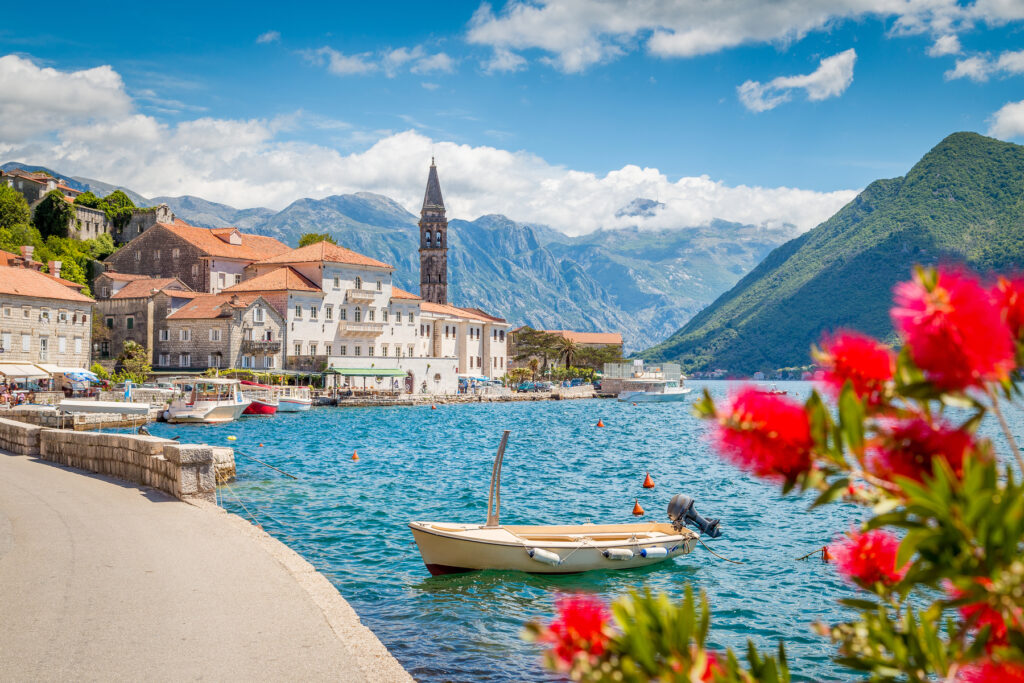
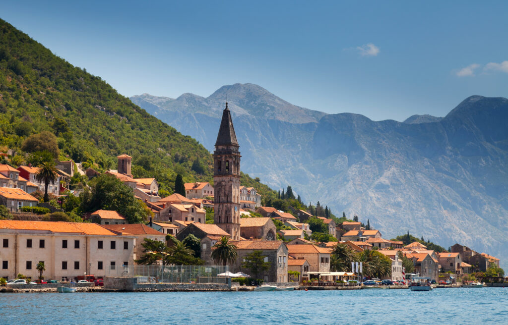
Wedged into a narrow arc between the main road and the water’s edge, just 3km around the bay from Risan, is Perast, as picturesque a place as any along the coast. The houses that run by the waterside are toytown Venetian Gothic, with a homely grandeur that recalls the town’s magnificent past. For nearly 500 years, Perast was the muscle of Adriatic maritime strength, holding forth against repeated Turkish attacks when the rest of the gulf had fallen. The sailors of Venice, and later Russia, came to the nautical school here and learned the skills of Perast’s mariners, cartographers and engineers.
At the peak of its powers, in the mid 18th century, there were four shipyards here and a fleet of around 1,000 ships. Eventually, earthquakes, political manoeuvring and simple age took away the town’s pre-eminence and left it to graceful retirement. Although you can quite comfortably take in what Perast has to offer within a few hours, including Our Lady of the Rock Island, you’ll probably want to linger a while longer.
Perast to Kotor
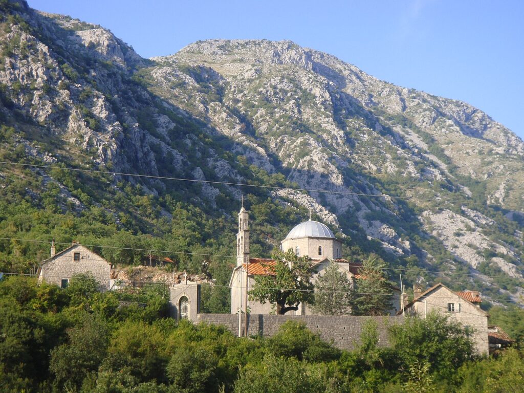
Beyond Perast, a number of small settlements are beautifully placed along the narrow shore leading to Kotor, respectively: Dražin Vrt, Orahovac, Ljuta and Dobrota. It’s worth popping your head into Ljuta’s 18th-century Church of St Eustace, which has painted walls and ceiling, a treasury of trophies captured from the Turks (no heads) and a collection of Dobrota lacework – a local speciality.
Some 3km on from Ljuta is the handsome suburb of Dobrota, which itself stretches for several kilometres down towards Kotor. It’s chequered with ancient churches, patrician mansions and summer houses, such as the leaning palace of Radomir Dabinović, with its elegant Venetian bell tower. Dobrota also makes for a good (and certainly more relaxing) alternative to Kotor in terms of somewhere to stay, with a number of upmarket hotels scattered along the waterfront.
At nearby Tomići, the Baroque Church of Sv Matija is keeper of a Madonna by Giovanni Bellini. It seems likely there are other Italian painters hiding in these churches: you will simply have to go in search. The story is the same; as sail gave way to steam, the power and wealth of this area simply melted away into the Boka mist.
The driving route ends at Kotor. Squeezed into a small triangular wedge at the very end of a long, narrow bay, in the shadow of Mount Lovćen, this medieval walled town is indisputably the jewel in the coast’s crown. A UNESCO World Heritage Site, it was once one of the busiest ports in Europe, both commercially and militarily, though today its picturesque natural harbour funnels mainly cruise ships.
Kotor is essentially its compact Old Town, an enchanting warren of smooth stone-paved streets (mostly unnamed) and irregularly shaped squares, many endowed with delightful names such as Milk Square, Flour Square and Salad Square, reflecting the various trades or crafts that were once practised there.
Although the town can get swamped at the height of summer, particularly when large groups of day-trippers pile off the liners that dock here, its essential charms remain undiminished. While a drive along the Boka Kotorska offers enough natural beauty to last a lifetime, there is no better place to conclude a tour of Montenegro’s coast than with a weekend spent exploring the twisting alleys, tight-knit buildings and delectable food scene found in Kotor.
More information
For more information, check out Norm Longley’s guide: