The best beaches in Orkney and the Outer Hebrides
These Scottish island chains are home to some of the most spectacular sands in the UK.
There’s a strong case to be made for the UK’s top 10 beaches all being located in the Outer Hebrides or Orkney. Both archipelagos feature far-flung, sand-fringed edges where your footprints may be the only indent made all day on the fine substrate.
They are also incredibly varied: take your pick from golden or white-shell sand, pebbled, sliced with wave-cut edges or indented with rockpools. Some are hunkered down beneath glowering cliffs, others only truly reveal themselves at low tide when they can stretch to the horizon. Still more slip neatly into the classic half-moon mould, set against banks of dune and wind-buffeted marram grass. Others, in the right light, can pose for the Caribbean or Indian Ocean idyll (indeed, in 2009 the Thai tourist board notoriously tried to pass off an image of West Beach on Berneray as one of its own).
On reflection, limiting the two archipelagos to just ten beaches risks shortchanging many other gems. So, here’s ten from each.
Orkney
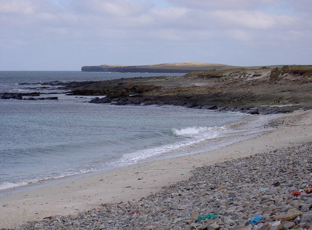
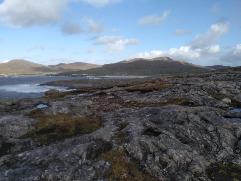
Warebeth Beach (Mainland)
For visitors who arrive in Orkney on the Scrabster-Stromness ferry, Warebeth is the first beach they see. Look out for it on the port (left) side as the MV Hamnavoe sails thorough Hoy Sound.
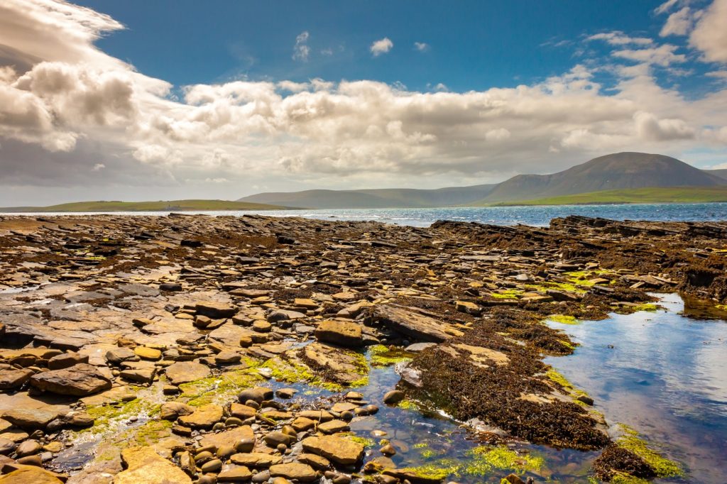
Hidden away behind Stromness, Warebeth beach is a glorious mix of sand, pebble and wave-cut ledges. These create fantastic rockpools at low tide. The cemetery just above the beach is the final resting place of author George Mackay Brown.
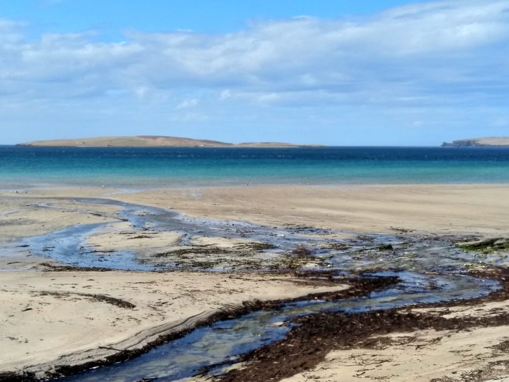
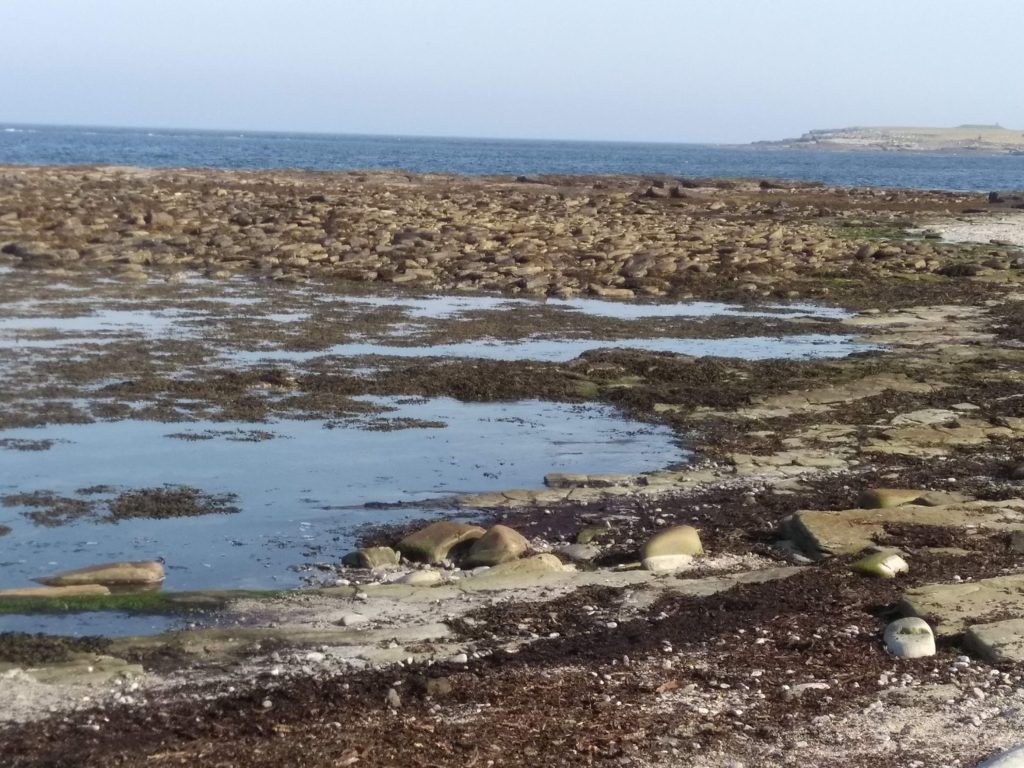
Waulkmill Bay (Mainland)
Located on the southern shores of Orkney Mainland, Waulkmill Bay’s attractive sands are squeezed between the moors of Hobbister and Veness Hill. The sands all but disappear at high tide but the water is considered safe for swimming.
Part of the RSPB’s Hobbister Hill reserve, the beach is also a wonderful spot for collecting the abundant seashells that get washed up. The head of the bay lies Orkney’s largest area of saltmarsh, which is home to beautiful fronds of sea arrowgrass and sea milkwort.
Evie Sands (Mainland)
You’ll find these glorious golden sands on the Mainland’s north coast where they give way to Eynhallow Sound.
In Old Norse, ‘evie’ means ‘backwater’ or ‘eddy’ and this can certainly feel like a sleepy, stretch of coast. The beach extends either side of a burn with a shimmering aquamarine tinge to the waters when the sun shines.
Doun Helzie (Sanday)
The island of Sanday means ‘sandy island’ in Old Norse, and is appropriately defined by more than 25 strikingly white beaches and bays.
One of the most delightful is close to the ferry terminal at Loth. Doun Helzie (pronounced ‘Doon Hellie’) is tucked away beneath cliffs carpeted with flowers and is busy with nesting fulmars in spring. Low tide reveals a sliver of sand and a handful of caves at the southern end of the beach, where there is also a modest arch.
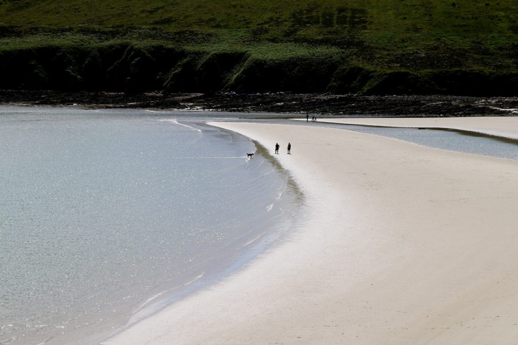
Cata Sand (Sanday)
The lagoon-like bay of Cata Sound fills and empties twice daily, either brimming like an overfull bathtub or empty, the sea retreated to the horizon.
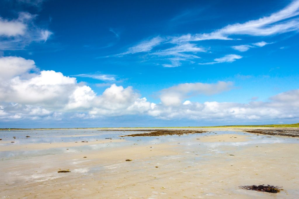
Wonderful dunes on its eastern flanks will keep children busy for hours. Cata Sand is also on the route of one of the UK’s great walks – along the coastal margins of the island to the extraordinary Tresness Chambered Cairn.
Barrier 4 beach (South Ronaldsay)
Four blockades, known as the Churchill Barriers, were put in place during World War II to stop German submarines entering Scapa Flow. The barriers, or causeways, connected a series of islands south of the Orkney Mainland. One by-product of the barriers has been to stop the natural flow of tides and sands.
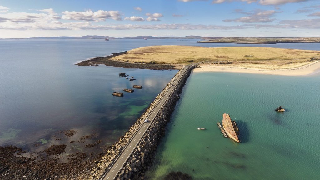
The dunes east of barrier 4 (which closed Water Sound) have been stabilised by marram grass and the rubbery oyster pant (which yields a pink bell-shaped flower in summer). This is now both a fine beach and home to Orkney’s main colony of little terns.
For real sand-seekers, don’t forget to check out our guide to the best beaches in Lithuania too.
Grobust (Westray)
A strong contender for Orkney’s most beautiful beach, Grobust is located on the north coast of Westray. A gentle crescent of sand is broken by a series of wave-smoothed flagstone ridges.
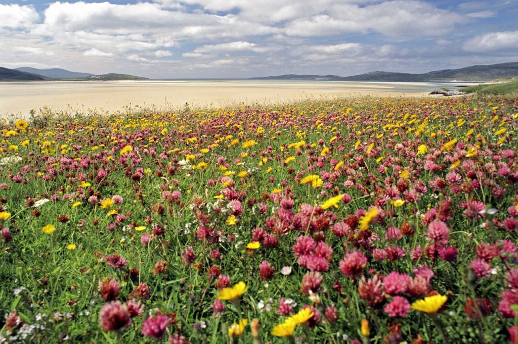
The grasses that back on to the beach here are one of Orkney’s rare slivers of machair, the coastal sea meadows more usually associated with the Outer Hebrides. In summer they transform from a sandy green into vast splashes of colour produced by eyebright, felwort and cowslip. The combination of sandy machair soils, blue-green sloping rocks, verdant grasses, a glassy sea and yellow-white dunes all combine to create a colour scheme of great symmetry that is aesthetically easy on the eye.
North Wick (Papa Westray)
The vast crescent-shaped sands of North Wick emerge where the northern cliffs of Papay collapse into a jumble of shingle and ledges.
At low tide, sandbars emerge where seals often haul out (you are likely to hear them groan).
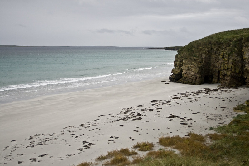
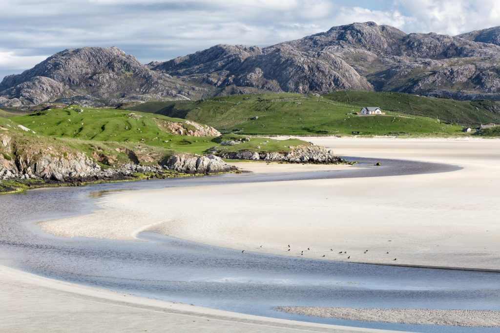
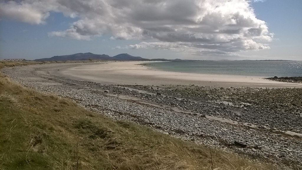
Rackwick Bay (Hoy)
Rackwick Bay is a magnificent beach hemmed in by sheer cliffs and Arctic-looking mountains. The bay stretches for the best part of a mile and is impossibly scenic. To the south, the beach crashes abruptly into the base of a solid lump of rocky headland known as Point of Craig-gate, behind which a series of pleasingly geometric headlands poke out.
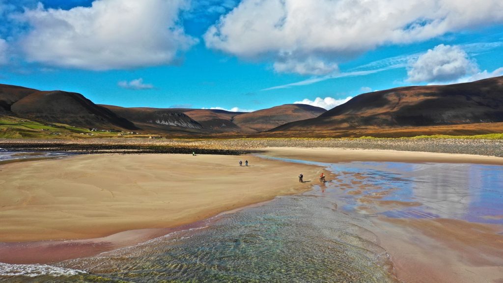
Towards its southern end, the bay comprises sand made from pure quartz – one of just three places in Scotland it can be found. Run along this stretch of the beach and you can feel the sand reverberate under your feet.
Sands of Odie (Stronsay)
The northern flank of Stronsay is incised by the romantically named Sands of Odie, which are as attractive as the name suggests. The rock ledges exposed at low tide are smothered in seaweed and, combined with the backdrop of neighbouring islands and sea, create a striking colour scheme.
The small island visible here is the Holm of Huip, an important breeding ground for grey seals in autumn (and you may also see harbour seals hauled out here).
Outer Hebrides
Uig Sands (Lewis)
Many people will have heard of Uig Sands (Tràigh Ùige) as the place where the Lewis chessmen are said to have been uncovered; perhaps fewer are aware of the spectacular beauty of this monumental landscape.
Visible for miles around, the vast sands of Uig boast an extraordinary tidal range. The distance between the highest and lowest spring tide can be almost a mile, and at low tide it feels as though you can walk towards the sea for ever.
Dalmore (Lewis)
Located on Lewis’s west coast, Dalmore (Dail Mhòr) is a glorious beach that you are likely to enjoy in blissful solitude. At the top of the bay is a lonely sand-blown cemetery, featuring many grand tombstones.
A great way to visit the beach is to take the coastal footpath from the Na Geàrrannan Blackhouse Village.
Garry Beach (Lewis)
Tràigh Ghearadha, popularly known as Garry Beach, is a delightful small bay on the northeast coast of Lewis. A wooden bridge leads across to the beach, where there are sea stacks at the southeast end of the sands, which you can walk around at low tide.
High above the beach is the Bridge to Nowhere, where the roads runs out and gives way to 11 miles of bleak moorland.
Hushinish (North Harris)
Located at the end of a 14-mile winding single-track road, Hushinish is a glorious shell beach with spellbinding views across to South Harris. The sand settles far inland and environmental groups have made the claim – difficult to refute – that the beach has a higher percentage of shell fragments (92%) than any other in Scotland.
The machair here is a bewitching khaki-mustard colour and flowers with creeping willow and Scottish bluebells, or harebells, in late summer. Superb rockpools can be found on the western edge of the bay.
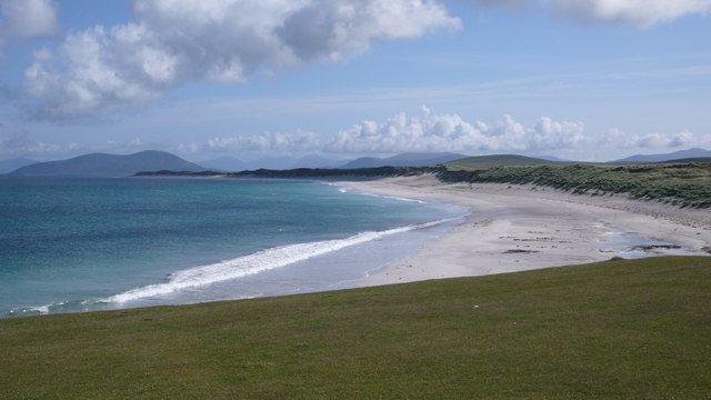
Sands of Luskentyre (South Harris)
The first views of Luskentyre sands and the Sound of Taransay take your breath away and herald an area of beaches and headlands that reaches 7 miles from east to west and 6 miles from north to south. At low tide, the various beaches along the western shoreline seem to become conjoined and laced with rivulets of retreating and advancing water and ever-shifting dunes.
Superb beaches include those at Seilebost and Iar, though the pick of the bunch is arguably Tràigh Rosemol, an exquisite and almost perfect rectangle of white sand.
Culla Bay (Benbecula)
This west-facing beach is safe for swimming and the gorgeous sweep of sand and shingle, with seabirds flying overhead, is a pleasant place to wander.
The tumbling dunes above Culla Bay form a bulwark with the machair, an area of flower-rich coastal sea meadows that are an area of international importance as a breeding site for corncrakes. Also look out for lapwings and the great yellow bumblebee.
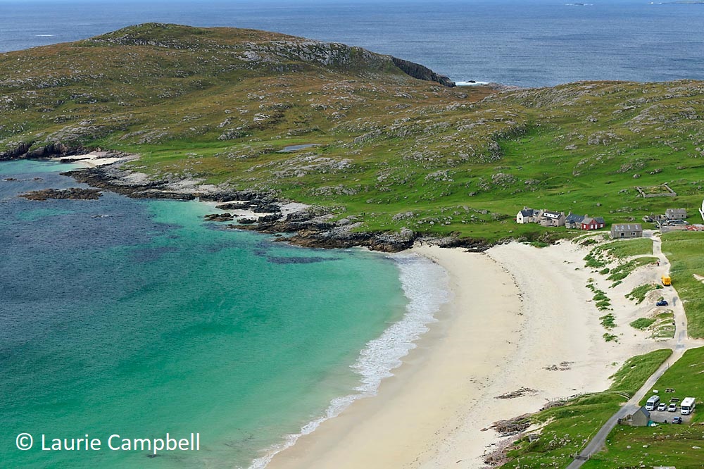
West Beach (Berneray)
Among stiff competition, many people cite West Beach as the very best sands of all in the Outer Hebrides.
Certainly, it deserves its place in the beach pantheon: the whole of the west coast is effectively one unbroken strip of glistening shell sand. You reach it by means of a glorious walk through Berneray’s machair.
Tràigh Iar (North Uist)
The beautiful and huge sands of Tràigh Iar lie on the island’s north coast.
The tidal range is vast and at low tide you feel you can walk almost to the horizon. The dunes feel as though they are sky-high here.
Halaman/Tangasdale beach (Barra)
As you head west out of Castlebay on Barra, you pass an endless clutch of fine beaches. The first is among is among the best: Haman Bay, also known as Tangasdale, whose sands command a dramatic sweep of coast.
A picturesque burn gurgles its way to the sea through dunes. If you have the energy, a 3-mile return walk along the coast west from here leads to the dizzyingly located Iron Age hill fort of Dùn Ban.
Tràigh Mhor (Barra)
Tràigh Mhor is world famous for being the site of the only scheduled aircraft beach landing.
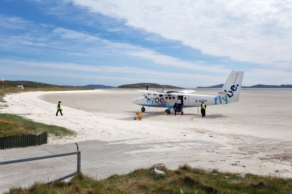
The name means ‘Big Beach’ in Gaelic and when the tides retreat (and aircraft aren’t taking off or landing) this is a magnificent place for a stroll along the white shell-sand, laced with seaweeds of all shapes and sizes. Your only company will be cockle pickers.
More information
For more on the islands, take a look at Mark’s guides: