A perfect walk for a long weekend: the Grantham Canal Path
This 33-mile walk takes you from south Lincolnshire’s glorious countryside, through the Vale of Belvoir, and into the suburbs of Nottingham.
Not all of us are intrepid explorers. If you’re new to hiking, don’t want to spend time map-reading or just fancy an accessible route where your boots won’t get too muddy, a canal path could be your perfect option.
Last autumn, local Bobby Twidale walked the 33 miles of the Grantham Canal Path, exploring south Lincolnshire’s glorious countryside and heritage before finishing in Nottingham. The canal was built in the late 18th century, the heyday of the British inland waterways, to link the River Trent to the eponymous market town.
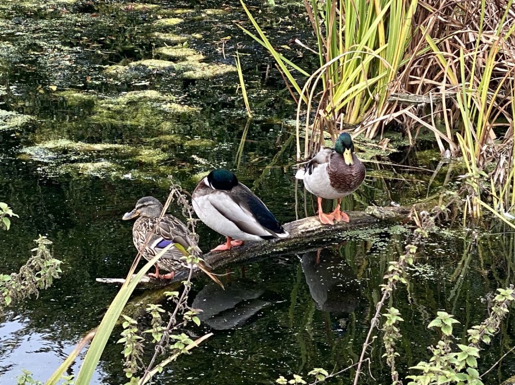
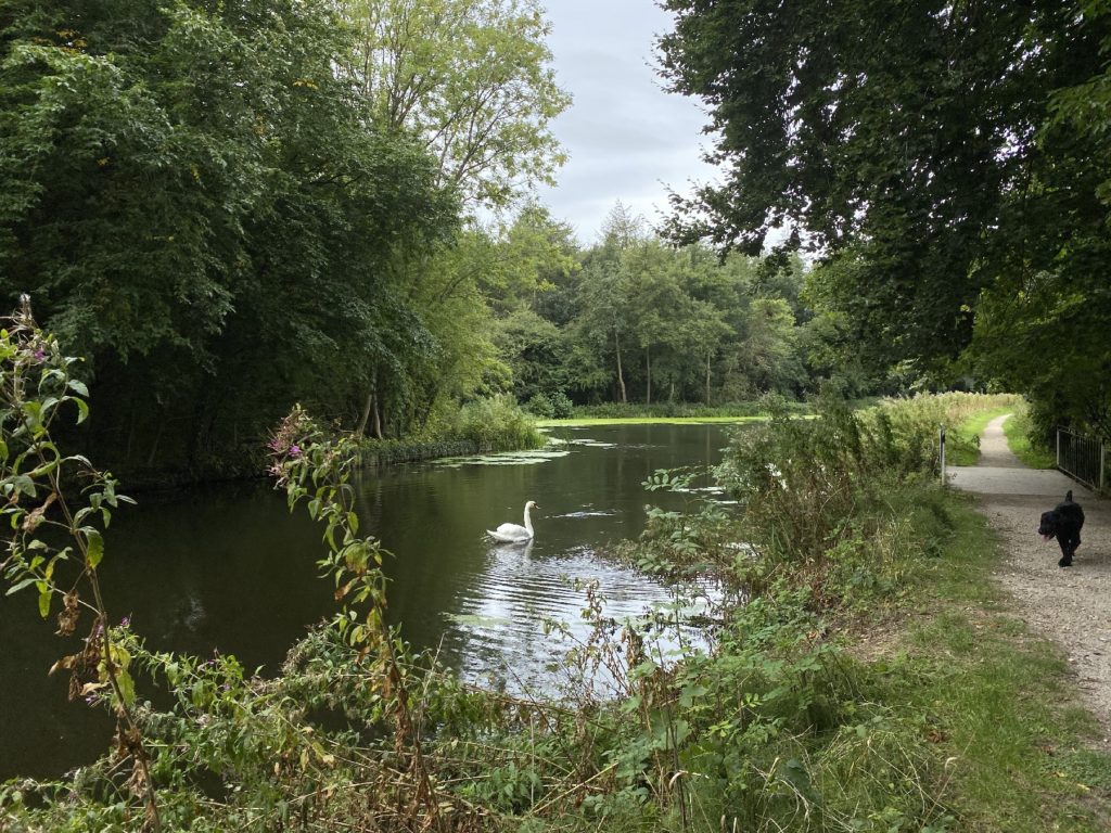
It remained profitable until the railway brought faster logistics to the local coal and agricultural industries in the 1850s. The canal ceased to be navigable in 1929 and has subsequently become home to an abundance of wildlife. In fact, the stretch between Harby and Redmile in the heart of the Vale enjoys SSSI protection for its rare wetland plants, birds and insects.
Day one – Grantham to Redmile
The walk begins on the outskirts of Grantham. Set close to the A1 and an industrial estate, the first section of the route feels busy and urban and isn’t especially scenic. It’s also rather difficult to navigate as the canal disappears temporarily from sight. Keep the faith and head out of town alongside the A607 passing under the A1. A footpath opposite the Premier Inn will get you quickly away from the roar of traffic and into lush countryside.
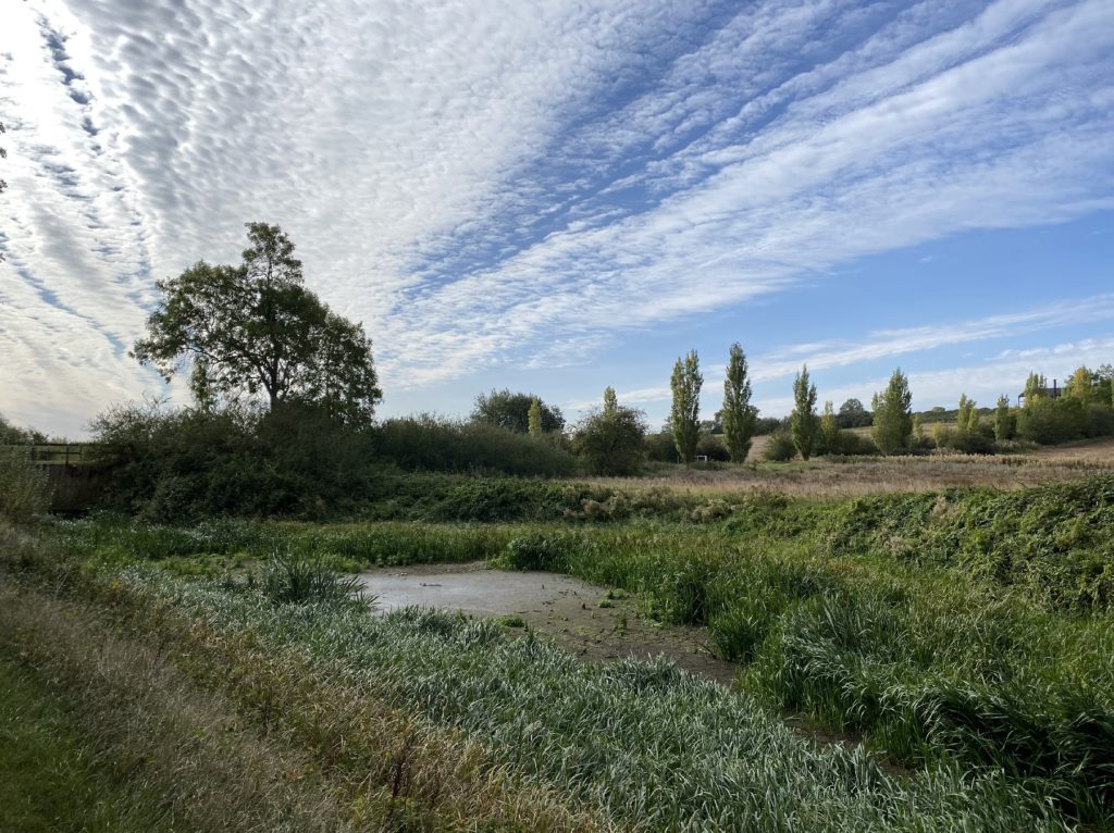
From this point, the path is well-maintained and easily followed, meaning you can focus your energy on enjoying the sights and sounds of the canal’s route through the greenery of Lincolnshire as you head out into the ancient and rural Vale of Belvoir.
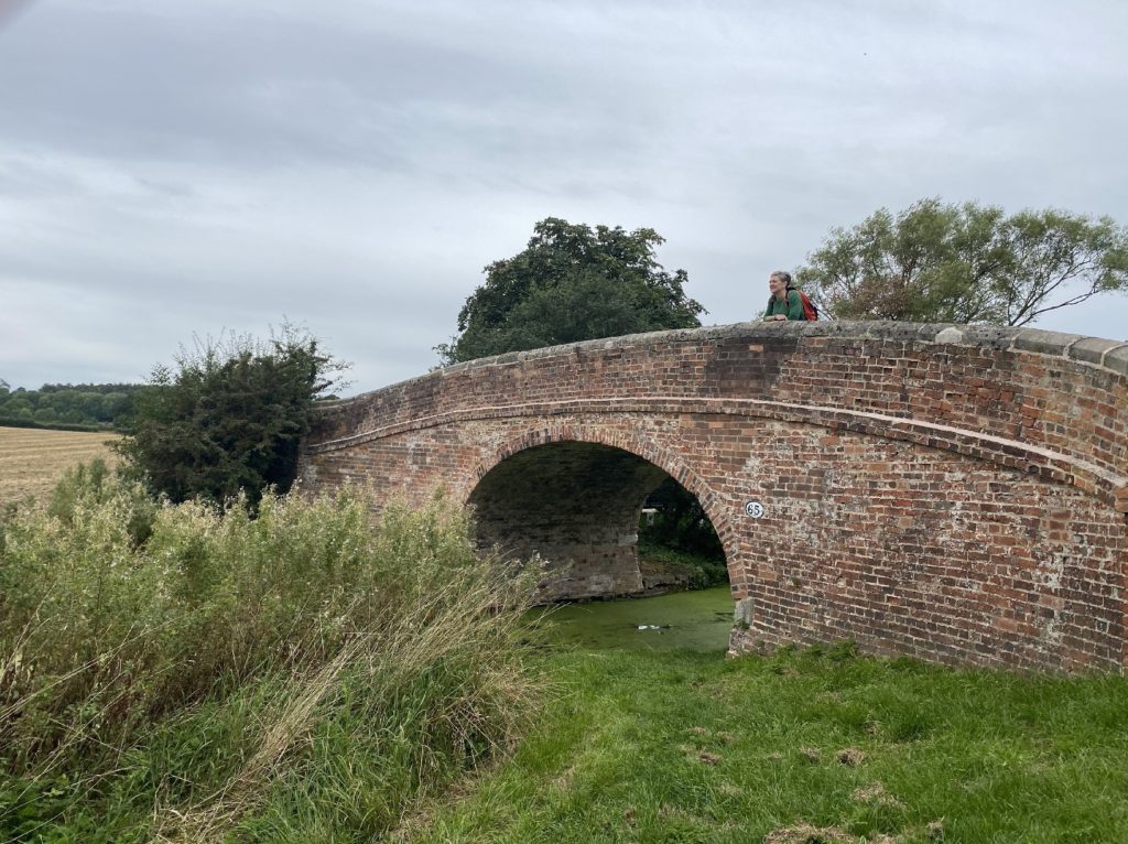
This first stage takes in 15 bridges, many of them the archetypal hump-backed, redbrick variety. Further on, some will be replaced by the flat bridges that ultimately brought an end to navigation by boat traffic, but for this stretch the Grantham Canal path cuts an unspoilt, wildlife-rich path through the Vale of Belvoir.
The village of Woolsthorpe is worth a pause – not only to admire the restored three locks and buy a takeaway lunch from the Dirty Duck pub, but also because you can catch a glimpse from here of the magnificent and distinctive Belvoir Castle looking down over the whole Vale from its hilltop vantage point. The terraced gardens of the castle are open to visitors and well worth a detour with their striking statues and intriguing mix of formal and natural styles, woodland and lakes.
Beyond Woolsthorpe, the path takes you past the recently renovated Stenwith lock. Originally built by William Jessop, the lock has been painstakingly restored by the Grantham Canal Society and the Waterway Recovery Group, using Heritage Lottery funding to construct its new gates weighing in at several tonnes each.
The final stretch of the first day’s walk passes through the rich arable land of the Vale of Belvoir. This leg always offers an insight into the local farming calendar with its predictable passage of frost and mud, through green shoots in spring, to the heady scents of harvest and the subsequent plough-turned earth of autumn. The path loops around to finish once again at the foot of the castle in the picture-perfect village of Redmile.
Day two – Redmile to Kinoulton
Beyond Redmile, the western edge of the Vale of Belvoir settles into rolling pastureland. You’ll see more livestock, including the black and white cows that supply the Coslton Bassett and Long Clawson dairies with milk for their stilton cheese. Expect lively discussion among locals as to which of these is the superior example!
At Harby, make a short detour for a warm welcome, well-earned cuppa and slice of homemade cake from the friendly volunteers at the popular Dove Cottage Day Hospice tearoom and charity shop (planning to reopen from 10 April).
The bridges become more varied along this section of the Grantham Canal path, with wooden, brick, swing-bridges and some flat bridges with scant clearance over the path. At bridge 37, we found the way around closed off and had to crawl to continue our route!
Just before entering Hickling, stop and admire the restored Lengthman’s Hut. A resting place for canal maintenance workers, it was in a state of disrepair until very recently, but has been beautifully renovated by the Canal and River Trust.
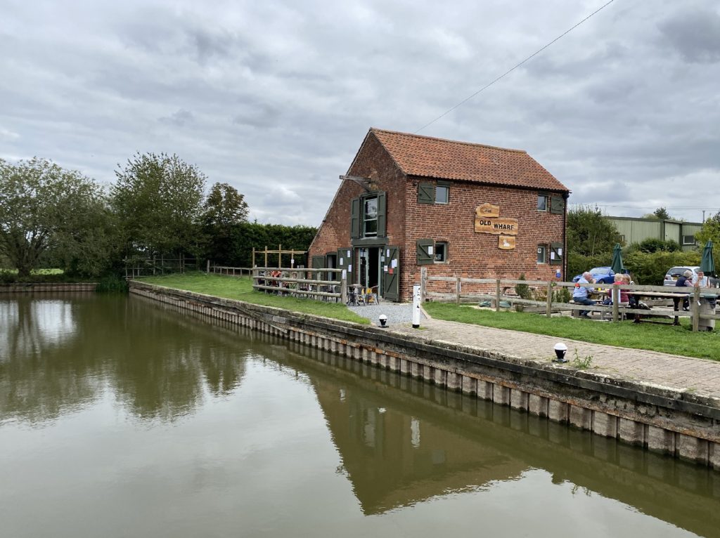
A little further on is Hickling Basin, home to the wonderful Old Wharf Tearooms – there’s no need to pack a lunch for this section of the route (please check website for updates).
Appropriately refreshed, head across the road from the basin and re-join the path for the short final leg into Kinoulton.
Day three – Kinoulton to Nottingham
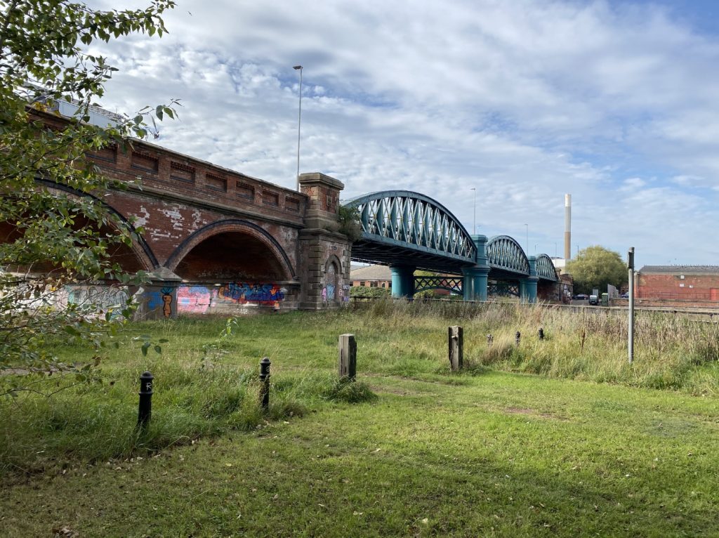
The final leg of the path leaves behind the agricultural to embrace the industrial, passing underneath the busy A46 Fosse Way before heading into the West Bridgford suburb of Nottingham.
Out of Kinoulton, you pass by the now-derelict Vimy Ridge farm. Formerly known as Pasture Hill Farm, it was renamed by Sir William Jesse Hind and once sported a striking avenue of poplar trees planted in memory of his son who was killed in action at the Battle of the Somme. The air of sadness at the site is palpable even before you know the story of its former resident.
Cropwell Bishop has three locks, Top, Middle and Bottom, divided by the A46. When the Grantham Canal was constructed, a bridge was built to carry the original Fosse Way, the Roman road running from Exeter to Lincoln, over the top. The original remains alongside the new brick and concrete bridge that takes the traffic of the much busier modern road. The first lock is now dry but, without water, gives an interesting insight into its construction.
Beyond Cropwell, the route heads on to the former mining village of Cotgrave. The path becomes busier as it nears the suburbs of Nottingham but remains a haven for wildlife and plants, even as the landscape becomes more urban.
Beyond the A52, the Grantham Canal path passes into the residential areas of Gamston and then West Bridgford with its choice of cafés and a lovely park if the weather is picnic friendly. This is where the canal ends at the River Trent. If you’ve got a couple more miles in your legs, the stretch of the river that heads back out from the city from Lady Bay Bridge to the National Water Sports Centre at Holme Pierrepont is a great way to see a little bit of Nottingham before heading home.
More information
Discover more of Bobby’s adventures on her website, Fifty Not Out.