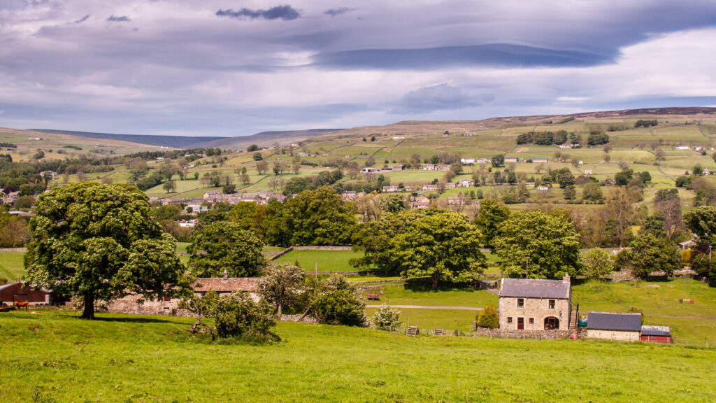
The best walks in County Durham for hikers
There’s nothing quite like the great outdoors.
Enjoy our author’s collection of the best walks in County Durham for beginners and advanced hikers alike.
Durham has a rich and varied landscape, from the remote Pennine fells and waterfalls of the Dales to the forested denes and high cliffs of the coast, and beautiful river, meadow and woodland scenery in the central Durham valleys.
With picturesque scenery to enjoy in all directions, walking County Durham is a truly rewarding experience. These are the trails not to miss.
Blanchland & the River Derwent, Derwentdale
1¼ miles – easy
This straightforward riverside trail, that winds through Durham’s gentle wooded countryside, makes for a pleasant evening wander if you’re staying in Blanchland.
The route
By the old stone bridge and with your back to the village, turn right following a grassy track to the River Derwent, past a little playground and then over a wooden bridge. There are plenty of places for children to throw stones and a few bathing pools ahead when water levels are high enough.
Keep the Derwent on your left, following a well-trodden path upstream through trees by the side of a drystone wall which is crossed a few times (note the hefty coping stones on some lengths). A fairy waterfall trickles down the opposite side of the gorge to meet the river, where dippers and grey wagtails are a familiar sight. Pass through a couple of gates and walk the length of a boardwalk until you reach a road.
Turn left on meeting the road, crossing a bridge over the Derwent. Now on the south side of the Derwent, you’ll see the entrance to woodland on your left. Follow the trail through dark conifers and then brighter broadleaved trees, and at one point stepping over the aforementioned cascade running down the bank. Return to the village by the hump-backed bridge.
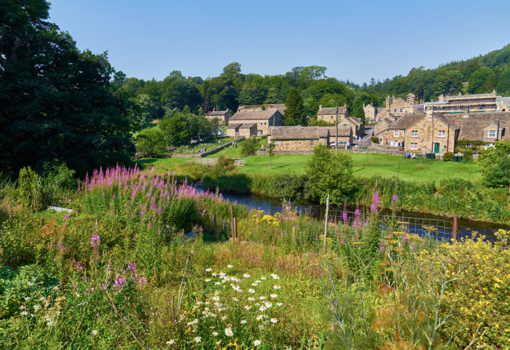
Ireshopeburn hay meadows walk, Weardale
2½ miles – easy
A glance at an Ordnance Survey map reveals an obvious circular walk from Ireshopeburn into the surrounding countryside north of the Wear. It’s a beautiful route, both for the dale views and hay meadows brimming with wildflowers from May to August.
The route
With your back to High House Chapel, turn off the A689 and down a lane signed for New House, crossing the Wear over a stone bridge.
Turn right on the riverbank and pick up the Weardale Way, following the river downstream for around 500yds towards a junction with a few paths. Turn uphill then right, passing in front of cottages on your left. Trace the drystone wall uphill passing a farm to the tarmac lane at the top.
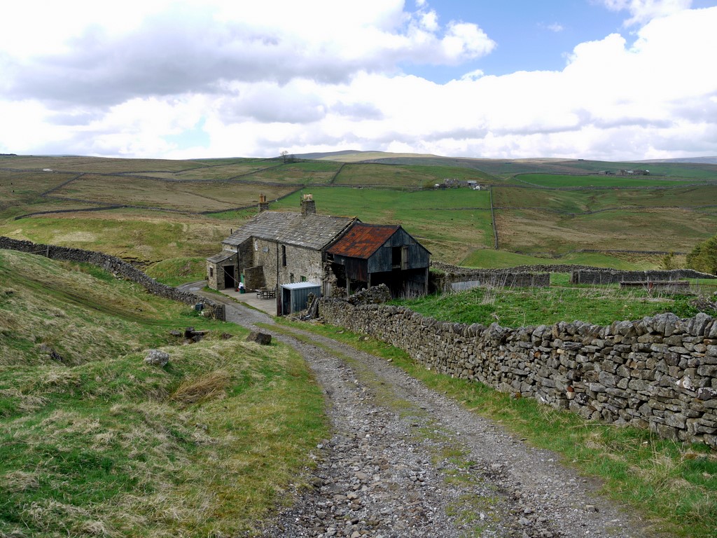
Cross the lane by a stone cottage and continue straight uphill, keeping the drystone wall on your left. The path swings in a long arc to the west to meet with another lane, a quarter of a mile uphill. Again, cross straight over this lane and traverse the side of the hill on a track to the farm at Allercleugh, keeping the wall on your right and taking in the fabulous meadows below you.
Continue a short way past Allercleugh towards High Whitestones before turning downhill to Whitestones Farm. Stay on the farm track until you reach the lane at the bottom. Pick up the footpath signed on the other side of the lane through Low Whitestones and into the field below, descending into the picturesque hamlet of West Blackdene by the riverside.
Don’t cross the charming stone bridge here but instead pick up the Weardale Way by taking the lane off to your left that runs alongside a stone terrace facing the river where the Wear splashes over several little pretty falls. Walk along this lane to another bridge. Continue eastwards, taking the muddy riverside path for the final amble back to Ireshopeburn tracing your steps back over the Wear at the stone road bridge.
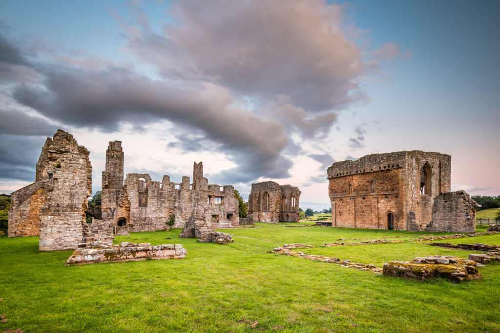
Barnard Castle to Egglestone Abbey, Teesdale
3 miles – easy
This family-friendly riverside walk from Barnard Castle takes in the ruins of 13th-century Egglestone Abbey before returning to town along the wooded banks of the Tees and across gentle farmlands via the Teesdale Way.
The route
At the southern end of Thorngate, cross the wrought-iron pedestrian bridge over the Tees, taking in the fine riverside views as you do so, and turn left when you reach the other side. A well-trodden woodland path skirts the back of some pretty cottages with gardens in full bloom during the summer and then some smallholdings before you reach a caravan park.
Pick your way through the friendly site, ascending into open countryside along a lane with the caravan site now below you. Turn left off the lane through a gate by a hut painted with woodland animals, which takes you into a field. Continue across the next three fields, keeping the trees and the sound of rushing water to your left. At the end of the third and final field, squeeze your way between two stone pillars to reach Abbey Lane where you turn left, downhill.
After around 200yds you’ll come to a road bridge. On the other side of the bridge, a fingerpost by a farm gate directs you into a field with the abbey ruins poking above a prominent hill. Enter this field, with the ruins on your left, and continue ahead for around 100yds to a lone ash tree. Here, turn left up a steep bank to some stone cottages. Egglestone Abbey is ahead and accessed via a car park.
After exploring the ruins (this is a good spot for a picnic and the grounds are rarely busy), return to the car park and turn left on to the lane that curls downhill towards the river. At the handsome double-fronted cottage at the bottom, you meet another lane where you should turn right. At the traffic lights, turn left, crossing delightful Abbey Bridge, a tall arch of stone dating to 1773. Enjoy the plunging views of the Tees rushing through the wooded gorge below.
Now on the north side of the river, pick up a muddy footpath on your left which winds through oak, ash, holly and hazel trees to the riverbank. You are now on the Teesdale Way; Barnard Castle is 1½ miles ahead, as the signpost indicates. After 300yds, exit the woodland by a kissing gate into a field.
Continue ahead across the next few fields. When you’re opposite the caravan park, you’ll need to cross over a (collapsed) fence into a field. Continue ahead through a gate and along a stony track to the outskirts of Barnard Castle. Cross the large green with a playground and re-enter the town along Gray Lane, which connects with the bottom of The Bank and top of Thorneygate.
The Kings Walk & Hudeshope Valley, Middleton-in-Teesdale
1½ miles – easy
This is a very enjoyable short woodland walk suitable for families, with a stretch along the Hudeshope Beck where there are some little falls and places to picnic.
Note that even on the route set out below it’s easy to become confused by the becks, so do take a map and gain a general sense of how the paths connect to each other before you set off.
The route
From St Mary’s Church, walk up Town Head on the pavement for a quarter of a mile until you reach a prominent fork in the lane. Turn left on to Beck Road, entering woodland. The scent of wild garlic will hit you immediately if walking this route in early spring.
After 100yds, a dirt path rises through pine trees to your right with a Raby Estates notice pinned to a tree marked for the Kings Walk: follow this well-trodden permissive path through the woods. A meadow soon appears on your right.
After a few hundred yards, where the path swings sharply uphill to the right, take the path to the left descending through trees to meet with Snaisgill Beck. Cross the little footbridge over the water and turn left, continuing through trees until you reach a lane by Hudeshope Beck. Turn left on to Beck Road; there are lovely picnic and paddling spots hereabouts and a pleasing spout waterfall ahead.
Stroll down the lane, keeping left of the river until you come to a track off to your right. Take this spur and cross the green metal bridge. The beck is now on your left and you should follow it downstream, crossing it again when you reach a wooden bridge. Climb through beech trees to meet with the lane, and retrace your steps to the church.
More information
For more information, see Gemma Hall’s guide to Durham: