A cyclist’s dream: Walberswick to Southwold Loop
This East Anglia cycling route offers a classic cross section of the Suffolk coast, heath and countryside.
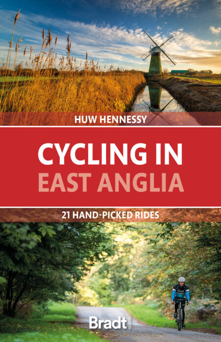
The following route was taken from Huw Hennessy’s guide to Cycling in East Anglia.
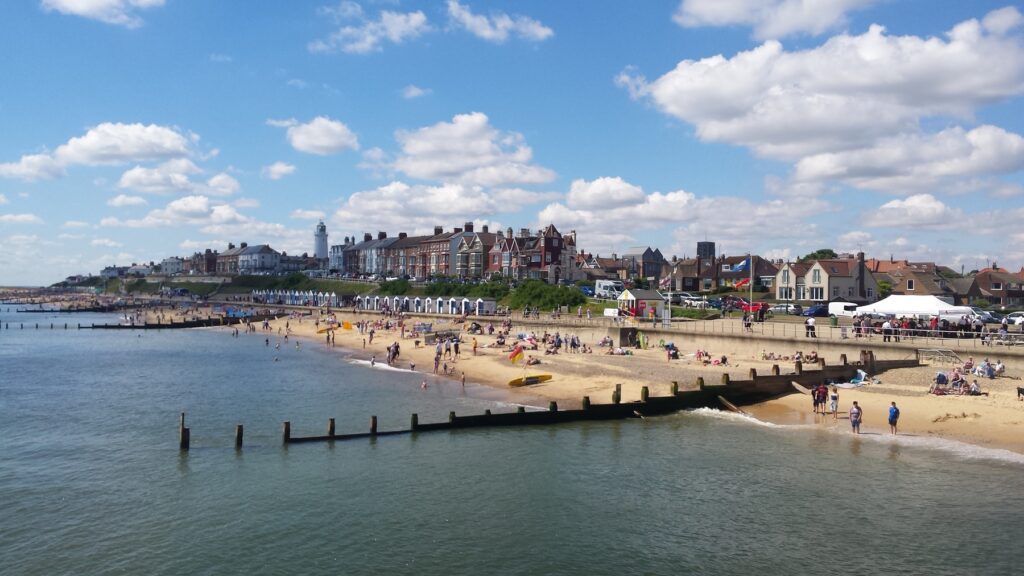
Facing each other across the River Blyth estuary are the popular resorts of Walberswick and Southwold, the former an arty retreat and the latter a traditional bucket and spade seaside town.
Starting from Walberswick, this route heads off-road through Dunwich Forest, then across country to the pretty village of Wenhaston and the historic windmill at Holton. Winding north and back towards the coast, you will pass through more farming villages and fields, before reaching Southwold.
You could stop overnight here in Southwold, as there’s plenty to see and a wide range of accommodation available. Or, to return to Walberswick, there’s a footbridge across the river, and a little ferry (which takes bikes). However you choose to do it, this picturesque Suffolk ride promises beautiful scenery and a charming seaside vibe that should not be missed.
The details
START/FINISH – Walberswick
DISTANCE/TIME – 31.3km/3½ hours
DIFFICULTY/TERRAIN – Level or rolling terrain, mostly on quiet backroads or B-roads, including a couple of A-road crossings, plus a short off-road stretch through Dunwich Forest
SUITABLE FOR – Gravel bike, hybrid or e-bike
NCN ROUTE – Partly on the NCN31, between Wangford and Southwold
MAPS – OS Explorer 231 (1:25 000)
The route
The route starts in Walberswick, at the harbourside ferry car park. This former fishing village has long been a favoured retreat for artists and is still today a popular, but quieter holiday destination than Southwold, its lively neighbour across the water. In midsummer though, Walberswick also comes alive for its ever-popular crabbing season, the waterfront packed with families wielding whiffy buckets and fishing lines.
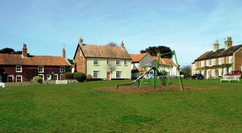
Turn left out of the car park and go through the village, past the Bell Inn and the little green, lined with prettily painted cottages. Follow the road winding around to the right and, at the end of the village, take the left fork straight ahead on to Lodge Road. This soon narrows to a single lane, through residential suburbs and out into the countryside, between fields lined with high hedgerows.
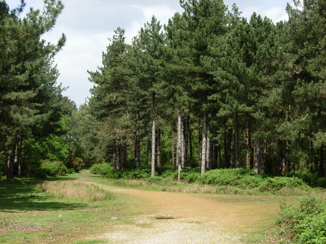
After about 1km, Lodge Road comes to an end at a construction works. An unpaved, flint and sand track continues straight from here, through the fringes of Dunwich Forest, part of the Suffolk Coast and Heaths AONB protected area. The track climbs a little through clearings of heather and bracken; it’s wild and peaceful here, though as ever be aware of others using this trail, including walkers and horseriders.
As the track descends through the trees, it gets a little rougher and sandier too. Take it slowly here as it’s easy to skid on the loose sand: keeping one foot off the pedal after every few turns may help you keep steady. It can also help fend off the occasional protruding tree root and dangling bramble.
After about 3.5km of off-road fun, the track comes to a little parking area by the B1125/Dunwich Road. Go straight over on to the road opposite, signposted Hinton, and then turn right immediately, opposite a pig farm, signposted Wenhaston. The road starts climbing gradually, past another piggery on your right, and levelling out through shady trees. At the brow of the hill pass a little lily pond on your right, in front of wooden barns, a classic photogenic scene and perhaps a good place to catch your breath after the climb.
The road levels out now, through arable fields, and comes to the A12. It’s quite a straight road, but the traffic can be fast, so cross carefully and dismount if necessary. Carry on straight ahead, with a nice downhill run through the trees, coming to a careful stop at the T-junction at the bottom, where you turn left, and into Wenhaston (pronounced Wenner-st’n). This attractive village is spread out along its long straight main road, running roughly parallel to the River Blyth in the valley below on the right.
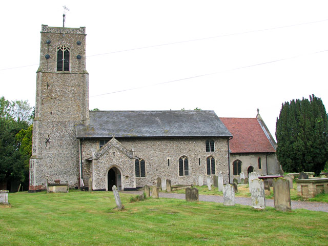
Pass the Star Inn on the left and then turn left at the fork just after St Peter’s Church on the left. You might not guess from its rough, flint-clad exterior, but inside the church is a remarkable Doom painting. This early 16th-century depiction of the Last Judgement is one of only a few surviving in Suffolk. For its vividly coloured details, the painting is considered one of the finest in England, and is worth a peek even if only for another breather after the climb up through the village.
Continue along Back Road, through the houses and out of the village, heading north towards Holton. The road undulates through more woods and farmland and, about 2km from Wenhaston, we suddenly come across Halesworth Golf Course on the left: quite a surreal sight, of golfers clad in pastel pullovers and baseball caps, after the earthy pastures and pigs in muck.
At a crossroads, alongside the golf course, turn right on to Wash Lane, which dips down over a little bridge across the River Blyth and up again, coming shortly to a T-junction. Turn left here on to the B1123, signposted Holton and Halesworth, coming into Holton after about 500m. Turn right at a fork down Mill Road, as we enter this lovely old riverside village.
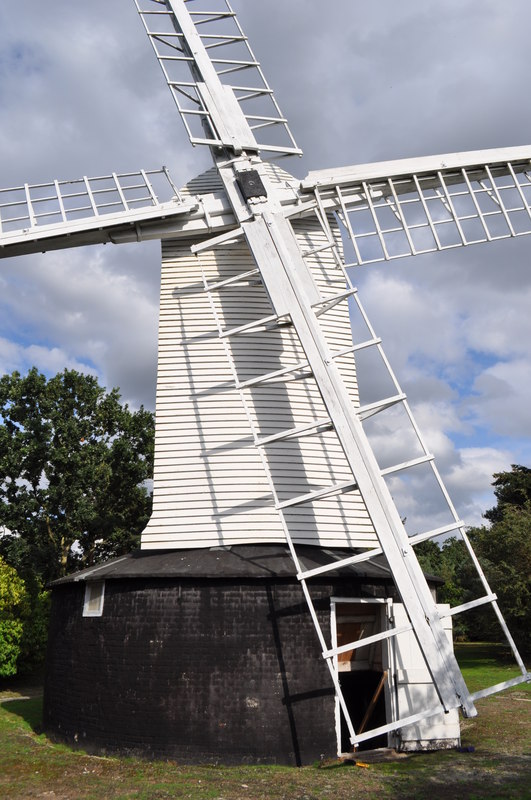
Just before the fork, a little footpath on the right leads to Holton Post Mill. The whitewashed 17th-century windmill has been closed to visitors since the pandemic, but is worth the short detour to see its ingenious design: it has a fantail attached to a turntable around the mill, allowing the whole building to rotate 360° with the prevailing wind.
Returning to the main route, turn right down Mill Road, passing a row of pretty cottages on the right and coming to a T-junction just after the Lord Nelson Inn on your right. Turn right here, signposted Brampton and Beccles, and out of the village on the B1124. The two-lane road is wide and flat, winding through tree-lined fields. There’s not usually much traffic here, so it’s not hard going. By way of contrast to the Holton windmill, look out for the tall wind turbines lining the horizon to the left.
About 3.5km from Holton, turn right on to the unmarked King’s Lane, downhill over the river and up the other side, taking the first left, signposted Wangford and Southwold. This pleasant back lane cuts straight between open countryside, coming to a crossroads with the A145. Carry on straight ahead here, dismounting if it’s busy, reaching a T-junction after another kilometre or so.
Turn right here and after another kilometre you come to the A12. Luckily, there’s a footpath on the right of this dual carriageway, with a safe crossing on to a traffic island in the middle, then another footpath on the other side, which winds left and into Wangford.
Wangford is a no-frills working village (which incidentally gave its name to country singer Hank), mostly composed of modern housing estates. Go straight up the High Street, right at the crossroads, then left immediately on to Elms Lane, by a vet’s clinic on the left-hand corner. Take the first right after a few hundred metres (joining the NCN31 now all the way to Southwold) towards Reydon, along quiet lanes winding gently downhill to the coast.
Keep following the NCN31 signs, with Wood Farm Lane continuing into Rissemere Lane East winding right and left through open fields and past attractive farmhouses, barns and cottages. After around 3.5km, turn right on to School Lane, then left at the triangle on to Wangford Road, leading to Reydon. Then take the next left-hand turning, on to Green Lane, a small detour avoiding the busy main road straight ahead into Southwold.
Coming into Reydon, turn left at the T-junction continuing along Covert Road and passing a row of Victorian almshouses on the right. Go straight ahead/right at the next angled T-junction soon after the almshouses, signposted Southwold, joining the B1127/Lowestoft Road, past Reydon Village Hall on the right. This suburban village is practically contiguous with Southwold – there’s more traffic here too, so leave space as you pass parked vehicles, in case of doors opening suddenly.
At the next T-junction turn left, with a short stretch of cycle path on the pavement on the left, and on to the main road into Southwold. There’s a cycle path on both sides here, providing some escape from the traffic that flows in and out of this bustling resort, particularly during the summer. There’s plenty to do and see here, not least the pier, with Tim Hunkin’s gloriously wacky arcade games.
The NCN31 carries on down the High Street to the seafront. If you’re going straight back to Walberswick, though, there’s a quieter route around the edge of town. Turn right at the fork in front of the Southwold Arts Festival building and on to York Road, passing the rugby club and golf course on your left. The road soon comes to the River Blyth.
Turn left by the Harbour Inn and alongside the river, past the yacht marina and boatsheds to the ferry crossing. The small rowing boat ferry takes up to 12 passengers and a couple of bikes if space is available. There’s no advance booking, so it’s best to get in the queue to be sure of a place. There is also a footbridge across the river further upstream; take the right-hand turning before York Road, on to Blyth Road, which becomes a narrow, single-track footpath after the golf course on your left.
Across the bridge, the path comes out on the outskirts of Walberswick, close to the fork where we turned off at the start of the ride, so turn left here and follow The Street back to the harbour.
More information
For more information, check out Huw Hennessy’s guide: