Mesmerising St Helena: The five best postbox walks on the island
A series of ‘postbox’ walks take travellers on a round-the-island walking tour, showcasing the very best of St Helena’s scenic beauty.
The tiny British outpost of St Helena has all the feel of an enchanted island. Step foot on to its rocky terrain and you’ll find yourself on an ancient volcano, its roots firmly on the sea bed some three miles below, its verdant head 820m up towards the clouds.
In between, as the narrow roads twist and turn through a landscape formed millions of years ago, you’ll move almost seamlessly from one world to another. From rolling hills grazed by sheep to dauntingly high cliffs that drop straight down to the ocean; from multi-coloured volcanic rocks worn smooth over millennia to forests of eucalyptus that plunge down the hillside; from balmy pinewoods beloved of fairy terns to the pinnacle of the island: a rolling series of deep-green valleys and ridges that stretch out to the sea, endless sea.
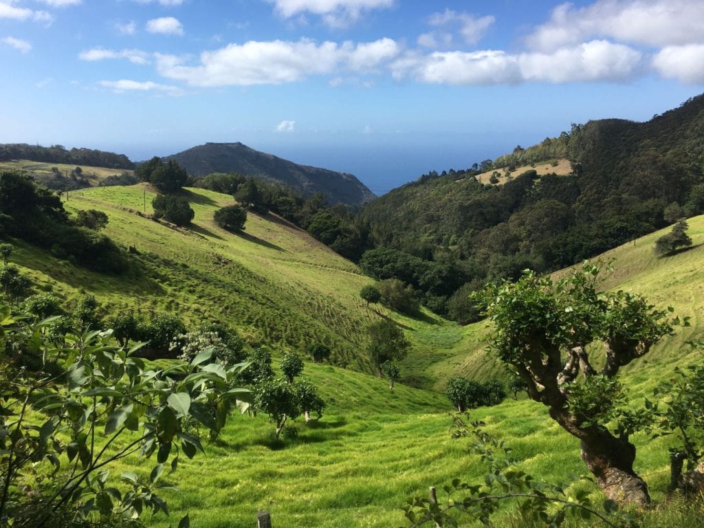
A series of 21 ‘postbox’ walks effectively take travellers on a round-the-island walking tour, visiting almost every area of coastline, and showcasing the very best of St Helena’s scenic beauty. From the verdant central ridge to the volcanic drama of the northeast and Sandy Bay, from rolling pastureland to fragrant pine woods and stupendous views down to the sea: it would be hard to imagine greater variety in such a small area.
Based upon a similar concept on Dartmoor, each of the walks is linear, with a postbox at the end concealing a log book and a rubber stamp for you to keep a record of your achievement.
The walks vary in difficulty and terrain, but none of them could be called a walk in the park. With sheer drops not uncommon, it’s advisable at least to consider a local guide, especially for any walk graded 5 or above. If you’ve only time for a few, then the following make a pretty unbeatable combination.
Diana’s Peak
(5/5; 2hrs)
The highest postbox in the South Atlantic is located up at Diana’s Peak, along with the standard postbox stamp so you can authenticate reaching the highest point of St Helena. Beginning either from Cabbage Tree Road or Black Gate, you can follow a circular route, with the option of taking a marked detour off Cabbage Tree Road to Halley’s Mount.
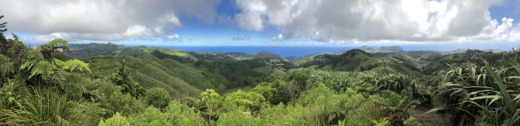
Either way, it’s quite a steep, but not particularly difficult, hike up through dense vegetation, along the trail of the endemic pink blushing snail=, which is easily spotted on the cabbage trees. A knowledgeable guide is invaluable to avoid missing out on several of the island’s endemic plants and countless invertebrates (there are over 120 species here that are seen nowhere else in the world).
As you near the top, where the mists of the cloudforest swirl around, the walk takes in St Helena’s three highest peaks: Diana’s Peak, the tallest at 2,690ft (820m), is flanked by Mount Actaeon and Cuckold’s Point, which are both marked by tall, slender trees. From the top of each there are breathtaking views over the whole island and, on a clear day, far out to sea, while below your feet are thickets of endemic cabbage trees, tree ferns,dogwoods and whitewoods.
Sandy Bay Barn
(5/6; 2hrs 15mins)
With impressive views as well as challenges, the approach road to Sandy Bay is spoken of with respect: a steep, narrow, winding slip of a road which is one of the most testing on St Helena. But make your way slowly down, past the flax, the buddleia, the coffee plantation, the tiny Baptist church, and the thorn trees laden with shimmering morning glory, and you’ll understand why it’s worth the effort.
At the end of the route, there’s an alternative route for those with no head for heights. When you reach the foot of the Barn you can either scale the rock face ahead (not for the vertiginous), or follow the path to the right across a short, steep slope under the cliffs.
Blue Point
(3/3; 1hr 20mins)
This moderate postbox walk is also one of the most popular. It follows the edge of the wonderfully titled Gates of Chaos (belying its melodramatic name, the gradient is generally gradual).
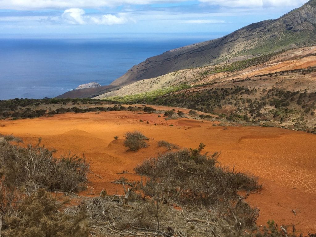
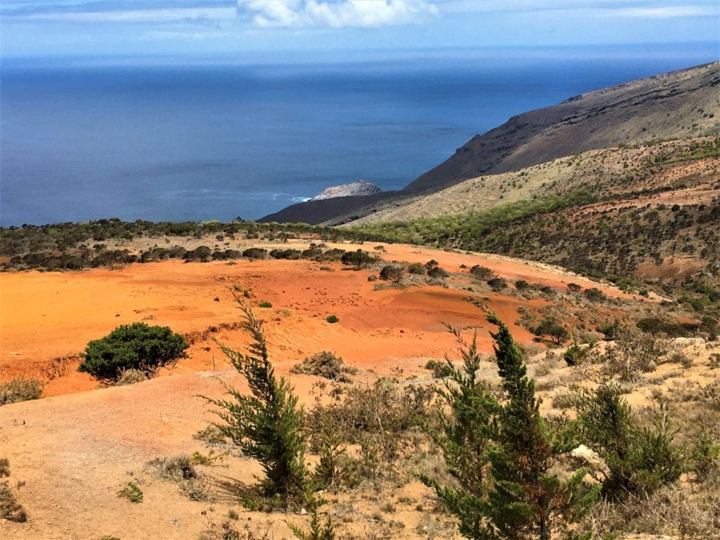
Characterised by wind-eroded volcanic terrain, which reveals the rusty coloured soils beneath, the path to Blue Point opens out to give spectacular views over Sandy Bay. The track then descends, with views over Manati Bay (said to be named after a ‘seacow’, which turned out to be seals).
The route leads along the spine of the ridge and over two stiles and past two habitat restoration areas (where you’ll find patches of endemic rosemary and scrubwood, with its white daisy-like flower), to Blue Point peak at 600m.
Just offshore, you’ll see the guanospattered Speery Island, as well as Castle Rock and the Black Rocks. Besides the great views along the way, this walk also offers the regular spectacle of clouds being blown over by the southeast trade winds, billowing up from the sea and blanketing the surrounding peaks before the sun burns them away.
South West Point
(4/3; 2.5hrs)
It’s hard to resist the allure of this lovely long walk to the westernmost point of the island, the first hour of which is spent winding up around an open hillside, dramatically overlooking Speery Island.
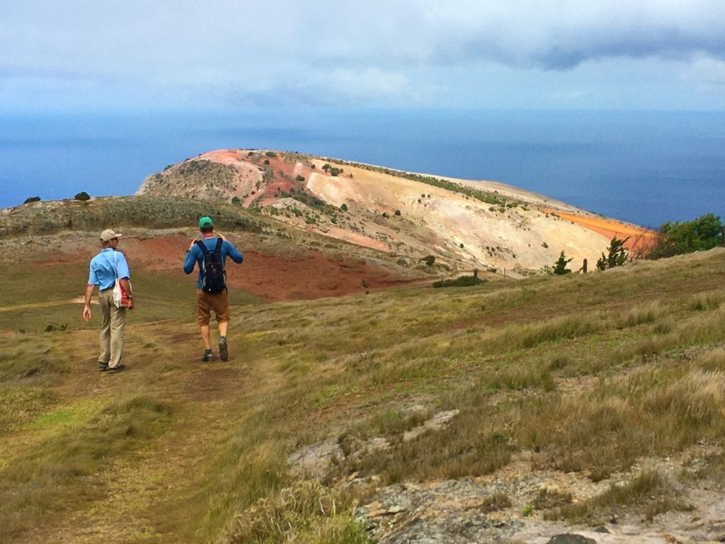
There’s plenty to appeal to the naturalist, too, with patches of wild bilberry and the blue-flowered gobblegheer on the approach track and the likelihood of seeing the wirebird as the path opens out on to undulating pastureland.
Beyond the pastures and before the postbox, a beautiful area of multi-coloured earth comes into view – scorched reds, ochres and flame pinks brighten the hillsides.
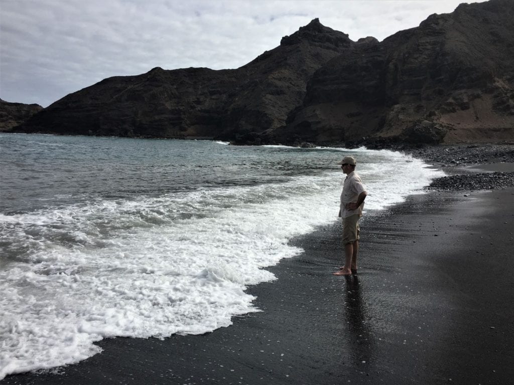
Lot’s Wife’s Ponds
(6/8; 2.5hrs)
The end of the track leading down to Sandy Bay is the starting point for this, justifiably the most popular of the postbox walks. As spectacular as this walk undoubtedly is, it is definitely not for anyone with vertigo, and is better undertaken with an experienced guide.
The narrow path crosses the dry riverbed, then winds up and over a multicoloured ridge: millions of years of geology right at your feet. At the ridge, the views over the craggy coastline and aquamarine sea are spectacular.
On several rocky outcrops, masked boobies make their nests, evidenced by splashes of guano. The birds seem remarkably unconcerned by passing walkers, but keep your distance so as not to disturb them. Look out too for patches of babies’ toes, ground-hugging clusters of succulent plants.
After around another half an hour of zig-zagging downhill, your efforts will be rewarded following the final descent to the seawater ponds via two knotted ropes down the vertical rockface. Sheltered from the waves by natural rock, they’re large, deep, and full of colourful fish (striped sergeant majors, wrasse and blennies), starfish, sally lightfoot crabs, and even the occasional eel or octopus.
Don’t forget your swimming things – the water is warm, crystal clear and inviting (not least because of the effort it takes to get here).
More information
For more information, check out our guide to St Helena: