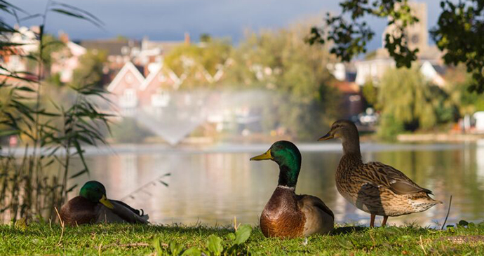
Norfolk is the perfect place for Slow travel whether it is the county’s rich network of footpaths, exploring unspoiled villages by bicycle, drifting leisurely along its waterways or taking a ride on a heritage railway line.
Laurence Mitchell, author of Slow Travel Norfolk
I may not be a native but I have lived in Norfolk for longer than anywhere else in my life. When I first arrived here I was quick to explore the obvious places like the Norfolk Broads and the marvellous north Norfolk coast. These places still hold endless appeal but over the years I have also come to appreciate lesser known parts of the county too: the Brecks of west Norfolk, the Waveney Valley that follows the border with Suffolk, and the wide-open vistas of ‘high’ Norfolk in the northwest of the county. All of these regions make an ideal focus for a holiday or short break.
Although it could hardly be described as hilly, the county is not quite as flat as some might have you believe. The Norfolk countryside is a wonderful place for outdoor pursuits like hiking, cycling and birdwatching. Norfolk’s towns and villages should not be overlooked either: King’s Lynn and Great Yarmouth at either end of the county both have a rich maritime history, while Cromer and Hunstanton are characterful Victorian-era resorts.
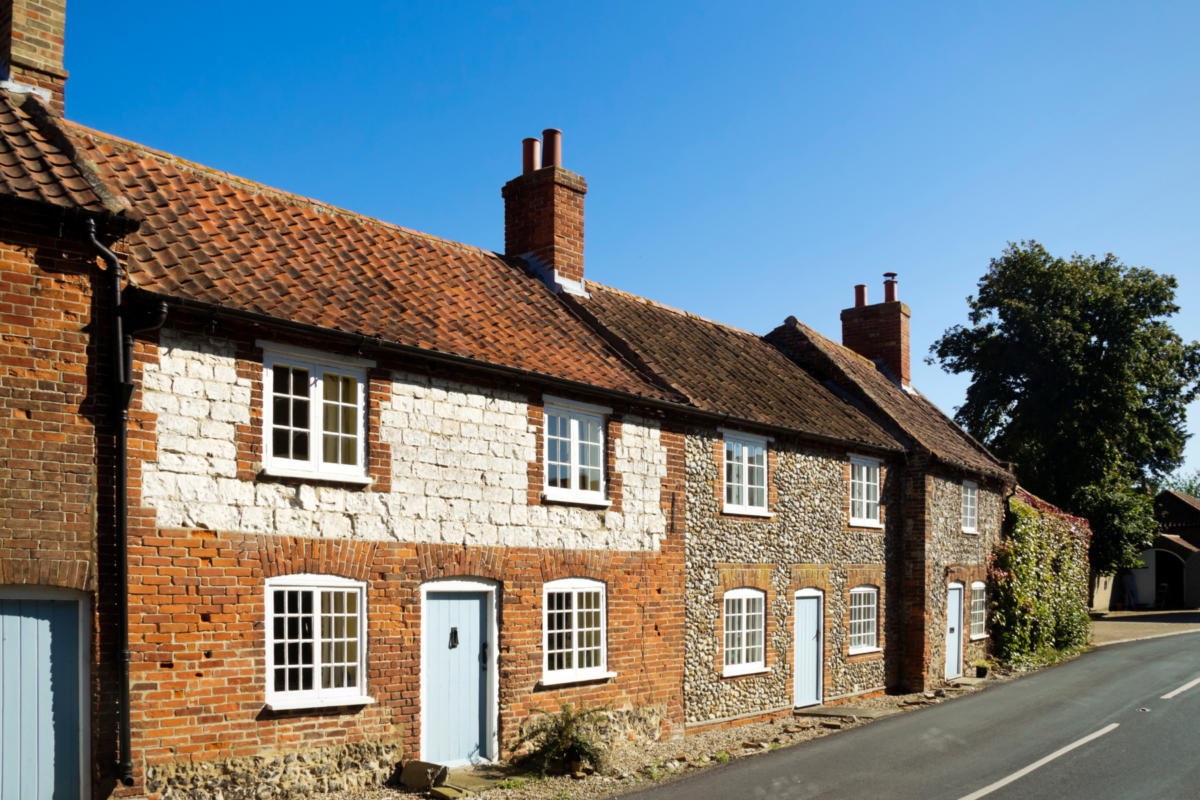
Away from the coast, historic market towns like Holt, Aylsham and Diss have their own distinctive charm too, partly thanks to their attractive vernacular architecture but also because of their laid-back, slightly old-fashioned atmosphere. If life seems a bit too ‘Slow’ in such places then there’s always Norwich, which for a small city punches well above its weight in terms of its facilities and provision for the arts. The city, which each May hosts the highly regarded Norfolk and Norwich Festival, one of the oldest city arts festivals in the country, became England’s first UNESCO City of Literature in 2012, one of only seven such cities in the world.
Bradt on Britain – our Slow Travel approach
Bradt’s coverage of Britain’s regions makes ‘Slow Travel’ its focus. To us, Slow Travel means ditching the tourist ticklists – deciding not to try to see ‘too much’ – and instead taking time to get properly under the skin of a special region. You don’t have to travel at a snail’s pace: you just have to allow yourself to savour the moment, appreciate the local differences that create a sense of place, and celebrate its food, people and traditions.
For more information, check out our guide to Norfolk:
Food and drink in Norfolk
Savouring the tastes of Norfolk
With something like 90 miles of North Sea coastline it is hardly surprising that Norfolk has a wealth of seafood to savour. Probably the most highly regarded are the Cromer crabs that are caught just off the north Norfolk coast. There are plenty of lobsters and shellfish too, the most famous being ‘Stewkey Blues’ – a type of cockle – and tasty fresh mussels from Brancaster. The wet fish options are also excellent; cod and haddock especially, and herring too, a nutritious and plentiful fish for which the port of Great Yarmouth was once world-famous.
Several smokehouses around the coast, like the one at Cley-next-the- Sea, make good use of such provenance and produce all manner of delicious goods like kippers and smoked mackerel. To complement your seafood you may wish to try a seasonal favourite, marsh samphire, a salty delicacy that grows in abundance in the saltmarshes of north Norfolk in the summer months.
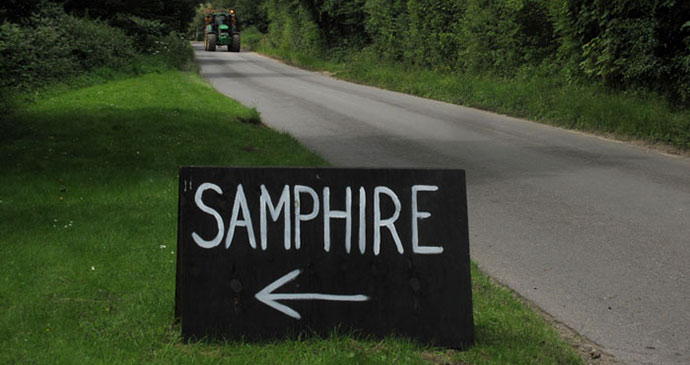
Samphire grows in abundance in the saltmarshes of north Norfolk in the summer months © Laurence Mitchell
For committed carnivores Norfolk meat is a treat too, especially that which comes from some of the county’s rare breed varieties, like beef from Red Poll cattle. Many Norfolk restaurants make use of locally reared meat on their menus, but the county also has a large number of farm shops and farmers’ markets where such products can be purchased for home consumption. With a relatively dry climate and a tendency towards arable, Norfolk is not really much of a place for dairy farming, but the county does produce a number of cheeses with a distinctive local flavour. Probably the best known are those made by Mrs Temple’s Cheeses at Wighton in north Norfolk, especially Binham Blue, which is made with vegetarian rennet and milk from British Holstein cows.
Vegetarians are well provided for as a rule: the county has a wealth of fresh vegetables and there are a number of organic providers, too. A decent number of restaurants also specialise in, or serve only, vegetarian food. This is particularly true of Norwich, the county capital. Asparagus is one of the county’s specialities, abundant in early summer, especially in those areas that have light, sandy soil.
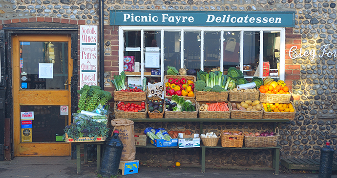
Local produce on sale at Cley-next-the-Sea © Martin Charles Hatch, Shutterstock
Contrary to expectation, Norfolk actually has a few vineyards – some of the most northerly in the country – one of which has produced prize-winning wines. Overall, however, it is probably fair to say that the county is better celebrated for its beer. Norfolk has a plethora of small-scale real ale breweries scattered around the county – Woodforde’s from Woodbastwick, Wolf from Norwich, Yetman’s from Holt and Humpty Dumpty from Reedham, to name just a few. If these are not enough to quench your thirst then there are always Adnam’s or St Peter’s Brewery ales from over the Suffolk border. Surprisingly, perhaps, the county is also a whisky producer, with the English Whisky Company distilling a range of hand-crafted whiskies conjured from Norfolk barley and deep aquifer water at its base in Roudham in the Brecks.
Where to stay in Norfolk
For information about accommodation, see our list of the best places to stay in Norfolk.
What to see and do in Norfolk
North Central Norfolk
Norfolk’s wool country that once was – the north coast hinterland – is a region of small, solid Georgian towns and massive wool-trade churches, grand estates and country houses: an enclosed landscape with lighter soils and fewer hedgerows than further south. The area is bounded, more or less, by the market towns of Aylsham, Holt, Fakenham and East Dereham, although there will inevitably be the odd diversion.
The main rivers here are the Wensum and Bure, which slowly converge as you head east across the county to combine at Breydon Water outside Great Yarmouth.
Visitors tend to rush through this part of the county en route to the Norfolk coast, which is a pity because there’s plenty of interest here.
And it’s true to say that you’ll probably find more of the traditional spirit of north Norfolk away from the coast than at it. Holt is close enough to the fashionable north coast to have its own claim as an alternative base for visiting that region, a reality reflected in its range of smart shops and places to eat. Aylsham is more overlooked, despite the fact that the presence of Blickling Hall just down the road brings in quite a few visitors.
This is a shame as, for my money, it’s just as attractive as Holt. Fakenham and East Dereham are a little more humdrum, but both pleasant enough market towns with their own merits. There are some highly appealing villages. Reepham and Cawston have imposing churches, while Salle is just an imposing church without a village. North Elmham has a Norman chapel and the site of East Anglia’s former Saxon cathedral, while Little Walsingham, tucked away in lovely rolling countryside, has very much a living pilgrimage tradition. In between are sleepy villages like Heydon and even sleepier ones like, dare I say it, Great Snoring.
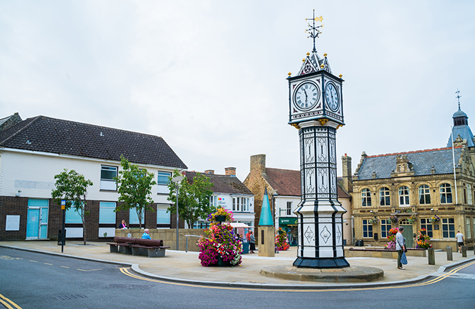 The old-fashioned market town of Downham Market is well known for its iconic clock tower © BBA Photography, Shutterstock
Northwest Norfolk & The Wash
As you head west along the north Norfolk coast, it turns south just before the resort of Hunstanton and with a change of direction, comes a change of character. Instead of vast expanses of salt marshes, pebble cottages and silted medieval harbours we find ourselves in a zone of sandy beaches and low dunes, stone-banded cliff s and low chalk ridges inland.
The coast runs down as far as King’s Lynn, which once had a far more important place in the scheme of things than it has today but, there again, so did Norfolk as a whole.
It may seem strange to witness the sun setting out to sea – this is East Anglia after all. But the realisation that the Wash is just a rather wide inlet will come when, in fine weather, you see the wind turbines on the far Lincolnshire shore, or, on a very clear day, catch a glimpse of the ‘Boston Stump’, the improbably tall tower of Boston’s St Botolph’s Church. The Wash’s beaches attract both holiday makers and wildfowl, with buckets, spades and suntan oil out in force at Snettisham in the summer months, and geese, ducks and waders feasting on the tidal mudflats and sandbanks off shore in winter.
Inland from the coast it is a different picture, with low chalk hills, quietly attractive carrstone and chalk-built villages like Ringstead and lush pasture with scattered patches of woodland.
Further inland still and you edge into the light soils of what’s sometimes termed as High Norfolk – the agricultural landscape of north Norfolk enclosure, with its hedgerows and woodland copses.
The slow pace of life here quickens only marginally in its urban centres, old-fashioned market towns like Swaffham and Downham Market that lie on the edge of this region and give way to Breckland and the Fens respectively. On the whole though, smaller villages like Great Bircham and Great Massingham, both far from ‘great’, are generally more typical of this ultra-rural corner of the county.
This is estate country too, with Sandringham, the Royal family’s country retreat, being the prime example. The hall at Houghton is even more impressive and one of the finest country houses in East Anglia.
King’s Lynn, once a thriving port, is central to the area and although it may seem unprepossessing on arrival, has a concentration of intriguing distractions centred around its historic core. South and west of here lie the spectacularly contour-free, drained arable region of the Fens, often associated with Norfolk but really far more typical of Cambridgeshire and south Lincolnshire than Norfolk as a whole.
The Fens are not to everyone’s taste, but have huge wide skies and distant horizons that are unsullied by anything as presumptuous as a hill or even a contour. Lines of straight poplars stretch into the distance like a French impressionist painting; pylons recede to vanishing point – you can almost sense the curvature of the earth.
The Peddars Way runs arrow-straight across this area, beginning uncertainly – or rather, ill-defined – in the heathland at Knettishall near Thetford but gaining confidence, and a more obvious surface, as it progresses through Castle Acre across the heathland and chalk ridges of west Norfolk to terminate at Holme-next-the-Sea. Such a linear, determined route suggests a Roman origin, and it was constructed as a military thoroughfare in their campaign to pacify Norfolk’s warring Iceni tribes.
When the Romans finally removed their sandals from these shores and high-tailed it back to Rome in time for the fall of their empire, the route came into its own as a thoroughfare for peddlers, thieves, drovers and pilgrims. There again, the route may well be even older – an extension of the undeniably ancient Icknield Way that was remodeled by road-mad Romans shortly after they arrived.
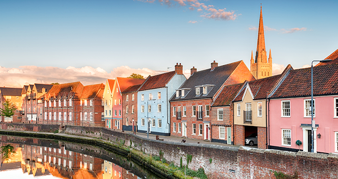
Town houses in Norwich overlooking the river © Helen Hotson, Shutterstock
Norwich & The Yare Valley
This area comes as something of a catch-all, a means of including parts of east and south Norfolk that don’t conveniently fit in elsewhere. The River Yare that flows from central Norfolk to Great Yarmouth is perhaps an obvious point of focus: a natural conduit for river trade between Norwich and the coast. This same river also connects with the Broads at Breydon Water, and even has a couple of important minor broads of its own at Surlingham and Rockland. If the Yare Valley is a convenient means of incorporating uncooperative slices of east Norfolk, then the valley of the River Tas can be brought in to do the same for south Norfolk. The modest River Tas, which joins the Yare just south of Norwich (having quietly meandered up from south Norfolk), has nothing of the importance of the Yare, but it does link a number of villages that are worth a visit south of Norwich.
It is probably true to say that Slow philosophy has its heart in the villages and market towns rather than the cities, but Norwich is hardly your average city. Despite recent plaudits in ‘Best place to live’ features by some newspapers, the general image is that of a city out on a limb that is out of step with modern times; a place of gauche, unfashionable attitudes and a plucky, if sometimes unpredictable football team; Alan Partridge, Delia Smith, parochialism, mustard, banking and insurance.
Naturally enough, the reality is somewhat different: Alan Partridge is a fictitious character (although there really is a Radio Norwich these days), Delia Smith lives in Suffolk despite her regular outings to Carrow Road to watch football, and Norwich Union have re-branded as Aviva and outsourced to Sheffield and India. Contrary to expectations, the city is increasingly cosmopolitan, has a thriving university and is one of the fastest growing cities in England. Simply put, Norwich punches well above its weight.
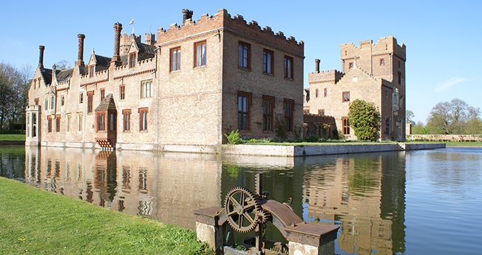 Oxburgh Hall is a popular attraction in the Brecks region © Raedwald, Dreamstime
The Brecks
The Brecks is a region in the western part of Norfolk which lies between Swaffham in the north and Thetford in the south. Both towns have historical interest well beyond what one might expect. Thetford was home to the monarchs of East Anglia and the seat of a bishopric; it was also the birthplace of that staunch anti-monarchist Thomas Paine. Swaffham is an old-fashioned market town with a futuristic and heart-warmingly eco-friendly Green Britain Centre. As a discrete region, the Brecks reaches well into Suffolk across the border. Of the five market towns that belong to the Brecks area – Swaffham, Watton, Thetford, Mildenhall and Brandon, the last two are in Suffolk.
Although the Brecks borders the pancake-flat region of the Fens, it really could not be more different. The Brecks, in contrast to the fertile black soil found in the Fens, has light, sandy soil that is far less ideal for intensive farming. The word ‘breck’ comes from a word that means land that becomes quickly exhausted. It’s the closest thing that Britain has to a desert and this is really not so far-fetched, as the rainfall is the lowest in the country, summer temperatures can be among the highest, and winter frosts the hardest. The sand that covers the chalk was originally wind-blown, but trees have since been planted to stabilise the soil. Back in the days before such enlightened ideas, when large estates sought to maximise their profits by introducing sheep, the sand blew freely around causing untold damage, depleting thin topsoil in one place and covering up fertile land in another. In north Norfolk, sheep may have brought fortune but here they just heralded disaster.
The vast Thetford Forest, flanking the A11 around Thetford itself, is a recent innovation, planted by the Forestry Commission after World War I to provide a strategic reserve of timber. Much of what is not forest goes to make up the Stanford Battle Area, established in 1942, where the Army practise manoeuvres and test ordnance. Vast stands of Scots and Corsican pine may be what most people immediately associate with Breckland these days but it is a very recent trend. Step back just a hundred years in time and you would see only sandy heathland, gorse and rabbits – lots of rabbits.
It almost goes without saying that this is a part of East Anglia that many speed through without stopping. Consequently, it is not as well-known as perhaps it deserves to be. Outside the few towns, the Brecks’ distinctive habitat is a prized haven for wildlife: it is home to several species of plant, insect, bird and mammal that are found almost nowhere else in the country.
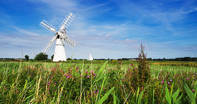 Many windmills can be found in the Broads area, such as this one at Thurne © Broads Authority
The heart of Norfolk Broadland
Just inland from the coast is an area that really could not belong anywhere else in the country. The Broads dominate the landscape south of the small market town of Stalham: a sprawl of inland lakes linked by the River Bure and the shallow but navigable tributaries of the Thurne and Ant. Another collection of broads lies further south, east of Norwich along the River Yare, while a few more can be found across the border in Suffolk. They are all generally referred to as ‘The Norfolk Broads’.
These sparkling bodies of water, previously assumed to be natural phenomena, were only proved to be manmade in the early 1960s, when research by Dr Joyce Lambert, a botanist, revealed that they had originally been medieval peat diggings that had become flooded over the centuries.
With unique wildlife and landscape, and 28 Sites of Special Scientific Interest (SSSI) and nine National Nature Reserves within their boundary, the Broads have been awarded national park status, with the Broads Authority responsible for the area’s management since its establishment in 1989.
The Broads are the one place that everyone associates with Norfolk (even though part of the area overlaps into Suffolk). Even David Bowie has made mention of them in one of his songs, although he was singing about ‘Life on Mars’ at the time. He also mentioned Ibiza in the same line, which hints at the frenzy that some parts of the Broads experience in high summer. At this time of year, the ‘tourist honeypot’ principle is amply demonstrated in the streets of Hoveton, where wannabe ship captains from the Midlands crowd the pavements, and Potter Heigham’s medieval bridge has a lengthy tailback of floating gin palaces queuing to pass underneath. But this is just one face of the Broads; the other is a serene, watery wonderland of windmills, dykes and reed beds so rich with butterflies, dragonflies and exotic looking birds that it can feel almost tropical. It very much depends where you go … and when.
Not surprisingly, the busiest part of the Broads is around the boat hire centres – Wroxham, Hoveton and Ranworth Broads, and the River Thurne around Potter Heigham. Far quieter and more rewarding for landscape and wildlife are Barton, Cockshoot and Hickling Broads, the latter two having boarded walkways and water trails.
How Hill near Ludham has special activities for children and a delightful walking trail through grazing marshes and woodland, and standing at a towering 40 feet above sea level, the highest point for miles, also offers one of the best panoramas in the area. It is also one of the most reliable places to see swallowtail butterflies around midsummer. Another excellent place for an overview of the Broads is the tower of Ranworth Church.
The North Norfolk Coast
From the slightly faded Victorian resort of Cromer to the village of Holme-next-the-Sea, the north Norfolk coast stretches resplendently east to west: a classic landscape of wide beaches, salt marshes, off shore sandbanks, muddy tidal inlets and all-too-rare harbours. This stretch of coastline is quite unlike any other place in the British Isles, and has been designated an AONB (Area of Outstanding Natural Beauty). The icing on the cake is that there are even some modest hills here, with Beacon Hill near Cromer – 345 feet high – marking the highest point of the ridge where the southbound glaciations of the last ice age finally gave up the ghost as they deposited chunks of Scandinavia and North Sea seabed on Norfolk soil.
In spring, the road verges are emerald green with alexanders, a plant related to celery (of which it tastes strongly) that is particularly abundant at the coast and was recently considered for selection as the county flower of Norfolk. Predictably, the powers that be chose the poppy instead – a safe, if less representative, choice. In summer, the saltings glow purple with large swathes of sea lavender, and, with bright blue skies, the coastal marshes become an Impressionist painting of sea, sand and sky. Autumn brings waves of migrating birds, and the bushes twitch with freshly landed migrants at this time of year, as do the salt marshes where exotic waders feed cheek by jowl much to the delight of birdwatchers. In winter, the sky is oft en alive with noisy flocks of geese in their thousands. In fact, if you can put up with onshore wind that seems to hail directly from the Arctic, a bright, crisp winter’s day is hard to beat for a bracing walk along the seashore followed by lunch in a cosy pub.
With a range of distinct habitats for wildlife that include salt marshes, sand dunes, pebble banks, reed beds and woodland, it is hardly surprising that birds – even some rarities – are found everywhere, and that conservation bodies like the RSPB and NWT (Norfolk Wildlife Trust) have several reserves along this coast, as does the National Trust. In fact, Cley-next-the-Sea, a village with the vast NWT Cley Marshes Nature Reserve of salt marshes and reed beds, has long been considered one of the best sites for birding in the entire British Isles. Seals are easy to see too, and a boat trip out among them is invariably a hit with visitors of all ages.
This coast is largely a place of small fishing villages that have turned, in part at least, to tourism. Flint and pebble rules supreme, with whole villages – houses, pubs, churches, even bus shelters – constructed out of these plentiful beach materials. It’s almost a surprise that public phone boxes aren’t made out of them – since public conveniences generally are.
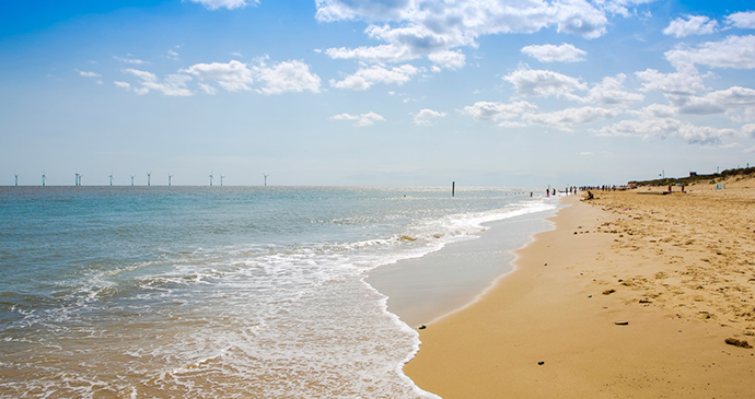
Caister-on-Sea, near Great Yarmouth, has an excellent sandy beach © Greater Yarmouth Tourism
The Northeast Coast
East of Cromer, the north Norfolk coast curves gently southeast towards Great Yarmouth and the border with Suffolk. The coast here is less spectacular than that further west but provides locals with pleasant spots for dog walking and fishing, as well as sunbathing and swimming in the summer months when the wind drops.
Thousands of hedgerows were enthusiastically grubbed out in this part of the county back in the 1960s but, that said, even some of the larger expanses of grain seen inland from the coast are a far cry in scale from the geometric prairies in the Fens further west.
With quiet, old-fashioned villages like Overstrand and Mundesley, along with the slightly more bucket-and-spade atmosphere of places like Sea Palling, Norfolk’s northeast coast is likeable but it’s hardly superdistinctive. Nevertheless, its safe sandy beaches and marram-grass covered dunes make for great places for young families to potter about.
The villages that punctuate this stretch of the coast have little of the cosmopolitan gloss of places like Blakeney or Burnham Market in northwest Norfolk, but there are enjoyable corners: this is workaday Norfolk, and there are far fewer incomers and second home owners than elsewhere in the county.
The timber groynes that push out to sea along the length of this shoreline – sometimes mysteriously erased from view by the frequent sea mists – give a clue to the nature of the coastline in these parts. West of Cromer, it is a landscape in the making, with transported sand creating spits and extensive off shore sands. Here, it is one of occasionally brutal erosion. Dotted sporadically along this stretch of coast are houses perched precariously on the edges of crumbling cliffs, with livelihoods hanging in the balance as the North Sea threatens to breach dunes and sea walls to flood valuable farmland. Measures to slow down the rate of coastal nibbling by the sea are hugely costly and ultimately don’t often solve the problem. This can be hard to explain to those whose lives have always been based here.
 The Waveney flows east through small towns including Diss © Duncan Kerridge Photography
The Waveney Valley
Just as the Little Ouse River forms a natural boundary between Norfolk and Suffolk in the west of the region, the River Waveney performs the same function in the centre and east. The Waveney’s source lies between the villages of Redgrave in Suffolk and South Lopham in Norfolk, close to where the Little Ouse also rises. The sources of the two rivers are actually so close that Norfolk is almost an island – a heavy downpour and a flooded road or two and the separation is complete.
From its humble origins in Redgrave Fen, the Waveney flows east through the small towns of Diss (Norfolk), Bungay and Beccles (Suffolk) before looping north around Lowestoft to join the River Yare at Breydon Water and eventually go to sea at Great Yarmouth. East of Bungay, the river lies within the boundary of the Broads Authority and the river is connected to Oulton Broad just west of Lowestoft by a manmade channel, Oulton Dyke.
All this talk of rivers and county boundaries might suggest that the Waveney forms some sort of impenetrable barrier. Far from it: the river is more of a conduit than anything, a far cry from the situation with the Yare to the north where the river represents a real physical obstacle. The Waveney, in contrast, has plenty of bridges spanning it, especially in its western reaches.
The Waveney Valley may not be much of a valley in physical terms – it’s hardly Kashmir – but it does have a personality all of its own that seems quite separate from the rest of Norfolk and Suffolk. Teenagers along the Waveney Valley may display keen allegiances to either Norwich City or Ipswich Town but that is about as far as it goes. The birdsong in the hedgerows sounds pretty much the same on either bank.
So what characterises the Waveney Valley? It’s a sense of cosy isolation, where south Norfolk eases into the clay country of north Suffolk, where there are fewer big estates, and more commons, ancient hedgerows and moated farmhouses; more meandering tracks that seem to follow every field boundary before ending up nowhere in particular.
There has probably been less change over the past half century in this region than anywhere else in southern England. While the attractions of north Norfolk have undoubtedly lured numerous outsiders, downsizers and weekenders over the years, the Waveney Valley has a different kind of draw. Those that have settled here have tended to become more integrated into the existing community. It has long attracted artists, writers and craftsmen and there was a noticeable, if small-scale, invasion of folk escaping the city for something simpler and more wholesome back in the 1970s – they are mostly still here.
Related books
For more information, see our guide to Norfolk:
Related articles
From 16th century cottages to vintage chalets.
From renovated Victorian buildings to oak-beamed pubs.
From idyllic riverside spots to eco-friendly glamping.
From boutique country retreats to luxurious spa hotels.
From medieval castles to Edwardian Arts-and-Crafts architecture.
Sheringham’s charming coastline, fascinating fishing history and small-town feel make it the perfect place to spend a weekend.
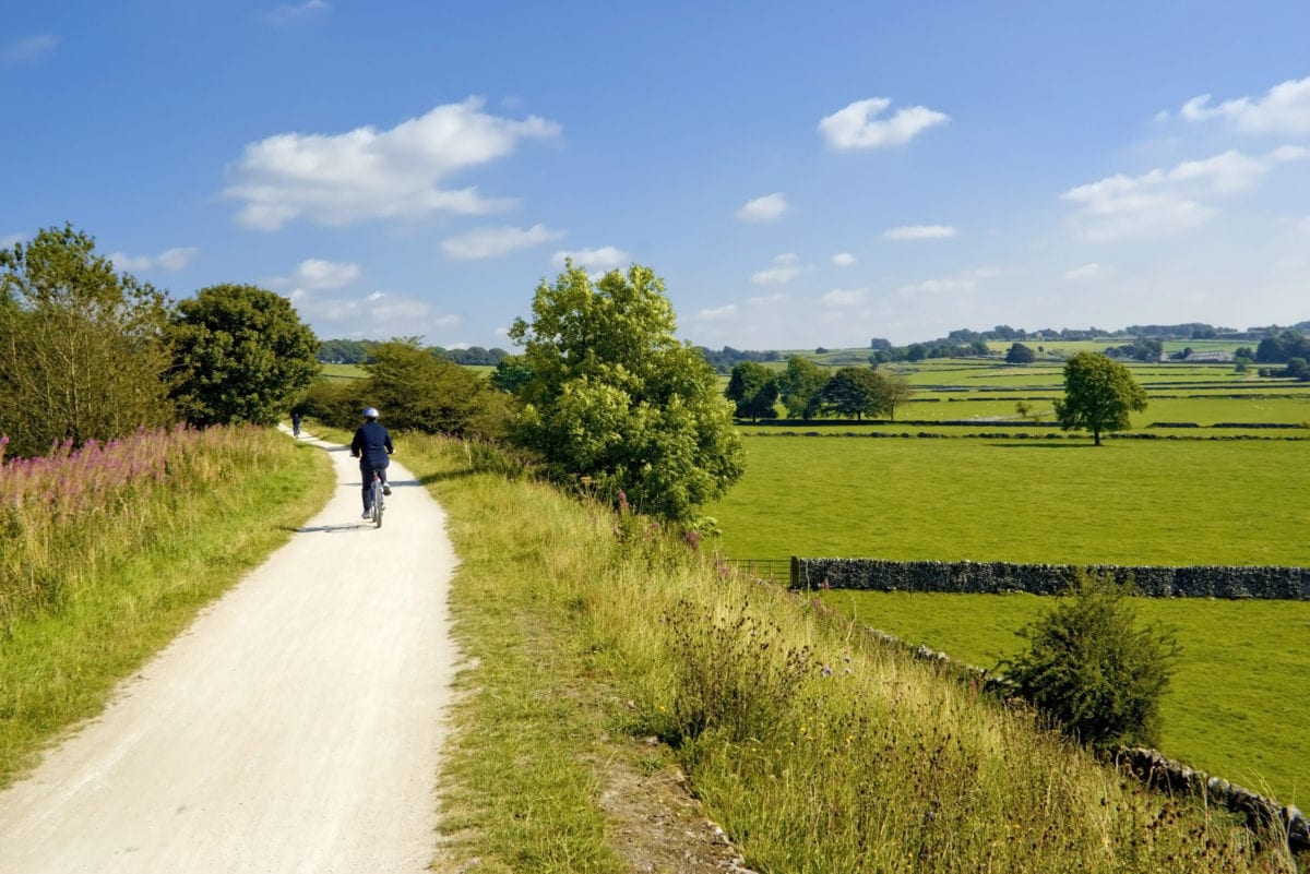
Leave the car behind and explore Britain’s highways, byways and coastal pathways on two wheels.