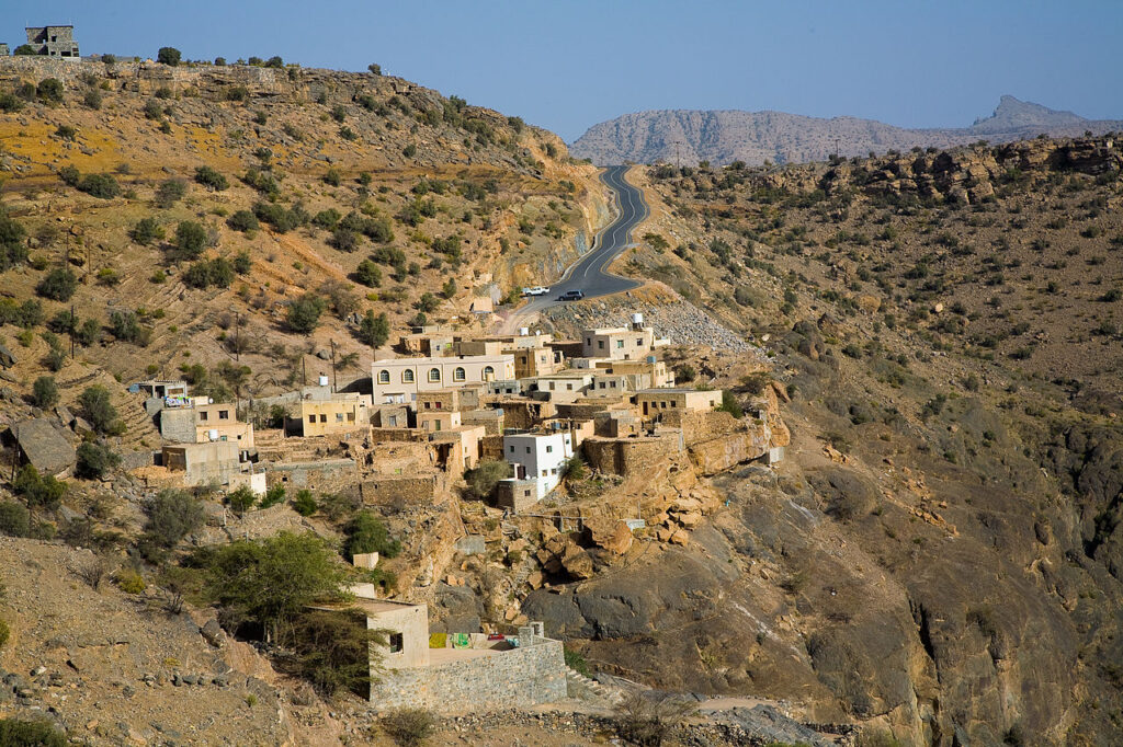
Part of the pleasure of any visit to Oman’s Al Jabal Al Akhdar, and the Sayq Plateau – the area that surrounds the main area of terraced agricultural fields – is the drive up, and down, the extraordinary modern tarmac road that cuts up from near Birkat Al Mawz, following the route of the old military road.
Before the superb tarmac road was finished in 2006 and non-military vehicles allowed to use the route, the ascent to this area of Al Jabal Al Akhdar was a gruelling 6-hour climb, up a near-vertical path with donkeys as support for provisions.
Today, the ascent starts at the police checkpoint. All drivers should have vehicle registration documents and may be required to show their valid driving licence. The nationality of everyone in the vehicle is noted for Ministry of Heritage and Tourism records. Once past the checkpoint, follow the tarmacked road, which is also fully lit at night, for 28km to reach the Al Maha petrol station on the Sayq Plateau. Your vehicle will consume huge quantities of fuel as the engine strains to ascend the mountain, so make sure that you have at least half a tankful at the start.

This road alone is worth the visit: on clear days the views are stupendous. However, there’s no need to keep looking over your shoulder to check the vista, since you will descend on exactly the same road and can stop at one of several parking places. After nearly 12km of continual gear-changing ascent, the road reaches over 2,000m and the general undulating plateau area. This altitude is usually above the clouds and general haze of the plains, and feels fresher. The rocks here are limestone, faulted through the collision of the surrounding ophiolite on the plain below.
From the Sayq Plateau a tarmac road branches north off the main route, ascends a few hundred metres and then leads on to other small villages and the Alila Hotel. To the north of the branch road is the escarpment area, which drops down towards Al Batinah. This general escarpment area, which does include areas of the branch road, is a natural reserve, and there are plans to charge entry to it in the future.
Al Jabal Al Akhdar, which translates as ‘the Green Mountain’, refers to the mountain range that extends from the Nizwa–Muscat road west until Sharafat Al Alamayn, a stretch of about 40km. This is part of the greater Western Al Hajar mountain range, which extends through Jabal Shams to the UAE border and beyond. The name ‘Al Jabal Al Akhdar’ is misleading, as the greenery is mainly confined to the terraces of a handful of villages on the Sayq Plateau, notably between the villages of Al Aqr and Ash Shirayjah. On the south-facing slopes these villages grow almonds, apples, apricots, figs, grapes, lemons, peaches, pomegranates, roses and walnuts, and scattered under the trees and bushes barley, garlic and onion thrive.
The best views of the terraces are from near Diana’s Point, signed as Al Fayyadiyyah, named after a legendary visit to the location by Princess Diana. The turn is 300m west of the Al Maha petrol station; continue for 1km, turn right and the car park ahead is next to the viewpoint. The view Princess Diana may have seen has somewhat changed in the intervening years since the vast Anantara Hotel was built on the cliff ’s edge.