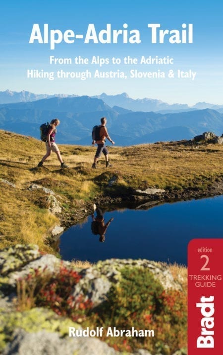
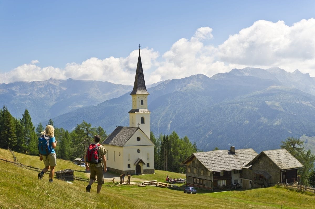
One of the great strengths of the Alpe-Adria Trail is that it highlights just how much, culturally, this Alpe-Adria region – spanning the borders of three European countries – has in common. Which in the increasingly polar Europe of today, is something I find enormously welcome.
Rudolf Abraham author of the Alpe Adria Trail
Over its 750km length the Alpe-Adria Trail winds through some of the finest scenery in the Austrian state of Carinthia, Slovenia and the Friuli-Venezia Giulia province in northeast Italy. Starting from Kaiser-Franz-Josefs-Höhe, at the foot of the Grossglockner in Carinthia’s Hohe Tauern National Park, this outstanding long-distance hiking route takes walkers from the Alps to the Adriatic in 43 stages, through spectacular mountains and national parks and visiting a succession of fascinating historical sites along the way.
For its first 11 stages the Alpe Adria Trail more or less follows the Möll Valley, dipping into side valleys and plunging through gorges, as far as Seeboden on the shore of the Millstättersee. From here it crosses the Millstätter Alpe and the mountains of Nockberge National Park, then further south passes close to several of Carinthia’s other large lakes – the Ossiacher See, the Wörthersee and the Faaker See – before three weeks into the route crossing the Karavanke Mountains, into Slovenia.
It is here, from Kranjska Gora in Slovenia or from Faak am See in Carinthia, that the six-stage Circular Route does a loop around the mountainous knot at the border of Austria, Italy and Slovenia. Entering Triglav National Park the main route then continues south, crossing the Vršič Pass before descending to follow the River Soča for several days.
After crossing the border into Italy’s Friuli-Venezia Giulia province, the Alpe Adria arrives at the UNESCO-listed city of Cividale, then for the remainder of its route jumps back and forth over the Italian-Slovenian border, passing through the Brda/Collio wine region and crossing the karst plateau, before finishing at Muggia, just south of Trieste on the Adriatic coast.
For more information, check out our guide to the Alpe Adria:
Food and drink on the Alpe Adria
Hiking the AAT takes you through a wonderful culinary landscape, earthy yet refined, with plenty of delicious local and regional dishes to try.
Carinthia
Carinthia’s signature dish is Kärntner Nudeln – something like giant, half-moon-shaped ravioli, filled with mashed potato, curd cheese, fried onion, garlic and herbs (including mint), pinched neatly along the edges and served smothered in melted butter. I confess to being completely addicted to these, and will indulge in them at any available opportunity. For vegetarians Kärntner Nudeln will be especially welcome (though you might want to make sure they don’t come scattered with bacon shavings). There are versions with a meat filling as well (Kärntner Fleischnudeln), or sometimes other vegetables such as pumpkin; but the traditional potato and curd cheese version is pretty hard to beat. For dessert there’s the rather heavenly Kärntner Kletzennudeln filled with dried pear, cinnamon, honey and nuts.
Game is popular in upland areas of Carinthia including the Möll Valley (Stages 1–11), there are seasonal dishes such as goose (eaten in October and November, if you’re lucky enough to be staying at Herkuleshof on Danielsberg (Stage 8) at that time), and duck is a signature dish at Metzgerwirt in Radenthein (Stage 14). Glockner lamb is a specialty of the upper Möll Valley, the animals having fed on a diet of alpine herbs high up the valley sides, just below the snow line. There’s some excellent freshwater fish – locally caught trout at Falkerthaus (Stage 15), char (de Saibling) and lake trout from the Millstätter See (Stages 12 and 14) and the Ossiacher See (Stages 19 and 20).
Slovenia
In Slovenia you can try ričet, a rich, warming stew made with smoked pork and beans along with other ingredients. Along the Trenta and Soča valleys (Stages 23 to 36), you can feast on freshly caught trout (though what you’re served won’t be the endemic Soča trout, which is an endangered species). Kranjska klobasa is a local sausage from the Kranj region, made with pork, beef and bacon fat – the traditional production of which is inscribed on the UNESCO List of Intangible Cultural Heritage.
You can sample some local cheeses in the Soča Valley, too, including Bovški sir, a sheep’s cheese that has been made in the area around Bovec since the 15th century (Stage 24), and Tolminc, a hard full-fat cheese from Tolmin (Stage 26). Both of these cheeses have been awarded Designation of Origin status. Traditional curd cheese (skuta) is often served with boiled potatoes (čompe).
Italy
In the mountainous northeast around Tarvisio (Circular Route Stage C4 and C5) and in the upper reaches of Valli dei Natisone (Stages 27 and 28) you’ll find plenty of dishes with game or wild mushrooms, and chestnuts feature prominently in recipes, too. In contrast, along the coast seafood dominates menus, especially at Villaggio del Pescatore (Stage 33) and in Muggia (Stage 37). Exquisite pasta dishes are ubiquitous.
Health and safety on the Alpe Adria Trail
Health
Ticks
Ticks are present in Carinthia, Slovenia and Friuli-Venezia Giulia (as they are across many areas of Europe, including the UK), and tick bites, particularly if the tick remains undetected and is not removed within 24hrs, carry a risk of infection, including with Lyme disease and European tick-borne encephalitis – both of them highly unpleasant, debilitating and in some cases, fatal. Ticks are at their most common in late spring and summer. Not all ticks carry the bacteria leading to these or other diseases, and not all tick bites lead to infection. However, the risk is still there.
Hypothermia
Hypothermia, meaning a dangerous loss in body temperature, is generally caused by cold and/or wet, windy weather conditions, insufficient warm/waterproof clothing, and exhaustion. If not treated it can lead to death. Be alert to any of the symptoms of hypothermia – loss of coordination, slurred speech, numbness in hands and feet, shivering, shallow breathing or impaired vision. If hypothermia is suspected get the victim out of the wind/rain, replace wet clothing with dry garments, keep the victim warm and give hot fluids and foods with high sugar and carbohydrate levels.
Deyhydration
Make sure you carry enough water to avoid becoming dehydrated – 2 litres per person per day should be sufficient.
Safety
The AAT is a relatively easy route, with no technical difficulties, only very few exposed sections, and the trail never strays too far into the wilds. Nevertheless, a simple slip or sprain or a sudden change in weather still has the potential to leave you stranded on high ground, possibly overnight, and anyone venturing into the mountains should be aware of the possible dangers, be prepared to administer basic first aid, and know how to react in an emergency.
Travel and visas on the Alpe Adria Trail
Visas
Since Austria, Slovenia and Italy are all fully fledged members of the EU, UK and other EU nationals do not require a visa to travel within any of these countries or to hike the AAT – just a valid passport or (EU citizens) identity card. United States, Canadian, Australian and New Zealand citizens can visit any of the three countries visa-free for a period of up to three months. Other nationals should check visa requirements with the Austrian, Slovenian and Italian embassies.
There are no physical border posts or restrictions at any of the points where the AAT crosses between any one of the three countries and another – though you will see signs announcing that you are now within a certain distance of the border, and plenty of evidence of the historical legacy of the shifting nature of borders over the centuries. No entry fees or permits are required to visit the national parks along the route of the AAT.
Getting there and away
By air
Access to the AAT is provided by three main airports: Salzburg in Austria, Ljubljana in Slovenia and Trieste in Italy. Treviso (Italy) is also useful, though slightly further away, while Klagenfurt (Austria) has no direct flights to the UK and is only really useful if you’re flying from Germany.
By train
Getting to the start of the AAT by rail from the UK is actually very straightforward. The journey takes between 14 and 20 hours to get from London to Mallnitz-Obervellach (on Stage 8 of the AAT, the closest you can get to Stage 1 by rail in any case), or one stop further to Spittal an der Drau (which has better bus connections to Stage 1, via Winklern), depending on which route you take and connection times, and involves between two and five changes (for timetables see www.bahn.de).
When to visit the Alpe Adria Trail
The hiking season for the AAT stretches from April to October, with snow lingering on the high passes in Carinthia and Slovenia until June, and snowfall generally beginning again sometime in October.
However, given that the route covers terrain (and climates) ranging from the Hohe Tauern to the Adriatic coast and takes up to six weeks to walk, the window for getting through the whole thing in one go is more limited – start too early, and you’ll find some of the high areas in Austria and Slovenia seriously buried under snow; arrive in the lower areas during the middle of the summer and you’ll find the weather oppressively hot.
Not only that, mountain huts start closing in October, as do some pensions and guesthouses; and the peak holiday season, August, can get extremely busy – not so much with people hiking the AAT, but with people holidaying in the area and possibly hiking shorter routes – with some accommodation providers reluctant to offer rooms for a single night. See this guide to Austria in summer for more information.
On balance, the best time for tackling the whole route in one stretch is to start at Kaiser-Franz-Josefs-Höhe in late August or even early September, thus avoiding the busiest time in August; getting through the Carinthian and most of the Slovenian sections, as well as the circular section through Italy’s Tarvisio region, by early to mid October; and completing the coastal section, where the weather will still be pleasant but not too hot, around the end of October. Those picking off the route over several trips, a week or two at a time, can obviously choose an appropriate season more easily.
Nevertheless having said all that I’ve walked different sections of the route in most months between April and January, including late October in the Nockberge when I was often the last guest of the season in mountain huts, but enjoyed the most beautiful weather and walking conditions of any of my visits to the Alpe-Adria Trail.
What to see and do on the Alpe Adria Trail
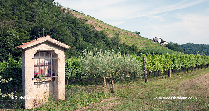
Brda wine region
Wine has been produced in the Brda region since at least as early as the Roman period, and today the Brda region has some 2,000ha of vineyards; the steep slopes, calcareous marl soil and the meeting between Mediterranean and alpine climates all contributing to make this Slovenia’s foremost wine-producing area.
Brda produces predominantly white wines. Rebula is Brda’s signature grape variety, producing a dry, minerally white; other varieties grown widely here are Merlot, Chardonnay, and Sauvignonasse (Sauvignon Vert), as well as Pinot Grigio. A couple of other autochthonous varieties still grown, though much less widely, are the sweet Pikolit and Verduc.
There are plenty of places to try local Brda wines on the AAT, including the historic cellars of Dobrovo Castle, the village of Medana, and the wonderfully situated terrace of the excellent Hotel San Martin in Šmartno.
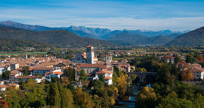
Cividale
The start and end point of Stages 28–29, UNESCO-listed Cividale del Fruili is a beautifully preserved medieval city. Accessed over the River Natisone by a fairytale bridge, it is one of the most fascinating places visited on the AAT. Unquestionably Cividale’s most important monument is the Longobard Temple, a true gem of world architecture, one of the most interesting buildings to have survived from the 8th century anywhere in Europe, and the finest surviving monument of the Lombards.
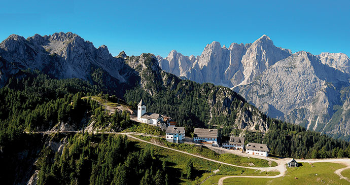
Monte Lussari
The focal point of Circular Stage C4, the village and peak of Monte Lussari are quite something. The 1,789m summit itself is just a couple of minutes from the village – there’s a path up from behind the spectacularly located church – and the views from it are outstanding. If you’re carrying a picnic rather than eating at one of the village’s restaurants, this is definitely the place to enjoy it.
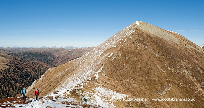
Nockberge Mountains
In terms of mountain scenery and hiking terrain, nothing on the route touches these mountains in Austria. The Nockberge or ‘Nock Mountains’, which form part of the Gurktal Alps and include the Nockberge National Park (a UNESCO Biosphere Reserve, the border of which lies slightly further to the NE on the far side of the valley of the Nöringback), owe their appearance to the presence of a band of dolomite rock, which has been more heavily eroded than the surrounding, more angular ranges. Stages 12–13 and 14–15 are centred on this range, and offer some of the best days on the AAT, taking in remote tarns and several high peaks and affording spectacular views over the Millstätter See.
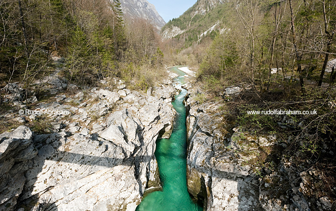
Soča River Valley and Gorge
The AAT follows the River Soča for several stages in Slovenia. Stage 24 is one of the most beautiful on the entire route, following the emerald green River Soča from Trenta to Bovec. Sharing the route (and trail markings) with the Soča trail, the route passes through the unforgettable Soča Gorge, pretty little mountain towns and stunning waterfalls.
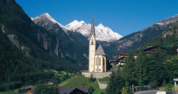
The Grossglockner
Stage 1 is a suitably grand opening to the AAT, which commands staggering views of the Grossglockner – a mountain of superlatives. Towering over the border of Carinthia and Tyrol at 3,798m at the head of the Möll Valley, it is the highest mountain in Austria, the highest peak in the Eastern Alps (that is, east of the Brenner Pass), and spewing the longest glacier in Austria and the Eastern Alps from its eastern flanks. Part of the Glockner group in the Hohe Tauern (High Tauern) range, it has a distinctive double summit divided by a high col, and can be seen from miles away.
Related books
For more information, see our guide to the Alpe Adria Trail:
Related articles
Don those hiking boots and explore some of Europe’s most spectacular scenery.
