Climate
When to visit
Highlights
Climate
Unlike the overwhelming aridity of neighbouring Arab states in the region, Lebanon’s climate is as diverse as its terrain. Temperatures and precipitation differ markedly from region to region, with the country’s Mediterranean climate and weather systems broadly coinciding with its topographical zones, though modified locally owing to the great variations in the country’s geography. Nevertheless, Lebanon as a whole enjoys around 300 days of sunshine annually, making the country virtually a year-round travel destination.

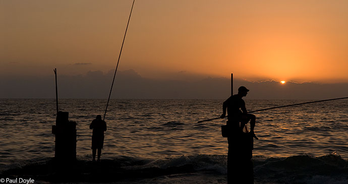
Lebanon enjoys a pleasant Mediterranean climate © Paul Doyle
When to visit
As the only Arab nation to experience all four seasons, Lebanon really is a ‘go anytime’ destination, and deciding on which season to go depends almost entirely upon your own interests and priorities. The dry summer months (June–September) tend to be a popular with visitors, but it can be extremely hot and humid on the coast with temperatures in Beirut often well in excess of 30°C, which is fine if you just want to while away the days by the pool or on the beach and catch some Mediterranean rays; but it can be oppressive and uncomfortable, and a retreat to the mountains for the cooler alpine air (6–22°C) affords a range of alternative outdoor activities such as hiking, rafting, trekking and mountain biking. Summer, however, is also the main season for Lebanon’s slew of annual artistic and cultural festivals such as those at Baalbek, Beiteddine, Broummana, Byblos and Tyre.
Winter (December–March)
The Mediterranean coast sees temperatures plummet to milder, more palatable levels (11–18°C) than in summer, but this season is often accompanied by the heaviest rainfall – though this tends to be in short bursts rather than the prolonged periods that often characterise many countries in northwest Europe. The winter months also herald the start of the ski season in the mountains, where temperatures range from around –5°C to 5°C. Lebanon has a range of well-equipped resorts, the best of these at present being Mzaar, with snow often remaining on the highest peaks until late April or even May. The latter part of the winter ski season also affords visitors the opportunity to indulge in the cliché of skiing in the morning and swimming in the Mediterranean in the afternoon. For classical music lovers, February sees the start of the five-week prestigious Al Bustan International Festival of Music and the Performing Arts, which attracts musicians and performers of international repute.
Autumn (October–November)
Cool temperatures in the mountains (5–20°C) and warm weather (13–28°C) on the coast, though with the increased risk of some rainy days. The pleasant temperatures make this is a good time for exploring Lebanon on foot, whether visiting the country’s wealth of archaeological sites or hiking in one of the country’s many nature reserves. Autumn is also wine-tasting time in the Bekaa Valley, along with the annual olive harvest. And being outside the main summer and winter tourist seasons, the price of hotel accommodation is often reduced during this period.
Spring (March–May)
Without doubt, the ideal time to visit Lebanon as the country is carpeted with beautiful and varied flora, the stifling summer heat has yet to arrive, and the winter rains have disappeared. Temperatures in coastal areas range from 12°C to 25°C, whilst the more mountainous regions experience temperatures ranging from 0°C to 15°C. Snow remains on some of the mountain peaks, which make an extremely picturesque backdrop when visiting some of the country’s ancient sites. Spring also presents a wealth of possibilities for outdoor enthusiasts such as mountain biking, caving, paragliding and rafting. This is also a great time for visiting nature reserves such as Horsh Ehden and the Chouf Cedar Reserve, and ideal for hiking in the UNESCO World Heritage site Qadisha Valley or perhaps walking a section(s) of the excellent Lebanon Mountain Trail.
The onset of the holy month of Ramadan in Lebanon, while not a time to be avoided as in some other Arab countries, nevertheless requires visitors to be sensitive to fasting Muslims. It would be polite to avoid drinking, eating or smoking during daylight hours in more devout Muslim neighbourhoods. Also be aware that some stores shut for a few hours during the daytime, but reopen later in the day.
Highlights and suggested itineraries
You didn’t decide to visit Lebanon to marvel at picturesque and undulating rocky desert landscapes or ride a camel, which is just as well, because Lebanon is the only country in the Middle East which is entirely without a desert. However, with an annual sunshine quota of around 300 days, a liveable cliché of skiing in the morning and swimming in the Mediterranean in the afternoon, world-class archaeological sites, breathtaking natural scenery and a diverse and cultured people, the absence of an oasis of sand and palm trees isn’t going to spoil your visit too much. As the initial point of entry to Lebanon for the vast majority of visitors, Beirut warrants a few days of exploration at least by any visitor in order to appreciate the country’s turbulent past and its optimism for the future. Nowhere is this hope more apparent than in the restored Downtown district of the city. Given Lebanon’s compact size, the capital also makes an excellent base for organising daytrip excursions to other areas of the country if time is precious. The following are my pick of the highlights to visit in Lebanon:

Aanjar This unique 8th-century Islamic trading town in the Bekaa Valley is the last remaining Umayyad-era site in the entire Middle East.
Baalbek Step back in time and admire soaring Roman columns and well-preserved temples, which are amongst the finest in the world.
Bekaa Valley Vineyards As one of the oldest places in the world for wine production, a visit to at least the Ksara or Kefraya vineyards affords an important insight into this still flourishing aspect of Lebanese culture.
Byblos This ancient and charming Phoenician port with Crusader castle, fine fish restaurants and souks is enchanting at any time, but particularly at sunset.
Chouf Mountains A beautiful, scenic region and the location for ancient cedar trees, the lovely old Ottoman-era town of Deir al-Qamar and the opulent Beiteddine Palace, home to some of the world’s finest Byzantine mosaics.
Jebel Sannine The location for some of Lebanon’s best winter ski resorts.
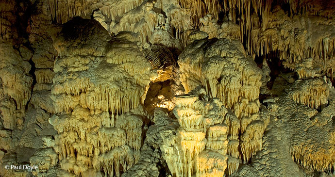
Jeita Grotto Majestic and stunning stalactites and stalagmites, and former finalist for the title of one of the world’s ‘New 7 Wonders of Nature’.