Five million people come to Cornwall each year as visitors, and more ink has been spilt by writers attempting to capture the county than over any other part of Britain.
Kirsty Fergusson, author of Slow Travel Cornwall: the Bradt Guide
It doesn’t seem to matter whether you are a seasoned resident returning home after venturing ‘Up Country’ or a happy holidaymaker heading west towards sun and surf – that moment when you cross the Tamar operates some kind of magical, mythical transformation.
Perhaps this should come as no surprise, for once on Cornish soil, we’re in the land of saints and tinners, whose relics inhabit the folded landscape in the form of weatherworn crosses and holy wells, skeletal chimneys and engine houses; while older communities yet have left their trace in wild moorland littered with standing stones and dark underground retreats or fogous as they are known here.
But despite this common mythology, I’ve come to love the place for its astonishing diversity and multiple identities, and while I completely understand why almost every Kernowphile I’ve ever met feels some deep attachment to a particular part of Cornwall, my own Slow journeying has made it impossible for me to pin my deep affection to one place, one shoreline, one moorland village or town.
I thought I had found it all in Penwith – that remote and wild peninsula stuffed with artists, eccentrics, fishermen and farmers – until I fell in love with the Fal estuary and its lively cultural and horticultural scene and quiet green tidal creeks, but that was before I discovered the exhilarating thrill of the ragged, windswept north coast, the rushing River Fowey on its journey to the sea or the blossom-filled lanes and soaring viaducts of that forgotten peninsula south of the Lynher…
Don’t ask me where I’ll eventually come to roost amongst such incorrigible plurality – all I know is that the Slow road home starts here.
A world first!
Our Slow Travel Cornwall & the Isles of Scilly is, we believe, the world’s first ‘a-book’ travel guide available to the public. What’s an ‘a-book’? Well, in essence it’s a printed book with a treasure trove of additional content – video, audio and photographic – gathered by the author during her travels that those with Android devices can view or listen to while reading.
See here for full details of the research project behind this, and how to access that content – free of charge – if you have an Android device and your copy of the book.
Bradt on Britain – our Slow Travel approach
Bradt’s coverage of Britain’s regions makes ‘Slow Travel’ its focus. To us, Slow Travel means ditching the tourist ticklists – deciding not to try to see ‘too much’ – and instead taking time to get properly under the skin of a special region. You don’t have to travel at a snail’s pace: you just have to allow yourself to savour the moment, appreciate the local differences that create a sense of place, and celebrate its food, people and traditions.
For more information, check out our guide to Cornwall & the Isles of Scilly
Food and drink in Cornwall & the Isles of Scilly
It’s not so long ago that Cornwall’s culinary identity rested squarely on its traditional pasties and cream teas, while crab sandwiches and early asparagus were push-the-boat-out treats. And it would probably be fair to say that until recently (with one or two noble exceptions) Scillonian cuisine was best described as…conventional.
How things have changed! Both Cornwall and Scilly have completely reinvented themselves as high-class foodie destinations and I’m struck by the pace at which this change is occurring. It started, we all remember, with Rick Stein in Padstow, who was followed by a large scoop of celebrity chefs nailing their colours to the Cornish mast and doing much to promote not only the superb local seafood but also award-winning Cornish cheeses, meats and charcuterie.
But Cornwall’s reputation as a top foodie destination has changed direction over the past few years. You no longer have to go to the big-name restaurants in Padstow, Newquay or Rock to fall in love with Cornish food, for even larger crowds seem to be drawn to places like Simon Stallard’s Hidden Hut – a coast-path café near Portscatho, where outdoor evening cook-ups sell out online in seconds.
A host of other informal venues that celebrate seasonal, local produce cooked simply but with passionate regard for the quality of the ingredients –and often served at shared convivial tables – have sprung up. Canteen in St Agnes, The Kitchen in Falmouth, The Crab Shack on Bryher or the Tanglewood Kitchen Company and On the Quay in St Mary’s are all places where solo travellers feel as though they are among friends, drawn together by a love of good food, cooked by good people.
Nor do you have to eat out to get a taste of the way things are heading. I admire the way that village and community shops have pitched in to support local producers and I’ve derived huge pleasure, while researching this edition, from making a point of buying all my weekly groceries – from salt and ketchup to flour and teabags – from Cornish suppliers or producers in village shops and from farmers’ markets and the Great Cornish Food Store in Truro.
A rising number of artisan bakeries – Vicky’s, Baker Tom’s, Stones, Da Bara’s – have acquired devoted followings too, and the peculiarly Cornish saffron bun is selling in record quantities from Sennen to Bude. Ice cream has also become an artisan affair, and coupled with the Kea plum that most desirable and local of fruits – is something you’ll not find anywhere else in the country. Cornish-grown and blended tea? Look no further than Tregothnan. Gorse-flavoured chocolate? That’s made in Cornwall, too.
Cornish ciders, ales, craft gins and wines have made a powerful impact on the drinking scene in recent years: there are almost 50 Cornish and Scillonian breweries and micro-breweries at the time of writing, while ciders made with Cornish apples can hold their own among the best that Devon and Somerset can offer and the latest generation of sparkling wines from Camel Valley and Polgoon continue to scoop awards by the bucketful.
And as for gin… I’m not alone in thinking that Westward Farm on St Agnes in the Isles of Scilly produces some of the finest botanical flavoured gins ever tasted. No doubt about it: Cornwall and Scilly have become hugely rewarding destinations for foodies of every persuasion.
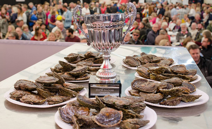
With such an abundance of local produce and culinary talent, it’s no surprise to discover that Cornwall and Scilly host more festivals dedicated to food and drink than any other region of Britain. Some celebrate a local speciality, such as the Falmouth Oyster Festival or the Newlyn Fish Festival, others bring all kinds of specialist growers and producers together, like the Great Cornish Food Festival in Truro, the Food and Farming pavilion at the Royal Cornwall Show in Wadebridge, or the Taste of Scilly Festival held every September – a wonderful excuse for an island-hopping, gastronomic adventure. Porthleven, St Ives, Mevagissey and Rock are also riding the wave of success, hosting food-and-drink festivals that attract greater numbers each year.
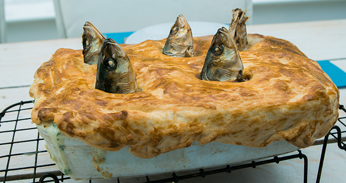
Away from the hustle of the foodie-fests, I’ve also discovered the joys of foraging in Cornwall. Rachel Lambert (www.wildwalks-southwest.co.uk), a neighbour of mine when I lived near Penzance, introduced me to the thrill of returning to the kitchen with a bag filled with fresh green alexanders, wild sorrel, crunchy pennywort, pungent threecornered leeks and young nettle tips. I must give special mention also to Liz Woods, whose blog, Feasts and Festivals, opened my eyes to the rich traditions of celebratory Cornish cooking, from stargazy pie to hot spiced cider; the blog became a book, Cornish Feasts and Festivals (Alison Hodge, 2013); and the recipes are now an established part of my own culinary adventures.
Another individual making tireless and inspirational efforts to promote quality Cornish produce is Ruth Huxley. Her books, The Great Cornish Food Book (Cornwall Food and Drink Ltd, 2014) and its companion volume The Great Cornish Fish Book (Cornwall Food and Drink Ltd, 2015), present a very contemporary picture of the richness and diversity of the Cornish culinary scene and are highly recommended. Ruth has also been instrumental in the opening of a terrific shop called, appropriately, Great Cornish Food, beside Truro’s new (and long-awaited) Waitrose.
So, what has become of the humble pasty and cream tea? The good news is that they are as popular as ever, but the bar has been significantly raised. The long-established supremacy of Ann’s Pasties is now challenged by the likes of Nicola Willis at The Dog and Smuggler in Falmouth, or Aunt Avice’s Pasty Shop in St Kew Highway. And a Cornish cream tea – jam first, cream on top unless you want to be thrown out of the county and into Devon where they practise the heresy of putting cream on first – is still a fine objective for a clifftop or moorland walk.
Travel in Cornwall and the Isles of Scilly
Getting there and around
Cornwall is famous for its long-and short-distance walks, and there are many references within these pages to the Cornwall section of the South West Coast Path (which follows the entire coastline and is waymarked with an acorn motif; see www.southwestcoastpath.com for further details) as well as lesser-known routes, such as the Copper Trail and Tinners’ Way. All these are well documented and easy to find online or in print; the circular walks I have suggested will often make partial use of these longer routes, but will only make sense on the ground if you are equipped with the appropriate OS Explorer map for the area.
I mention a few good cycle rides, following Sustrans NCN Route 3 (the Cornish Way), the Clay Trails and routes of my own devising. Cornwall is fantastically hilly, which I thought was a curse, until I found myself feeling slightly let down by the flatness of the extremely popular Camel Trail. No uphill struggles, but no downhill, freewheeling exhilaration either.
The Isles of Scilly, meanwhile, are too small to attract serious walkers, but strollers and Slow explorers will be captivated by the tangle of paths and narrow lanes that thread about each island. Bikes are used for short A-to-B journeys as tarmac roads are in very limited supply here.
Where to stay in Cornwall and the Isles of Scilly
For information about accommodation, see our list of the best places to stay in Cornwall and the Isles of Scilly.
What to see and do in Cornwall and the Isles of Scilly
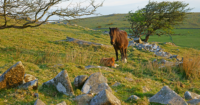
A mare guards her sleeping foal on Bodmin Moor © PJ photography, Shutterstock
Bodmin Moor
‘Cornwall is like a frame without a picture’, say those who believe that Cornwall’s coast is everything. It has to be one of the silliest platitudes ever uttered.
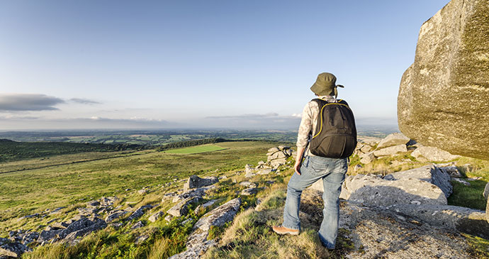
If your only perception of Bodmin Moor is a rather bleak stretch of granite moorland – often obscured by fog – sliced in half from east to west by the A30, then think again. This is where Cornwall hides some of its best treasures, generously revealed to those choosing to take the Slow approach. What I particularly enjoy about this area are the exciting contrasts of landscape, culture and people within such a small area. On the east side of the Moor, I have camped by the troutfilled River Inny at Tregillis Farm, discussing Steiner agriculture with the new tenant farmers, while just 20-odd miles away, west of Bodmin, I have found myself on the sunny slopes of the Camel Valley vineyards, a glass of award-winning Cornish Brut in my hand. Yet just a few minutes before, or so it seemed, I had been stumbling over the rainswept summit of Rough Tor, looking down over the haunting emptiness of Davidstow Moor. There had been a lusty performance of Twelfth Night in a tented, outdoor theatre at Upton Cross, and rambling beside the River Fowey, where it rushed and tumbled through beech woods just a half-hour bike ride from the uncanny stillness of Dozmary Pool. There was dazzling stained glass in St Neot, and desolate holy wells in muddy fields; not least, there were two of the best pubs encountered on my travels.
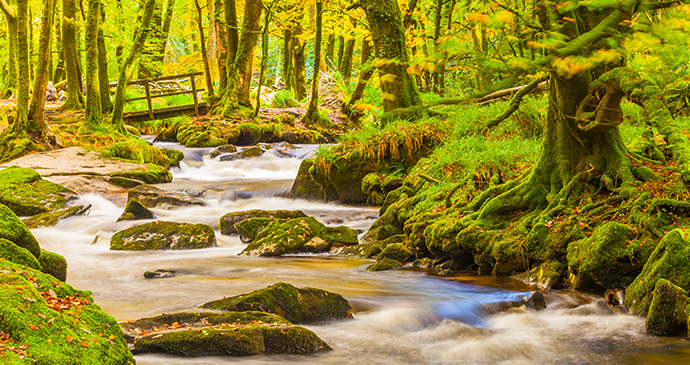
The young River Fowey tumbles over granite boulders at Golitha Falls, Bodmin Moor © Ian Woolcock, Shutterstock
In places, you can’t help but be reminded of Dartmoor, whose higher peaks loom on the eastern horizon. Goatish sheep, shaggy cattle and wild ponies graze among gorse and relics of the copper- and tin-mining industries; Neolithic standing stones litter the landscape. Bodmin is perhaps Dartmoor’s more condensed cousin, but less visited and most definitely less gentrified. An air of self-sufficient remoteness clings like mist in Bodmin’s hidden valleys and to the barren slopes of its highest peaks, Brown Willy and Rough Tor.
Village and farm shops are not a lifestyle option on Bodmin: they are vital lifelines for the rural community, and their precarious existence owes much to the support of visitors.
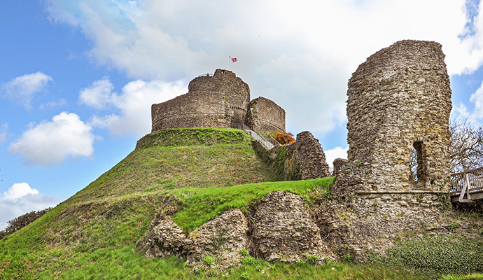 The dramatic silhouette of Launceston Castle dominates the skyline as you approach the town © Judita Jurkenaite, Shutterstock
Launceston & the Northeast
Geographically, Cornwall does not lend itself to neat chapter divisions, but Launceston, perched with strategic precision, just on the Cornish side of the Tamar, and right beside the main arterial road through the county, is a good place to start exploring the wild northeast coast and its gentler, rural hinterland.
If you exclude the tourist honeypots of Bude, Boscastle and Tintagel, northeast Cornwall is one of the least well-known parts of the county, but the rewards for Slow explorers are rich and worth savouring. It’s truly a land of contrast: here are some of the most unspoilt rural farmscapes in the West Country, grazed by chubby Ruby Red cattle and dotted about with orchards, woods, and fields bounded by streams and narrow lanes, while the coast, for miles south of the Devon border, is terrifyingly ragged and perilous. Vicious reefs of razor-backed rocks jut into the sea and black beaches emerge at low tide beneath formidable cliffs. The coast path rears and plunges with exhilarating – or daunting – gusto, testing walkers to the extreme; yet I love the fact that a mile or two inland, among the dipping hills, visitors on wheels can meander and potter along sheltered lanes designed for donkey carts, stopping in villages with names that hail from the Anglo-Saxon side of the Tamar – Stratton, Marhamchurch, Week St Mary – or ramble between some of the most leafily sequestered churches in the county, many having carved oak pew ends of exceptional quality.
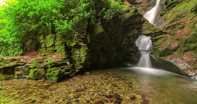
St Nectan’s Glen © Andy Fox Photography, Shutterstock
Travelling westwards, gaps in the cliffs open up and a tiny harbour or beach squeezes in among a scramble of cottages. Experienced boardmasters ride the dangerous surf, their vans and V-Dubs camped along the clifftops. Around Bude, where the surf at last rolls safely on to wide, sandy beaches, the natural drama of the coast seems to draw breath before embarking on another roller-coaster ride, rich in appeal to geologists, through Crackington Haven and Boscastle, rising to a wildly romantic crescendo at Tintagel. For me, however, the romantic coastline of Arthurian legend is eclipsed, just a mile short of Tintagel at the head of St Nectan’s Glen, where a 60-foot waterfall descends, through a halo of granite and foliage to a sequence of shallow rock pools and falls of staggering beauty and spiritual significance to latter-day Arthurians, pilgrims and healers alike.
Relics of Cornwall’s gritty industrial past are never far from view wherever you find yourself on the peninsula, but just inland from Tintagel, Britain’s oldest and largest slate quarry at Delabole remains in robust health and offers a rival identity to a region stamped everywhere with the image and legend of Arthur.
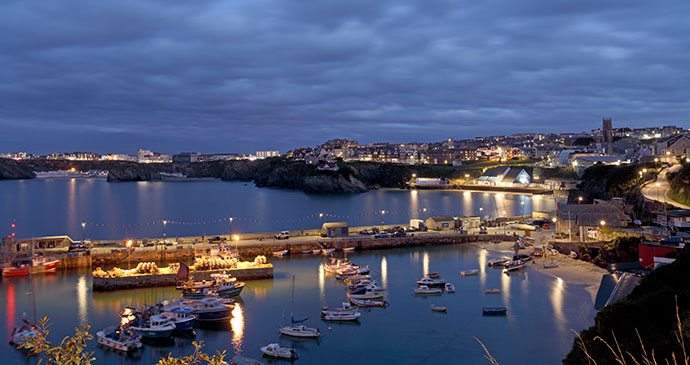
Newquay Harbour at night © Ollie Taylor, Shutterstock
Mid-Cornwall North: the Camel Estuary to Holywell Bay
The year-round appeal of breaking surf and sandy beaches makes this stretch of the Cornish coast one of the most-visited parts of Cornwall and while Newquay and Rock may not be everybody’s idea of paradise (at least everybody of Bermuda shorts-wearing age), Padstow fulfils an alternative vision of Cornish bliss with its pretty houses, working harbour and abundance of upmarket eating establishments where fresh fish and seafood are given celebrity status.
I seem to have spent rather more time among the quieter backwaters of the region, looking for angels in the architecture or otters in the Camel, often finding myself ambling in Betjeman’s footsteps: pottering about Wadebridge and revisiting his words in quiet churchyards or on windy headlands. I discovered too, that music is particularly strong in these parts. The now famous voices of a group of local men can be heard singing Cornish songs of the sea on the beach at Port Isaac on summer evenings, and the concerts in the lovely church at St Endellion have also found audiences from far beyond the Tamar.
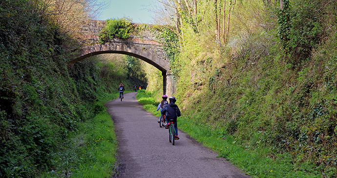 Exploring the Camel Way cycle route from Wadebridge to Padstow © Gary Perkin, Shutterstock
Inland, a landscape of river valleys, woods and fields is crossed by the hugely popular Camel Trail, while the Saints’ Way, used by traders and pilgrims for over 1,000 years, offers a superb walkers’ route through hidden Cornwall from Padstow to Fowey on the south coast. Off the beaten track, but often just a mile or two away from the big tourist attractions, there are unsung valleys and villages to explore, dotted with prehistoric stones, Iron Age hillforts and secluded churches.
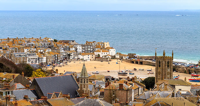
The town of St Ives rises behind its working harbour and sandy beaches © Bertl123, Shutterstock
Penzance, St Ives & the Penwith Peninsula
A peninsula at the end of a peninsula: small wonder that Penwith feels remote from the rest of Cornwall, let alone the rest of the country. Driving down the long A30 can be a grim affair, but that first, almost unreal glimpse of St Michael’s Mount and the wide blue sweep of Mount’s Bay never fails to lift the spirits, creating the feeling that some kind of threshold is about to be crossed to a wilder, older, more mysterious part of Cornwall. Penzance, which dominates the bay and makes a kind of gateway to the peninsula, has a special character entirely in keeping with its position. It’s no surprise that so many artists, writers, archaeologists and historians – as well as a healthy smattering of good old-fashioned eccentrics – have found their way down here over the years. As my Cornish neighbour likes to say, with enigmatic knowingness: ‘shake the stocking and all the nuts will gather in the toe’.
From the summit of Chapel Carn Brea you get a feel for a good chunk of Penwith and its history, as well as its siren appeal to artists. Approached from the narrow, twisting road between Crows-an-Wra and the Land’s End airport, this hill is a far from strenuous climb, but the visual reward suggests you’ve scaled something much bigger. You can perch at the summit on a ruined Bronze Age burial chamber and think you’re on an island, for on a clear day, sea and sky dominate for as far as you can swivel your head. The Isles of Scilly are a smudge on a horizon punctuated by ponderous tankers; smaller fishing vessels plough briskly through the white-capped swell; and waves which have travelled the Atlantic dash against the Longships lighthouse, enveloping it in dramatic clouds of foaming spray. Away to the east, St Michael’s Mount is palely visible through a gap in the hills, and northwest beyond the offshore twin peaks of the Brisons, there’s a glimpse of Cape Cornwall, believed for centuries to be the real Land’s End.
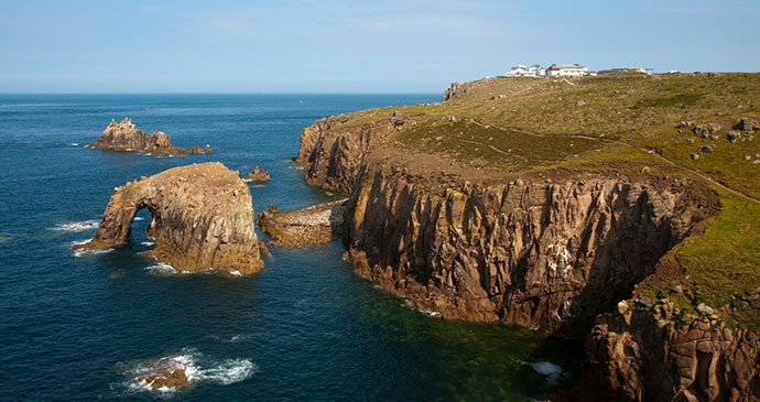
A view over the rugged cliffs at Britain’s most south westerly point, Land’s End © stocker1970, Shutterstock
At your feet, to the south and west, lies a green patchwork of fields and farms, bounded by hedges of wind-sculpted gorse and hawthorn; there are very few trees. Villages linked by ancient roads and tracks and the landmark church towers of St Buryan and Sennen are just discernible in the folded landscape where Davies Gilbert’s rhymes, composed of nothing more than names of hamlets and farms, still echo down the lanes:
Vellandrucha, Cracka, Cudna,
Truzemenhall, Chun, Crowzenwra;
Bans, Burnnhal, Brane, Bosfranken,
Treeve, Trewidden, Try, Trembah.
Turn northwards, however, and Penwith Moor looms on the horizon, littered with prehistoric sites and abandoned tin mines, its craggy hilltop carns rising abruptly above the jagged north coast. There’s a wild beauty here in the rough, windswept moors and cliffs, which is easy enough to appreciate when the sun is shining, but when the drenching clouds roll in, it can all feel rather raw and bleak. It’s fortunate for many that St Ives, with its cosy and picturesque streets and alleyways, cosmopolitan galleries and lively, art-filled culture, is part of the north coast scenery too.
The eating is good in Penwith. Fish and crab from Newlyn and St Ives rarely come fresher to the fishmonger’s slab; local dairies produce fabulous ice creams and farmers’ markets start the season with astonishingly early potatoes and Cornish asparagus. After years of decline, craft cider is making a strong comeback in Penwith and many real ale enthusiasts claim that their favourite pint ever is to be found at the Star in Crowlas, where it is brewed on the premises.
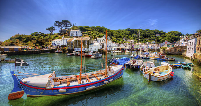
The fishing port of Polperro © Rolf E. Staerk, Shutterstock
Southeast Cornwall: From the Tamar to the Polperro
The bridges that cross the Tamar have a special significance for those whose hearts lie on the western banks – especially for those who regard Cornwall as another country rather than another county. As the historian A L Rowse wrote, ‘The Tamar is a decisive boundary such as no other county possesses – but, then, Cornwall is not an ordinary county…’ I’ve heard of all sorts of odd ritualistic behaviour by travellers on the bridges, but the story I enjoyed most came from a holidaying family where, said the parents, the children breathed out as the car joined the Tamar Bridge on the Devon side and refused to inhale until the Kernow a’gas dynergh (Welcome to Cornwall) sign on the Saltash side had been passed, ‘so the air doesn’t get mixed up’.
I’ve no great fondness for the blink-and-you’ve-missed-it Dunheved Bridge that the A30 rushes over at Launceston, and while I often use the impressively engineered road and rail bridges at Saltash, 20 miles to the south, it’s the three medieval road bridges that lie in between which give the greatest sense of place. The medieval narrowness of Greystones, Horsebridge and Newbridge allow Slow travellers to savour the moment of arrival, to register the exactness of departure. My favourite is the 15th-century Greystones Bridge, three miles southeast of Launceston, so narrow you instinctively breathe in as you cross. Arriving on the Cornish side, a left-hand turn, highly unsuited to heavy vehicles, rises swiftly above river and water meadows and there, on a near-vertical slope is Howard’s Wood, now in the care of the Woodland Trust, with ‘Welcome’ written on the gate. That’s a good start to a county.
Artists and fruit growers have colonised the gentle banks of the Tamar. Despite Rowse’s defiant assertion, I find the boundaries blurred in these parts. The Tamar Valley is its own world, neither especially Cornish nor Devonish, but happy with its own identity. Many on the Cornish side flit across into Tavistock for shopping or eating out; just as further south, many who work in Plymouth commute via the Torpoint ferry to homes on the Rame peninsula. It seems to me that there is less anxiety here than in other parts of rural Cornwall, less edginess; yet also less affluence and security than in the leafy creekside villages of the Helford, Fal and Fowey.
South of the River Lynher, Cornwall’s ‘forgotten corner’ may be linked umbilically to Plymouth, yet in the remote farmland beyond Torpoint, its self-proclaimed obscurity is easy to appreciate. There are grand houses at every strategic estuarine juncture, their gardens lush in the mild maritime climate, and in the south, fishing villages with an almost Mediterranean air about them; to the west are desolate, storm-lashed cliffs, shanty-town chalets and long, empty beaches.
Westwards of Seaton, the Channel coast suddenly assumes its Cornish personality; fishing ports, hidden rocky coves and Neolithic stones bear names that speak an older tongue; this is the start of the Pens and Pols, the Lans and Looes; instead of Johns and Michaels, churches are dedicated to semi-mythical Celtic saints. Inland, where wooded river valleys rise to meet the southern fringe of Bodmin Moor, there are some of the best walking and camping spots to be enjoyed in Cornwall, a wonderfully eccentric museum of music machines, beech trees that are home to Amazonian woolly monkeys and, in Liskeard, the opportunity to discover a handsome market town with an equally engaging identity.
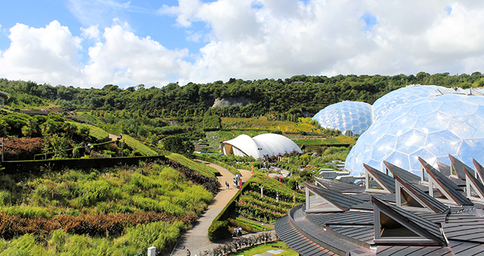
The impressive biomes of the Eden Project © Anna Jastrzebska, Shutterstock
The Fowey Valley & the Cornish Alps
Even by Cornwall’s extraordinary standards of contrasts, you would be hard put to find a greater divergence in the landscape than in the few miles that separate the wooded, watery world of the Fowey, its towns and villages steeped in medieval history, from the almost lunar landscape of the clay pits above St Austell. Slow explorers will relish the individual characters of both – and gardeners (to whom the concept of Slow comes as readily as planting trees, I suspect), will discover here some of the most inventive and creative gardens in Cornwall, enjoying a brave, windswept garden on the cliffs of Polruan as much as a dazzling display of summer perennials in the Hidden Valley Gardens, or the ambitious Eden biomes and magnolia-filled slopes of Caerhays.
Industrial heritage is never far from view in Cornwall, but here the exploitation and export of china clay is current and active and still shaping the landscape. Rivers and streams run milky white around St Austell, cargo ships slip through the yachts and pleasure craft at Fowey to load up just out of sight at Carn Point; the conical white spoil heaps from the clay pits grow and change shape on the horizon. Cornish Alps, indeed!
 Fowey is one of Cornwall’s prettiest coastal towns © Gordon Bell, Shutterstock
This region has some wonderful opportunities to take to the water: paddling a canoe up Lerryn Creek, in the wake of Kenneth Grahame, riding the little passenger ferries from Polruan to Fowey and Fowey to Mevagissey and swimming in the turquoise sea at Lantic Bay. It also encouraged me to start rereading Daphne du Maurier, whose lyrical descriptions of the Cornish coast around Fowey had first enthralled me as a teenager. Walking in her footsteps above the beach at Polridmouth or gazing across the water to Bodinnick from the chain ferry animated my reading, and gave added allure to an already romantic landscape. The great thing about this stretch of the Cornish coast and estuary is that you don’t need your own yacht to experience the thrill of seeing the land from the magically altered perspective of the sea. Returning to Fowey on the ferry from Mevagissey, I scanned the trees behind the red and white stripes of the Gribbin Daymark, hoping to glimpse the rooftops of Menabilly, the house that had been the inspiration for Manderlay in Rebecca. Then, like the novelist, cruising around the coast on Ysdragil, I saw ‘the clay-hills hard and white on the western skyline. Then the slope of the Gribbin peninsula… bracken-covered, green, and beyond it, hull-down between its coverage of trees, two chimney tops and the grey roof of Menabilly.’
A stroll around St Mary’s reveals breathtaking beauty at every turn © S Hughes, Visit Isles of Scilly
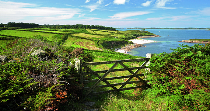
The Isles of Scilly
In many ways, life on the Isles of Scilly is an unselfconscious example of what the Slow concept is all about. Local culture and tradition, landscape, seascape, history and natural history are given affectionate respect here; people take time to enjoy what makes their islands so special. Traffic jams, chain stores and fast-food outlets belong to another world; everyone seems to have time to pause for a chat, leaning on the garden gate or over the shop counter. Children are able to roam and explore freely and safely, while wrinklier visitors remark that ‘this is what Cornwall used to be like, 60 years ago’. And everywhere you go, you sense an enviably easy and relaxed sense of community among the 2,000 residents and a willingness to share their good-natured, rat-racelessness with visitors, too.
Nevertheless, on a recent visit, I felt Scilly was going through a transitional phase, perhaps brought about by declining numbers of both residents and visitors of the Harold and Mary Wilson generation and a more 21st-century approach to what the islands have to offer: watersports – including the ultimate ÖTILLÖ challenge in interisland sea swimming and running, coasteering, snorkelling with seals, paddleboarding – and yoga on pristine white beaches. (‘Why go all the way to Sri Lanka, when it’s all here?’ I heard one woman say.) There’s also been a perceptible upgrade in accommodation at all levels, combined with a new generation of cafés and restaurants that make simple and imaginative use of the highest-quality local ingredients. The entrancing landscape, however, has not changed. Five inhabited islands, 51 uninhabited islands and dozens of jagged rocks and deadly reefs make up the Scilly archipelago, 28 miles southwest of Land’s End. But what you see are merely the hilltops of a submerged landmass, lost to an encroaching sea around a thousand years ago. Ancient field boundaries and Bronze Age settlements lie beneath the translucent waters that separate Bryher, Samson, Tresco, St Martin’s and St Mary’s (a deep channel has always set St Agnes apart) and, for a brief period during the extreme low tides of the spring equinox, it’s possible to paddle between Bryher and Tresco.
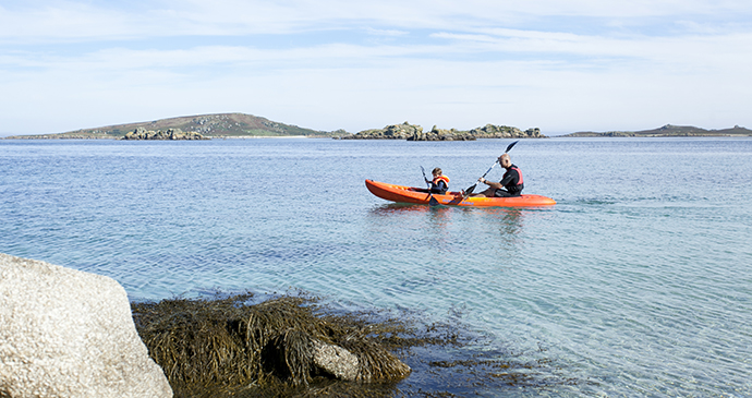 Kayaking around Tresco forms part of the 21st-century approach to travelling around the Isles of Scilly © James Darling
The islands are startlingly beautiful, with beaches that have an almost tropical quality – a turquoise sea, crystal clear and cool as jade, washes into shallow bays of sparkling white sand; spiky, succulent, showy subtropical plants flourish casually in gardens and waysides. And yet, on shores where the Atlantic crashes into the archipelago, the rock-strewn seascape is more Hebridean than Caribbean. Evidence of human occupation is not overwhelming – there are no big hotels or holiday villages – houses and cottages appear randomly among the lush vegetation or cluster around the curve of a harbour. Above the shoreline, chains of drystone walls coated in hairy lichen form a jigsaw of tiny fields, scattered across the sheltered, leeward slopes. Many, since the near-collapse of flower and potato farming, are abandoned to drifts of wild flowers, though some are still lined with sweet-scented narcissi or vegetables; elsewhere you might chance upon a couple of cows or a goat. On higher, exposed ground, it’s all granite and gorse and cushions of heather and ling. Permissive footpaths thread across and around the islands – and while it’s not difficult to get momentarily disorientated, it’s impossible to get seriously lost. Walking on Scilly is quite unlike walking on the mainland: maps aren’t really needed and in any case (with Tresco being a notable exception), waymarked routes and signs bearing place names don’t exist. The fun lies in exploring, rather than notching up miles of path, in discovering the distinctive character of each island and in enjoying the pauses for the heart-stopping views across the misty recessions of the archipelago.
St Mary’s, the largest of the inhabited islands, is the hub for all these adventures: flights from the mainland arrive here and the ferry from Penzance ties up at Town Quay, next to the busy inter-island boats. It’s the only island with anything resembling a town, and most of the residential and holiday accommodation is to be found here. There’s also a variety of holiday accommodation to be found on the Off Islands – as the four other inhabited islands are known – each containing a loosely linked hamlet or two, where populations dwindle to a weather-beaten core in the winter. The uninhabited islands, many little more than a fist or spike of granite rising above the water, others with beaches and relics of past human occupation, are home to countless breeding populations of seabirds and seals. Each of the five inhabited islands has its own very distinct character, and it’s funny how so many visitors end up with a partisan feeling for one island in particular. ‘It was always St Martin’s for me,’ says the island’s baker; ‘the people, the beaches, the starry night skies.’ An elderly passenger on the ferry sighed, ‘Bryher. For the solitude and the birds. I have to go every year, even if just for a day.’ His wife chips in, ‘St Mary’s isn’t appreciated enough outside Hugh Town: I love walking Up Country through the nature reserves to Pelistry Bay.’ A giggling six-year-old says, ‘I love camping at Troytown Farm [on St Agnes] because it’s next to the beach and there are cows and ice cream.’ And, ‘We’re third generation Tresco,’ I overheard one woman say with pride – she was a holiday visitor, not a resident.
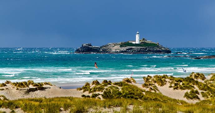 Looking out from Godrevy Head you can spot its lonely island lighthouse © Paul J Martin, Shutterstock
The Mining Heartland
Cornwall’s industrial heritage is stamped indelibly on the landscape, towns and coast over the whole county, but with no greater density – and pride – than in the region of St Agnes, Redruth, Camborne and Hayle. This region also covers the Godolphin estate and Tregonning Hill, which form the largest of the ten separate areas which together create the World Heritage Site, established in 2006 in recognition of the importance of the Cornish mining landscape. There’s enormous beauty here, not just in the wild and natural beauty of the north coast dunes and cliffs or the wooded hills and farmland valleys of the interior, but in the decayed industrial architecture, softened by the steady encroachment of nature. You’ll encounter a sense of place that grows on you and intensifies, especially after visiting one of the many museums dedicated to mining heritage, where the colossal human endeavour, which at its peak saw Cornwall meet two-thirds of the world’s demand for tin and copper, is brought vividly to life. You really don’t have to be an industrial archaeologist or have Cornish mining in your blood to appreciate the extraordinary inventiveness that went into extracting the shiny metals from lumpen ore, buried in wet ground, where efficient pumping was crucial to success and safety – nor the tales of courage, comradeship and survival that bound communities together.
The closure of the mines in the last century and the dispersal of the Cornish mining population to new, more profitable areas around the world was reflected grimly in the towns that had once prospered, but times are changing: affordable housing and studio space have brought an influx of artists to Redruth and Camborne, a multi-million-pound development of housing, offices and studios is rising from the wasteland of Pool – and Hayle, with its wave-energy Hub and historic waterfront is poised for a green, Docklands-style revival.
But it’s not all about mining and its aftermath. The north coast is studded with safe, family-oriented beaches, and the giant dunes above Hayle and Perran Sands conceal all sorts of treasures, from glowworms and butterflies, to buried explosives works, churches and sites of pilgrimage; among the dunes of Perran Sands you can lose yourself exploring the lost world of St Piran.
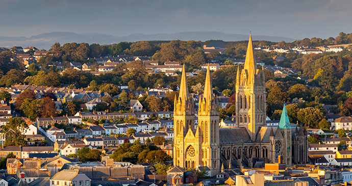 A view over the city reveals the impressive Victorian architecture of Truro Cathedral © Ian Woolcock, Shutterstock
Truro & the Fal Estuary
From Truro to Falmouth by river, there is not one inch of unloveliness, the estuary shores designated in their entirety an Area of Outstanding Natural Beauty. Herons, silent and still observe the water, egrets gather in oak trees and oystercatchers sweep down to the muddy banks at low tide. And the sorrowful cry of the curlew echoes around the tidal creeks, epitomising the soft, green loneliness of these very special hidden places.
Although it’s common to refer to the whole estuary as the Fal, the Fal is just one of several rivers that flow into the deep, wooded ria (meaning a flooded estuarine valley) below Truro, where the Allen and Kenwyn flow into the Truro River. The Truro is joined by the Tresillian at Malpas, and it’s not until further downriver that the Fal cuts in from the east. On the west bank, the Carnon and Kennal join in at Restronguet Creek and the Penryn River merges with the generous embrace of Falmouth harbour. Here, with the sea in sight, the estuary widens hugely and becomes known as the Carrick Roads, narrowing only marginally where Falmouth and St Mawes face each other across a yacht-filled mile of sea. It’s a busy estuary, populated not only by sailing boats and passenger ferries, but also towering container ships, heading to the deep moorings above the King Harry ferry, where they sit out the lean times, surrounded by dense oak woods, absurdly out of place beside the red-sailed oyster boats, dredging the riverbed the traditional way, through the autumn and winter months.
The western banks of the estuary are the busiest, with a student population at Falmouth and Penryn contributing to the youthful, arty buzz that distinguishes both these towns from other Cornish harbours. There’s a heady mix of culture here, encompassing music and the visual arts, gardens and regional cuisine that erupts into a summer-long series of festivals against the backdrop of the river. While not so much goes on across the water, the Roseland Peninsula has an idyllic waterfront, both riverine and coastal, fringed with sandy, secluded beaches, busy harbours, bright with yachts and dinghies – and some of the smartest hotels in the county. Inland, it’s quietly pastoral and dotted with wellheeled little villages, farms and harbours all the way down to its remote, southernmost tip at St Anthony Head.
More information
For more information, see our guide to Cornwall & the Isles of Scilly: