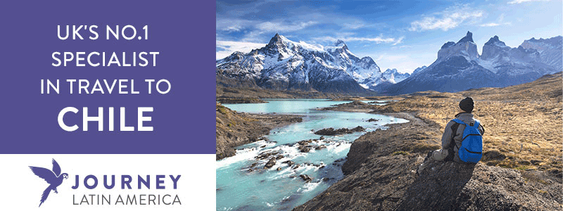
The Carretera is rapidly gaining recognition for being up there with the finest road trips in the Americas, if not worldwide.
Hugh Sinclair, author of Chile: Carretera Austral
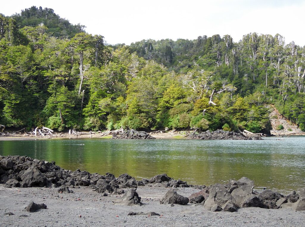
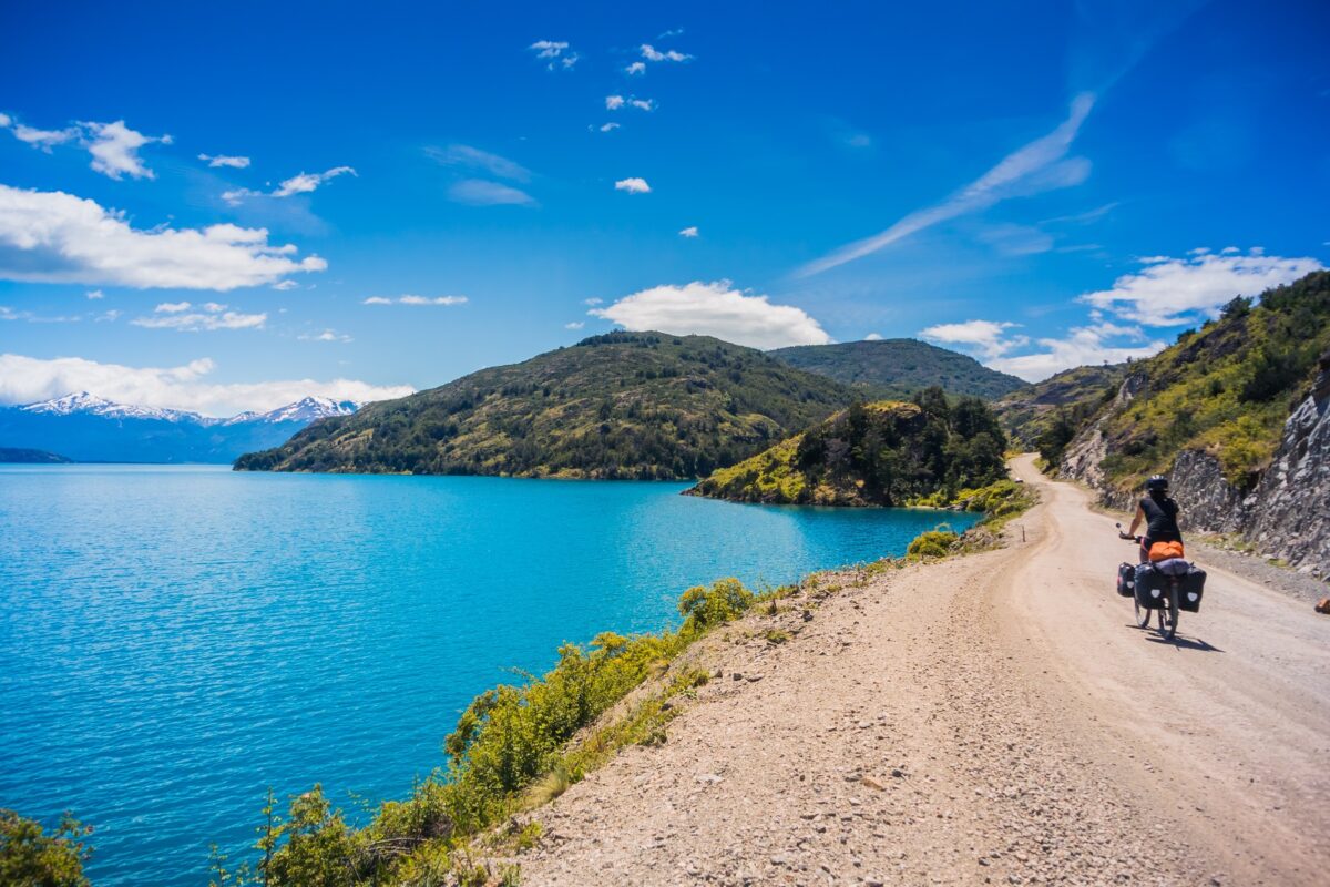
The ‘best road trip in the world’ is an oft-heard claim, but in the case of the Carretera Austral it is well and truly justified. From the subtropical jungles south of Puerto Montt to glaciers of dimensions that defy belief, a new vista emerges with almost every bend along the road.
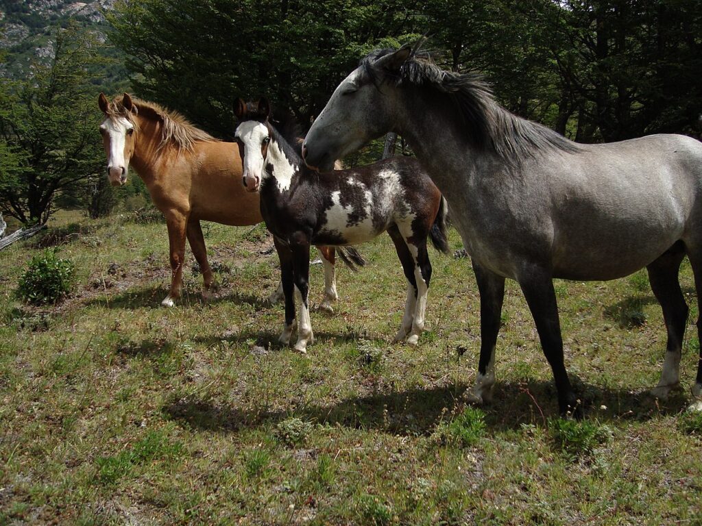
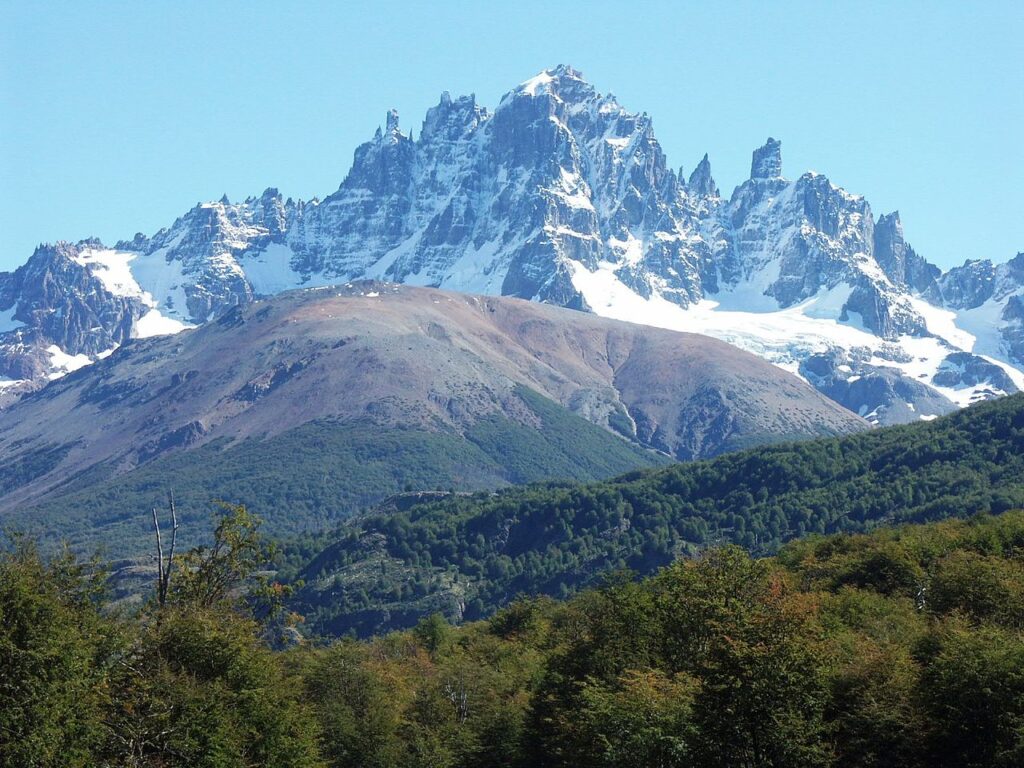
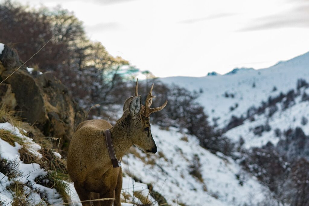
Wild rivers connect the Andes with the Pacific Ocean, carving through the narrow strip of land that forms Chile, pausing only to fill lakes with every shade of blue imaginable. Alerce trees have stood guard over the region for thousands of years, towering high above the Carretera Austral. Wild guanacos serve as traffic lights, pumas are considered a pest, Andean condors glide majestically through the valleys in search of carcasses, and beyond the confines of the road itself evidence of humankind’s impact is the exception rather than the rule.
And yet within this wilderness it is possible to find excellent accommodation, eat fine food, and interrupt the driving with an ever-expanding range of activities. The Carretera is rapidly gaining recognition for being up there with the finest road trips in the Americas, if not worldwide.
Chile is on our list of 2023 Exceptional Trips! Read the full list here.
Food and drink on the Carretera Austral
Food
Every village, however small, has a place to eat and a shop. Whether these are open or not is another issue. In smaller villages businesses tend to close around 20.00, or 21.00 if there are no customers, and restaurants may not have formal opening hours. It is wise to eat early. On the other hand, in larger towns restaurants might not open until 20.00. Lunch is generally available from 13.00 to 15.00. In Coyhaique and Puerto Aysén it is possible to find somewhere to eat all day and up to midnight. Coyhaique is the only place with all-night restaurants.
Tips are occasionally included on the bill in a restaurant; if not, they are not expected, and rounding up the amount is appreciated and sufficient. Chilean fare can become rather repetitive particularly along the Carretera Austral, where culinary creativity seems scarce. Expect to find merluza (hake), congrio (eel), mariscos (shellfish), puye (small, whitebait-like fish), a meat dish, perhaps cazuela (meat or fish stew), chips, potatoes, a basic salad, deep-fried bread and a range of nondescript puddings. Meat described as mechada is shredded, and milanesa in thin slices, coated in breadcrumbs; a lo pobre contains salad, a fried egg and chips.
Curanto is a particular delicacy originating in Chiloé, and is certainly worth trying. It generally contains two plates – one of shellfish and fish, and one of meat, a sausage, potatoes and a potato dumpling, all cooked together in the same pot. Strictly speaking a proper curanto should be cooked in a hole in the ground covered with leaves and mud, but this is generally only available on the island of Chiloé. The best place to try curanto along the Carretera Austral is Cocinería Altamar in Chaitén.
Although limited, there are some variations from Chilean cuisine: Coyhaique has sushi, Italian food and some excellent high-end restaurants. The German settlers of the region in the early 20th century secured an ongoing supply of cakes and savoury snacks (kuchen), as well as decent bread. Lamb (cordero), where available, is excellent; (vaca, or ternero) beef is abundant but rarely cooked to the standard found in Argentina.
Seafood is common and vegetarians, even vegans, may actually find this region to be more compatible with their food tastes than Argentina. A number of restaurants offer a vegetarian option.
Many restaurants offer a menú del día (set menu with limited choice), which are generally very good value and popular among the locals. Many cabins, and some hostels or hotels, offer self-catering barbecue facilities (parrilla/asado), and often these are included in a separate outhouse, called a quincho. Ideal for groups, this is basically a building available for rent with tables, plates, cutlery, etc, where guests can prepare their own food, usually lamb or steak, bought privately or arranged through the hotel/hostel.
Drink
Wine is available in mid-range restaurants but tends to be overpriced and offers limited variety; a finer range is available in upper-end restaurants, albeit at a price. Local beers are more abundant and cheaper. Chileans debate with Peruvians as to the true inventor of Pisco, but it is fair to say that almost anywhere along the Carretera Austral it is possible to find a decent Pisco sour, including flavoured with local berries and fruits. The water is generally fine to drink straight from the tap.
Standard beers available across Chile include Cristal and Escudo, or the now semi-national beers from medium-sized breweries like Kunstmann and Austral. However, a growing passion in the region is the production of fine craft beer (cerveza artesanal). What better way to utilise the abundant pure water of southern Chile than to make great beer? Most restaurants and bars will have at least one regional beer (usually bottled, sometimes on tap).
Health and safety on the Carretera Austral
Health
Before you travel, check the current Foreign, Commonwealth and Development Office (FCDO) travel advice as well as the country-specific page, which details any travel restrictions and entry requirements, as well as safety and security advice.
Ensure that any insurance is appropriate for the type of travel that you intend to do; currently this should include cover for Coronavirus-related events such as health problems and travel disruption.
Medical facilities are limited in the Carretera – any serious accident or illness will involve evacuation to Puerto Montt or Santiago. Every village has a posta de salud, which is a minimal medical centre for minor problems. Certainly outside of Coyhaique it is unlikely that doctors will speak English.
Tap water is drinkable across Chile, although mineral water is almost always available. To be really safe, stick to mineral water (though this should not be used to make up babies’ feeds as the salt content is likely to be too high) or bring water to a rolling boil or use a water filter bottle such as Aquapure to filter any water that you drink. Anyone with a compromised immunity is more susceptible to infections.
Food poisoning and cholera are not a great problem, but uncooked ceviche (shellfish) should be avoided. Depletion of the ozone layer, coupled with dry, unpolluted air, has led to increased levels of ultraviolet radiation in southern Chile, causing sunburn and increasing the risk of cataracts and skin cancer. Be sure to wear good sunglasses and plenty of sunscreen.
Inoculations
No vaccinations are legally required, but make sure you’re up to date with tetanus and diphtheria – which these days comes with polio as the all-in-one Revaxis – and measles mumps and rubella vaccine (MMR).
Hepatitis A and typhoid vaccines may be recommended. These food and waterborne diseases are more likely to occur in travellers who are visiting friends and relatives, long-stay or frequent travellers, or those going to areas where there is poor sanitation. In addition hepatitis A would be also advised for certain occupations, men who have sex with men and intravenous drug users.
Hepatitis B is carried by about 2% of the population of Chilewhich is classed as an intermediate/high prevalence. Vaccination should be considered for everyone ideally, but especially those who may be at increased risk. Hepatitis B can be spread by having unprotected sex, sharing needles and through working in medical settings and with children.
Chile is considered a low-risk rabies country as rabies is only reported in wild animals. Anyone working with animals in Chile should be vaccinated. Most other travellers will be at low risk, but you should consider having a pre-exposure rabies vaccine if you are travelling longer term or are going to be away from good medical care.
Yellow fever is not present in Chile and there is no requirement for proof of vaccination even if you are entering the country from yellow fever-infected areas.
Animal/insect bites
There are no venomous snakes, although the recluse spider (araña de rincón), found in many homes, has a venomous bite which can kill. There are biting insects in summer in the south (and sometimes around Arica) but they don’t carry diseases such as dengue, chikungunya or zika. Tabanos (horseflies) are prevalent across Patagonia in the summer. They are a nuisance but not life-threatening; they attack humans – particularly short-sleeved-shirt- and shorts- wearing trekkers – often in swarms, and do give a nasty bite. However, they are slow and easily swatted once they have landed on exposed skin. Motorcyclists should keep their visors closed if there is any danger of tabanos.
Safety
The entire region of the Carretera Austral is astonishingly safe. The greatest threats are road accidents, or accidents relating to outdoor activities. Consider that communications are often poor, ambulances may have to travel extended distances on poor-quality roads, and medical facilities are limited.
The best means to avoid road accidents are: drive slowly; avoid driving at night; always use headlights (even during the day); use a vehicle suitable for the road conditions; ensure you can see through the rear-view mirror; assume there will be an oncoming truck or horse in the middle of the road on every blind corner and brow of a hill; do not stop on a corner; and pull off to the side of the road when snapping a photograph.
Outdoor activities such as climbing, rafting, diving and horse riding carry inherent risks. Ensure the guide is qualified, has insurance, and participate according to your abilities. Use reputable operators, and if in doubt ask to see the SERNATUR qualification. Companies offering water activities require a licence, although informal and unlicensed companies also operate. Trekking, particularly in mountains, can be lethal for the ill-prepared. Although not as high as other parts of the Andes, weather can deteriorate rapidly.
Female travellers
Women travellers are equally safe. Care must be taken in certain rougher areas of Puerto Montt largely due to the prevalence of drunks. Taxis are the best means to travel at night. South of Puerto Montt there are very few safety issues. Around the mining areas it is possible to encounter the occasional drunk miner, but the same common-sense rules apply here as at home. Bars with suspicious red curtains are generally not the safest places in town, as they offer a range of ‘services’ not found in standard bars, and are perhaps best avoided by women travellers.
LGBTQ+ travellers
While same-sex unions were legalised in Chile in April 2015, this remains a very conservative country and gay couples would be best advised to avoid public displays of affection. The only gay bar along the Carretera Austral is Club Angels in Puerto Montt.
Travelling with a disability
The UK’s gov.uk website provides general advice and practical information for travellers with disabilities preparing for overseas travel. Where possible this guide lists hotels and restaurants with facilities for travellers with disabilities; unfortunately, these are few and far between. Significant sections of the Carretera Austral are not paved and, although this is slowly changing, the reality is simply that disabilities have not been considered in the construction of the vast majority of towns, buildings, restaurants, hotels, public transport options, roads or tourism facilities, and nor are the inhabitants of this region accustomed to assisting those with disabilities.
Travel and visas on the Carretera Austral
Visas
You don’t have to jump through many bureaucratic hoops to enter Chile. Tourists can generally stay for up to 90 days, and hopping across the border to Argentina and returning a day or two later is tolerated if not done too often. Visas are required for most Asian nations except Japan, Hong Kong, Mongolia, Macau, Malaysia, Singapore, South Korea and Thailand; and for all African nations except South Africa. Visas are not required for citizens of Russia, Israel, Indonesia, Turkey, Ukraine, UAE or Vietnam.
Chile takes the illegal import of restricted goods very seriously, including various agricultural or food stuffs. Fruit, dairy products, honey, etc, are all prohibited and this is strictly enforced at all airports and to varying extents at land borders. If in doubt, openly ask the border guards – they are generally relaxed if you are honest, and will allow you to eat any apples or sandwiches in their office before entering Chile.
Embassies
There are 72 embassies in Santiago. Of the countries without a full embassy, Bolivia has a Consulate-General, the European Union has a Delegation, the Sahrawi Arab Democratic Republic has a Mission, and Taiwan has a Trade Office. Argentina has a Consulate in Puerto Montt and Punta Arenas.
For a full and regularly updated list of embassies and consulates, visit embassypages.com/chile.
Getting there and away
By air
Santiago has one international airport – Aeropuerto Internacional Arturo Merino Benítez. International airlines flying to/from Santiago include: Aerolíneas Argentinas, Aeroméxico, Air Canada, Air Europa and Air France.
From the UK, British Airways flies direct to Buenos Aires and Santiago. From the USA, there are daily direct flights to Santiago from Atlanta, Dallas, Houston, Los Angeles, New York (JFK) and Miami.
The relevant Argentine airports for accessing the Carretera Austral are Bariloche and El Calafate, both of which are served by Latam and Aerolíneas Argentinas from Buenos Aires. Aerolíneas Argentinas also has a flight between Bariloche and El Calafate in high season, and regular flights from Buenos Aires to Esquel. It is a member of Sky Team. Latam is in an alliance with Delta. Flybondi and JetSmart fly between El Palomar (close to Buenos Aires) and Bariloche.
By ferry
Ferries are generally no slower than travelling by land; for example, the direct ferry from Puerto Montt to Puerto Natales takes four days (without delays), and it is a challenge to beat this travelling overland, even via Argentina.
Unless opting for a private cabin, prices tend to be reasonable for passengers; cars and motorbikes incur an additional fee, very roughly approximate to the cost of a person.
By bus
As it is impossible to fly directly from Argentina to any point along the Carretera Austral, it is cheaper and quicker to take a bus between southern Argentina and southern Chile.
Within Chile it is certainly convenient to fly to Puerto Montt, and flights are not substantially more expensive than buses if booked in advance.
On foot
Several border crossings are only possible on foot: from Villa O’Higgins to El Chaltén (also by bicycle); from El Bolsón (Argentina) to Cochamó (Chile); from Lago Puelo (Argentina) to Río Puelo (Chile; via Paso Río Puelo); and from Cochamó to Argentina at the more northern Río Manso crossing.
A rarely used trail, ‘Ruta de los Jesuitos’, connects Ralún, just north of Cochamó, with Bariloche via the Vuriloche border crossing. Although not recommended, the Río Mayer border crossing northeast of Villa O’Higgins is also only possible on foot.
Getting around
There is public transport to almost every inhabited community, but the frequency and reliability is subject to wide variation. Public transport between Coyhaique and Puerto Aysén is abundant, Puerto Cisnes and Balmaceda airport are well served, while Lago Verde, the Levicán Peninsula and Villa La Tapera are probably the hardest places to reach by public transport.
Less frequent are buses to/from Chile Chico and Raúl Marín Balmaceda, and there is currently no public transport to Paso Roballos, Paso Puesto Viejo or Bahía Exploradores.
By private vehicle
Private vehicle is by far the most common form of transport. Renting a car is a viable option, and as the road conditions improve it is not necessary to hire a 4×4 to reach most parts of the Carretera Austral.
Car hire
Most car-hire companies require a minimum age of 22–24 years, a valid driver’s licence in the country of origin or a valid international driver’s licence, valid passport and a credit-card guarantee of between US$500 and US$1,000. It is important to consider the following factors.
First, much of the Carretera Austral south of Coyhaique is unpaved, meaning that a small car with low clearance will not traverse some sections, particularly when wet, and most vehicles have an excess for damages. If considering the more remote sections of the Carretera Austral, get a car that is suitable for the terrain.
Second, one-way rentals tend to be expensive, so it is generally wise to plan a loop or round trip, or to return to Puerto Montt on the Navimag.
Third, you will need the vehicle registration to book a ferry ticket; this can be provided at a later date.
Finally, if intending to pass through Argentina, ensure the car can be taken out of the country and that you have the required paperwork, including insurance.
By bus
In high season buses fill up quickly (particularly the international bus from Coyhaique to Río Mayo in Argentina), and in low season the frequency diminishes yet further; departure and arrival times are ‘flexible’. Some buses deliberately synchronise with connecting boats or buses from other regions, adding an inevitable element of volatility into the timetables.
It is wise to arrange public transport in advance wherever possible, arrive early and be prepared to wait – when staying in a village for a few days consider buying your departing bus ticket as soon as you arrive. Often it is possible to make a change for a small fee, or cancel with relatively little penalty if done in advance. However, many routes are served only once per day.
On foot
Hitchhiking is a viable alternative to public transport. Certain stretches are reportedly harder than others, in particular from Chile Chico to the main Carretera and from Puerto Río Tranquilo. Security concerns associated with hitchhiking seem non-existent along the Carretera.
By sea
The ferry crossings are the single biggest logistical hurdle in the entire region. After long-haul flights this is probably the most important element to arrange in advance.
Once organised, be sure to get to the ferry on time, and check the updated time at least one day before departure. A missed ferry can have dire consequences: detours via Argentina can add hundreds of kilometres to the journey and days of additional travel.
When to visit the Carretera Austral
The Carretera Austral extends from approximately 41°S to 49°S, and as such suffers cold and extended winters (June–September) and surprisingly warm summers (December–March). Hours of daylight in Coyhaique, approximately midway along the Carretera, range from 9 hours in June to 15 hours in December. Snow is less common on the western side of the Andes, but precipitation is notably higher in winter. However, the coastal region of the Carretera is notoriously wet throughout the year. Puerto Cisnes suffers approximately 4,000mm of annual rainfall.
The peak summer season, when most tourists visit, is January and February, when most of the festivals take place. It can be hard to book ferries in these months, and hotels fill up, so it is worth booking in advance. The ideal time to visit is possibly from mid-October until the end of the year, or in March or April when the Chilean school holidays end, as during this time there are fewer tourists, less traffic, lower prices and decent weather.
October and April are the earliest and latest times when the Carretera is readily accessible and the majority of businesses are open, although increasing numbers operate year-round. In the low season, transport connections, including ferries, are fewer and some businesses simply close.
Climate
The Carretera Austral has four distinct seasons. The summer begins in December and extends into March, although January and February are the most popular months to visit, coinciding with Chilean school holidays. Temperatures exceed 20°C in summer, and very rarely 30°C. The winter extends from June to September, and temperatures routinely fall below freezing. The lowest recorded temperature in Coyhaique is –15°C.
Rainfall is abundant across most of this region, with the wettest months generally being April to August, particularly on the western coast. Puerto Cisnes and Puyuhuapi receive inordinate amounts of rain, contributing in part to the lush vegetation of the region. However, there is no month in the year where a waterproof jacket is not useful. Southern Chile is one of the rainiest regions on the planet. Annual rainfall in Puerto Cisnes, one of the wettest regions, can reach 4,000mm compared with a mere 600mm/year in London. The driest month of the year in Puerto Cisnes, February, typically receives 120mm of rain, raining every other day.
As a general rule, rainfall is lowest in February, and further to the east: Lago Verde receives an average of only 6mm of rain (three days of rain), Coyhaique perhaps double this, and Futaleufú 42mm (five days of rain). Snowfall is actually limited in the region, but it is sometimes possible to ski at the small Fraile ski resort near Coyhaique in winter.
Public holidays
- 1 January – New Year
- Late March/early April – Easter
- 1 May – Labour Day
- 21 May – Navy Day
- 29 June – Sts Peter and Paul Day
- 16 July – Virgen del Carmen
- 15 August – Assumption of the Virgin Mary
- 18 September – National Day
- 19 September – Army Day
- 12 October – Colombus Day
- 31 October – Reformation Day
- 1 November – All Saints’ Day
- 8 December – Immaculate Conception
- 25 December – Christmas Day
Besides the usual holidays around Christmas and New Year, the main public holidays a visitor to the Carretera Austral is likely to witness are the annual celebrations of individual towns, often based around a rodeo theme, generally in January or February – the exact dates vary from year to year.
What to see and do on the Carretera Austral
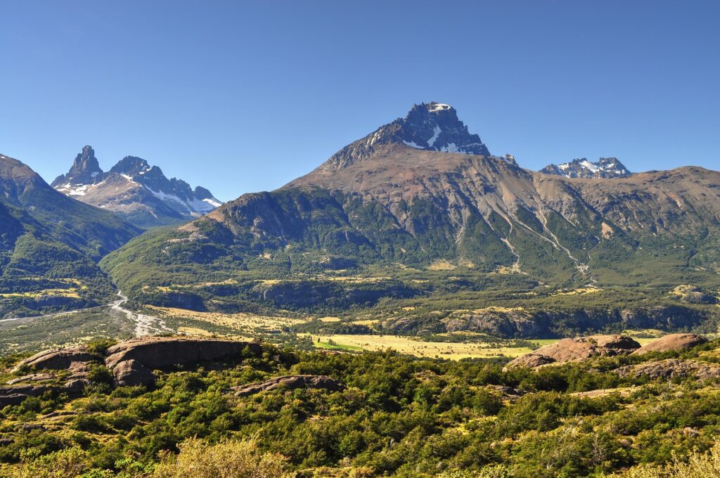
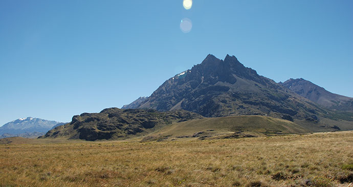
Cerro Castillo
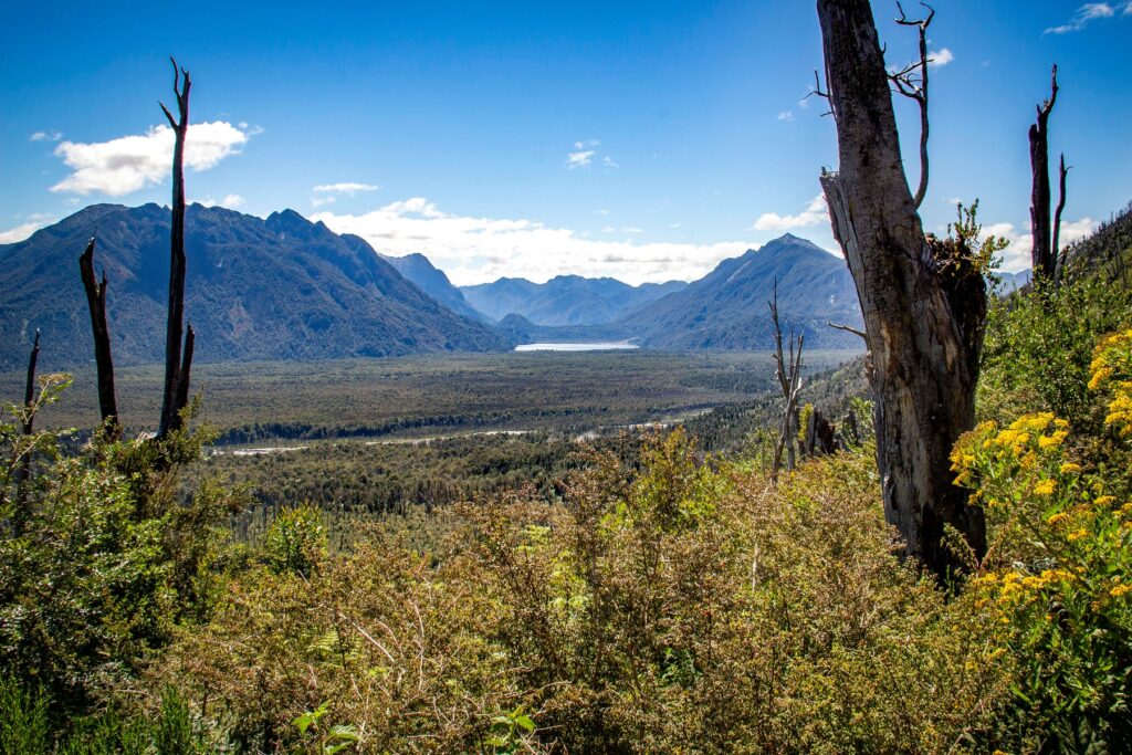
The dramatic approach to the village of Cerro Castillo offers vast panoramic vistas of the entire valley, with the snow-capped mountain range of the same name glistening to the west. A dozen hairpin bends later, the village itself is fairly drab, serving as a mere springboard to the mountain that deservedly features on most itineraries along the Carretera Austral.
Besides the beauty of the valley, Cerro Castillo offers some of the most accessible trekking and horse riding opportunities along the Carretera. The jagged basalt peaks are the crown jewel of the national reserve, named for the resemblance to the battlements of medieval castles, and reach an altitude of 2,675m.
The reserve covers 1,380km² of rugged mountains and roaring trout-filled rivers, waterfalls, hanging glaciers, lagoons and native bush. Indeed, Cerro Castillo, along with Parque Pumalín to the north and Parque Patagonia further south, are fast becoming as iconic a Patagonian trekking destination as the more established treks around Torres del Paine and El Chaltén.
What to see and do in Cerro Castillo
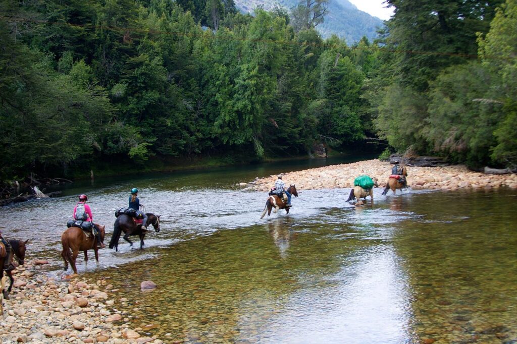
Horseriding
This is a wonderful area for horseriding with many breathtaking views of snow-capped mountains, roaring rivers and picturesque lakes and it is a lot easier (and quicker) to ride a horse along this steep, bush-clad, mountainous terrain than it is to attempt it on foot. Cerro Castillo has a strong gaucho history as the horse was the main form of transport until recent times when the road was fully developed.
Many of the old cattle trails used by the farmers to transport their cattle to market are now being rediscovered through horse trekking in the region, and tourists can now get off the beaten track and experience the true gaucho culture – Senderos Patagonia offer treks, including one to the lagoon at the top of Cerro Castillo.
Museo Escuela
After years of neglect, the old Cerro Castillo School has been restored – it was recognised as a national monument in 2008 and inaugurated in January 2014 as a museum. This impressive two-storey school was built by settlers in 1955 and operated for 16 years. Its original construction used traditional materials and building techniques. Its outer walls are brick, the floor and rafters were hand- cut from enormous tree trunks, and the spectacular roof was constructed with hand-carved tejuela wood shingles. This beautiful building now serves to educate visitors about the settlers of Valle Ibáñez and the first inhabitants of the area. These were groups of hunter-gatherers who occupied these lands more than 9,200 years ago. The focus of the museum is on the historic problems of education in an isolated region, forcing parents to send their children far away to boarding schools, and the impact that had on families.
There is a large viewing platform to admire the landscape of the Río Ibáñez and Cerro Castillo. Below is a central investigation centre where archaeologists investigate more than 80 recorded sites of the original inhabitants of the area. Geologists and volcanologists also use the on-site laboratory to study the active and sometimes destructive nearby Volcán Hudson.
Paredón de los Manos archaeological site
This site is located only 200m before the Museo Escuela and is an excellent opportunity to explore ancient Patagonian culture and see the traces left by the Tehuelches. The Valle Ibáñez is one of the most important archaeological regions in central Patagonia. The Paredón de los Manos is a rock wall protected under an overhang with handprints of adults and children dating back approximately 3,000 years. The Tehuelche artistic style was constantly evolving with some of the earlier paintings depicting hunting scenes of guanacos. Later they began to portray hands as positive and negative images. They painted with a mixture of dyes, including blood and mineral oxides blown through a hollowed-out guanaco bone.
Fortunately most of these paintings are protected from the elements. The guides are informative and give a brief description of the hunting that took place in the valley below. Some speak basic English.
Reserva Nacional Cerro Castillo
This 18,000ha national reserve is located 75km south of Coyhaique, and its main attraction is the impressive south face of Cerro Castillo (2,675m). The basalt spires are the crowning centrepiece and from a distance this mountain looks like a medieval castle. The upper slopes are covered with large névés and hanging glaciers, and below the formidable mountain peaks are beautiful valleys with roaring rivers and southern beech forests.
The reserve headquarters are located at the southern point of Laguna Chiguay on the Carretera Austral, 60km south of Coyhaique and 35km north of Cerro Castillo. A great website for more information, including maps, camping areas, park fees, etc, is parquenacionalcerrocastillo.cl.
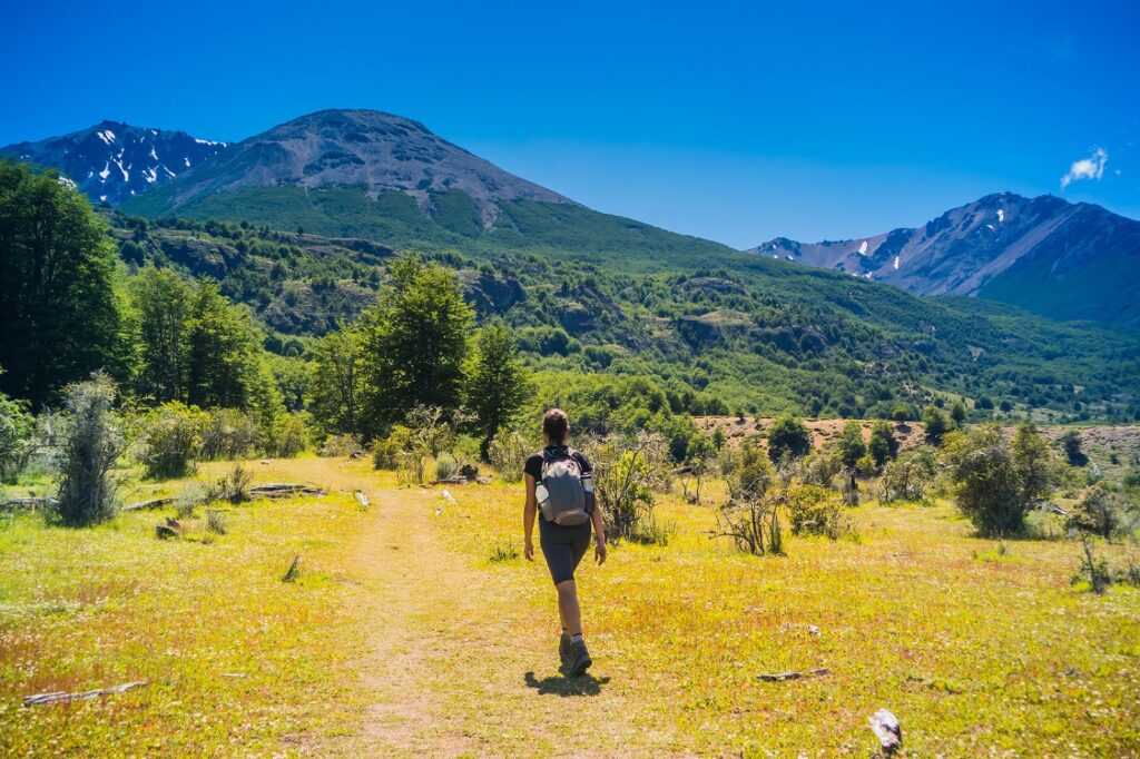
Trekking
The best time to trek Cerro Castillo is between mid-November and late March, subject to weather conditions – be aware that extreme weather and snow storms with gale-force winds can occur even in January. There are no refuges and mountain guides recommend a four-season tent, a three-season sleeping bag, layered thermal clothing and rainwear to cover all possible weather conditions. Trekking poles and hiking boots with ankle support are recommended, especially to assist with river crossings, steeper descents and rocky scree.
For river crossings a pair of sandals are a useful accessory. A mountain stove and food for an extra couple of days are prudent accessories in case you have to wait out a storm. Do not forget a brimmed hat, woollen hat, sunglasses and sunscreen. Be prepared for strong winds on the higher mountain passes. There are abundant water sources throughout the trek, apart from when crossing mountain passes. Wild camping and fires are not permitted, but there are campsites with bathrooms. The Chilean phone service provider Entel has a reasonable signal on the mountain passes.
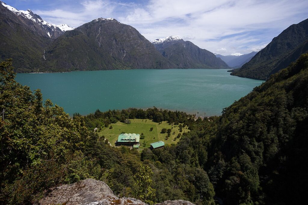
Cochamó
One of the lesser-known entry points to the Carretera Austral, this delightful village is perched on the edge of the Reloncaví Estuary. Trekking options abound – it is colloquially referred to as ‘the Yosemite of Patagonia’. Longer treks extend across the border to the Argentine towns of El Bolsón and Bariloche.
Founded in 1979, Cochamó (population 4,000) is a delightful town situated on the Reloncaví Sound. It has a pleasant central square and church, and great views when the sun shines. However, shopping options are limited, and there is neither an ATM nor a petrol station in the town, so come prepared and fill up at Ensenada, Río Puelo or Hornopirén.
While there’s not a great deal to keep visitors occupied within the town itself, the surrounding region, and in particular the interior mountainous section towards the Argentine border, has been christened ‘the Yosemite of Patagonia’ by climbers and hikers alike. The Valle Río Cochamó is accessed 5km south of town on a north eastern detour. It may not compete with the parks of Torres del Paine and Cerro Castillo further south, but the region is certainly worth a visit.
What to see and do in Cochamó
Sightseeing and excursions
Cochamó may appear a sleepy town, but there is a huge amount to do in the surrounding region, with excellent trekking, riding and climbing. There are also kayaking options, but given the abundance of alternatives further south, it is perhaps not something to prioritise here.
There are currently around 160 marked climbing routes, although this is growing, with 100 big-wall routes, including a 1,200m route (Tigres del Norte, 5.12d). Pitches range from 5.6 to 5.13. For kayaking, talk to Cristian Cea at Patagonia Nativa, who speaks English, offers tours, and knows all the guides in the region.
The trekking options are extensive, and of particular interest to those travelling the length of the Carretera Austral is the option to hike directly to or from Argentina, from either Cochamó or Río Puelo. The scenery in this region is simply jaw-dropping, and the trekking is some of the best in Patagonia.
The treks are generally not technically demanding and are accessible to anyone of reasonable fitness, especially when done partially on horseback. The trails are usually well marked, and a guide is optional for those with basic experience of trekking. In high season it is likely other trekkers will appear periodically along the way.
Owing to the array of interconnected treks it is highly advisable to obtain a map, available to download at turismo.municochamo.cl/mapas.php. Alternatively, you can purchase one from Stanfords.
Trekking in Valle Río Cochamó and Valle Río Puelo
For those wishing to combine a journey along the Carretera Austral with some trekking, the route between Cochamó and Argentina, which connects with an array of trails extending as far south as Hornopirén, is one of the best options in the region. Although short walks are possible, most people spend at least five days trekking in this area.
Leave Cochamó on the main road south, and turn left just before the bridge over the Río Cochamó to the east (about 3km from the southern exit of the village.) The gravel road continues for about 6km, accessible by car, but at the park ranger station the road ends, and from this point the route is accessible by horse or on foot only. It is possible to camp here. The main destination is La Junta, often referred to as ‘the Yosemite of Patagonia’, 13km from the park ranger station, where basic accommodation and food are available.
This leg is moderate and takes about 4 hours. La Junta has four campsites. During high season (15 December–15 March) you must book accommodation in advance online and register when beginning the trail. La Junta has large granite walls for climbing and various treks of approximately 7 hours, each offering spectacular views of the valley. Camping in La Junta and exploring these trails is highly recommended.
Continuing along the valley beyond La Junta and towards the Argentine border enters significantly more remote terrain, and is more physically demanding. From La Junta the trail continues for 10km (5hrs) along Valle Cochamó, involving three river crossings – there are no bridges, so be particularly careful if there has been recent rainfall. There is a large waterfall at the Río El Arco and a shelter on the other side of the river provides an alternative to camping.
The trail continues from this shelter further east through an alerce forest (less than 1hr, relatively flat), but pay attention in this section not to lose the trail. It then ascends to the southern shore of Lago Grande (campsite) and then to the northern edge of Lago Vidal Gormaz (8km from Río El Arco), with steep sections and passing several small lakes – it’s potentially treacherous along this stretch if it is raining.
The main trail heads 11km south along the west coast of Lago Vidal Gormaz to the small bridge at Torrentoso. Here the trail divides once again. Head northeast along the northern bank of the Río Manso for 9km to Paso Río Manso (½ day). Crossing into Argentina at this border will eventually lead to the legendary Ruta 40 highway running the entire length of Argentina roughly midway between Bariloche and El Bolsón. Alternatively, head south from Torrentoso along the western bank of the Río Manso. This southern route is 24km, with campsites available, and ends at the village of El Manso (2 days, potentially treacherous if raining).
From El Manso there are three options: a 15km one-way trek east to Valle El Frío; continue 20km south along the gravel road through the beautiful Valle Río Puelo towards the village of Llanada Grande (walking, hitchhiking or taking a bus that passes El Manso around noon); or walk 12km northwest along the gravel road to Punta Maldonado at the southern edge of Lago Tagua Tagua, take the ferry across the lake and head down to Río Puelo, completing a fantastic hiking circuit without backtracking.
In Llanada Grande you can stock up on food and continue walking, or hitchhike or take the daily bus south towards Primer Coral and Segundo Coral (camping and accommodation are available in all three). From Segundo Coral it is approximately 4km east to the southern shore of Lago de Las Rocas (where the Chilean carabineros are based, a mandatory stop for the border crossing paperwork).
Camping is possible on the lakeshore. It is an 8km trek along the northern shore of the Lago Puelo Inferior to the actual border, and 4km further to the Argentine gendarmerie (border police). The exit point from this trail is the Argentine town of Lago Puelo, some 10km south of El Bolsón.
Other trails
Other trails exist in this region but these require guides, and the state of the trails is questionable. From Primer Coral it is possible to trek west along the Río Ventisquero some 17km, but crossing the mountains at the end of this trail qualifies as an expedition for professional mountaineers, and it is not clear if any guides can offer this route. Lago Pinto Concha, south of Río Puelo, is accessible from Hornopirén. Road V-725, just before crossing the Río Puelo Chico bridge when entering Río Puelo, continues for 11km south along the Río Puelo Chico.
Some maps suggest a trail leads from the end of this road southwest to the northern shore of Lago Pinto Concha and connects with the trail to Hornopirén, but this trail is not confirmed and passes through private property. Anyone attempting it should be well prepared, seek local information either in Río Puelo or Hornopirén, and ideally go with a guide. As the crow flies, the end of V-725 to the northern edge of Lago Pinto Concha is only 9km.
A final trek in the region offers an exciting, albeit long trek, to Bariloche: the Ruta de los Jesuitas. This is an old trail connecting Ralún in Chile to Pampa Linda in Argentina (at the base of the Volcán Tronador close to Bariloche). There is also a well-marked trek from Pampa Linda to the main treks around Bariloche: it is possible to trek from Bariloche to Ralún and connect with the treks originating in Cochamó and Río Puelo all the way to Hornopirén.
While not requiring technically advanced skills, this is a large logistical undertaking and beyond the scope of this guide. Trekking from Ralún to Pampa Linda takes between five and seven days, with a further four days to Bariloche.
Futaleufú
Upon arrival it becomes pretty apparent what the main draw to ‘Futa’ is. There are as many kayaks as cars in the town, and every other business is somehow related to kayaking or rafting. The town is surrounded by mountains and retains a frontier feel reminiscent of towns in Alaska. The inhabitants are generally pretty laid-back and, when not in the water, the central plaza is a good place to relax and have a fruit juice.
Fly-fishing and trekking are also possible, but the Río Futaleufú is considered one of the top rivers worldwide for rafting, and most visitors come here to dip their toes in the water.
What to see and do in Futaleufú
Rafting and kayaking
The main attraction in the region is world-class rafting and kayaking. Professionals from across the world visit this town specifically to raft the river, so if you have never rafted before but were always curious, this is possibly the finest place in Latin America to do so.
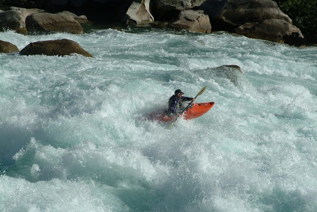
Up to class V+ rapids offer even the most experienced kayakers a serious challenge, and the Río Futaleufú is notably safe as the main white-water sections are invariably followed by more tranquil waters which makes rescue operations easier. The Río Espolón has class III rapids suitable for less experienced rafters, and is offered by most of the operators listed.
Horses
At the northeast corner of town lies the all-important rodeo, La Medialuna. Horse-related activities are taken very seriously both here and in Palena, a consequence of the gaucho legacy. Next to the rodeo is a small lake, Laguna Espejo, and a short trail around the north shore of the lake leads up to a viewing platform, Torre de Agua, with sweeping views over the town and valley.
Hiking, trekking and rock-climbing
A number of horse, hiking and mountain-biking trails surround Futaleufú for those less interested in rafting, generally following the main rivers. To the northwest of the town are a number of lakes and trails, as well as fishing options. Day treks include Lago Azul, Lago los Cedros and Piedra del Águila – Las Cascadas del Lago Espolón. Multi-day treks are possible around Espolón. There are also rock-climbing routes in the region – ask at Las Natàlias.
Patagonia Elements offer some non-river trips, but only two tour operators focus on non-river activities: Carpintero Negro and Otro Turismo. Indeed, Futaleufú is almost a victim of its own success – rafting and kayaking have so dominated tourism in the region that other activities seem to have been squeezed out. These two operators are noteworthy for trying to promote the other (often amazing) activities the village offers.
For something completely different, Somos Patagonia offers canopy tours suitable for anyone over five years old (under nine with guide). This is a short half-hour trek up, followed by six descents covering 800m.
The 12,000ha Reserva Nacional Futaleufú lies to the south of the town and has three trails and a couple of miradores, easily accessed by car. For the more adventurous, and with the advice of the CONAF guard, it is possible to hike through the reserve and on to Palena. There is a road heading south through the valley towards Cerro Cónico, but then an unmarked trail begins – this is for experienced hikers only.
Parque Nacional Patagonia
Following the merger of this park with Tamango and Jeinimeni national reserves, this has become one of South America’s leading parks, with abundant wildlife, countless lakes, excellent short and multi-day hikes and stunning scenery.
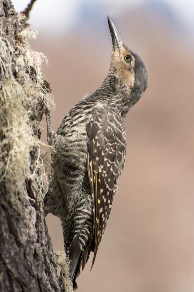
This national reserve is up there with the finest parks in the region, with a stunning trek all the way to the Roballos border crossing with Argentina, the headquarters of Parque Patagonia or to Cochrane. Established in 1967, the Jeinimeni sector (originally a national reserve rather than a national park) extends for 161,100ha and was merged into Parque Patagonia on 11 December 2018. Flora and fauna abound – a variety of woodpecker species, condors, black-chested buzzard-eagles,
huemul and guanacos. Only the very fortunate will spot the elusive puma.
Parque Pumalín
One of the first entirely private initiatives to protect major swathes of forest, pioneered by US conservationist Doug Tompkins, the park has a number of well-marked treks, campgrounds, two volcanoes, millennial alerce trees and is easily accessed from Chaitén.
If ever there was a reason to visit the northern section of the Carretera Austral, it is Parque Pumalín. US conservationist Doug Tompkins acquired the Reñihué farm in 1991 and over the following years the US foundation The Conservation Land Trust added substantial land to create the park.
In 2005 the park was declared a nature sanctuary and was managed by the Chilean Fundación Pumalín, until 2017, when it was donated in its entirety to the Chilean state and converted to a national park, affording it the highest level of environmental protection in Chile. As a result, it is entirely prohibited to fish, even with a permit. The park is now under the management of CONAF, and covers an area of approximately 300,000ha.
What to see and do in Parque Pumalín
There are two main sections to the park. Pumalín Norte is actually the more difficult to access, as visitors need to hire a boat from Hornopirén. Information on this section of the park is available at the Puerto Varas information centre. Pumalín Sur is more accessible. This part of the park is broadly divided into two sub-regions: the various trails and campsites located between Caleta Gonzalo and Chaitén; and those accessed from the extreme south of the park at El Amarillo – there are CONAF offices in all three locations.
The first park ranger station is located just north of the (old) landing strip approximately 10km north of Chaitén. South of Chaitén the Carretera is paved, and touches the park once more, at the southern extremity of Pumalín. This southern entrance is called ‘El Amarillo’, and located in the village of the same name, 24km south of Chaitén. The village of El Amarillo has undergone a major urban beautification scheme, sponsored by Conservacíon Patagónica (CP).
Where the Carretera Austral buckles south towards Lago Yelcho at the exit of El Amarillo, continue straight ahead into the park. The second park ranger and tourist information kiosk is on the right-hand side, and can provide maps and local information.
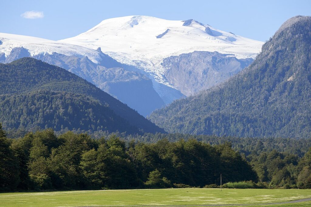
The road continues straight to the El Amarillo hot springs, or left into the park and to the trails and four campsites (Puente Carlos Cuevas, Vuelta del Río, Grande and Ventisquero El Amarillo). The Ventisquero campground, at the foot of Volcán Michinmahuida, is considered one of the most dramatic and spectacular settings for camping in Chilean Patagonia.
Hot springs are dotted along the length of the Carretera Austral, with perhaps the most famous being the Puyuhuapi Lodge and Spa. The El Amarillo hot springs (ask in El Amarillo for opening times; $7,000 pp/day), about 5km northeast of the park’s southern entrance, are worth visiting.
There are various pools filled with thermal water originating from Volcán Michinmahuida, said to possess healing properties, and undoubtedly containing sulphur. The springs are located among lush vegetation, well beyond the reach of mobile-phone coverage, and with ample picnic areas, a quincho and five barbecues. On 16 May 2020 a landslide destroyed the neighbouring lodge, and the springs were closed for some months.
The village of El Amarillo underwent a ‘beautification’ project supported by Tompkins Conservation shortly after the eruption in 2008. Almost all the local residents participated in upgrading both the public use areas, and private residences in the village, and constructing new facilities such as a supermarket. Pumalín’s landscape architects and builders painted houses, planted trees and flowers, and transformed the village in a very visible manner.
Walking trails
Here are eight trails in the park between Caleta Gonzalo and Chaitén. Seek up-to-date information from the park rangers or information centres at entrances to the park, as new trails may open and existing trails may close, or be undergoing temporary maintenance. Although maps are available from the tourist information kiosk, the trails are very well marked and it is easy to do them independently. The main ones along this section (listed from north to south) include:
Caleta Gonzalo–Cascadas trail – 6km round trip; 2–3hrs; easy – A loop following a river to the waterfalls. Well-maintained path with frequent boardwalks spanning wet sections.
Tronador trail – 5km; round trip; 4hrs; difficult – An initial ascent along a gorge, views over snow-capped Volcán Michinmahuida, arriving at the amphitheatre Lago Tronador.
Alerce trail – Under 1hr loop; easy – A short trail through a section of forest housing a number of impressive alerce trees approaching 3,000 years of age. The alerce has been cut to near extinction over the previous 2 centuries for its valuable wood. The path is well maintained & contains occasional explanatory boards.
Cascadas Escondidas trail – 4km round trip; 2hrs; medium – A fantastic trail alongside a river, to a series of increasingly impressive waterfalls. Wooden boardwalks are well maintained, but take care when climbing the wooden ladders which may be slippery. A small detour on the way down goes via approximately half a dozen alerce trees of impressive size.
Volcán Michinmahuida trail – 24km round trip; 10hrs; difficult – Probably the most physically demanding of all the trails in this section of the park, traversing forest, volcanic basalt & an unnamed glacier.
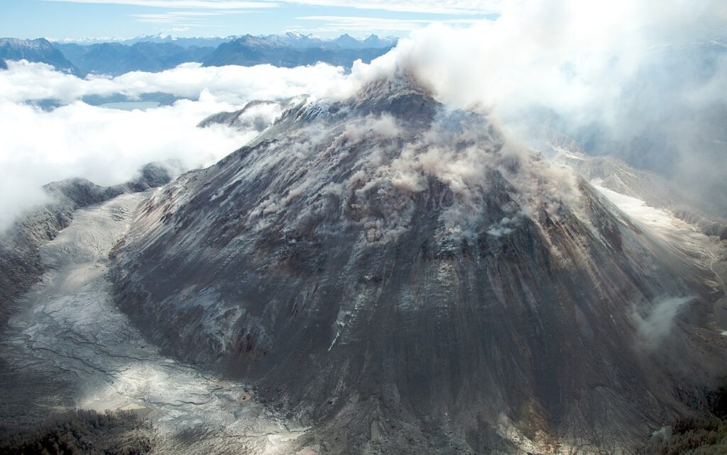
Volcán Chaitén trail – 4km round trip; 3hrs; medium – This trail heads to the edge of the Chaitén crater, where steam emerges from the ground on the far side. One of the most accessible volcano hikes on the entire Carretera Austral, & well worth the effort. Having lain dormant for nearly 10,000 years, in May 2008 this volcano erupted, causing massive devastation to the nearby town.
Darwin’s Frog trail – 2.5km round trip; easy – An informative loop explaining how forests grow following logging or fire. Pick up the interpretive guide in the tourist information centre at the
entrance to the park. Darwin’s frog is endangered & rather small, but can be seen along this trail, although perhaps only by those with a trained eye.
Ventisquero El Amarillo trail – 20km round trip; 6hrs; easy – An excellent trail to the base of a glacier protruding from the south side of Volcán Michinmahuida.
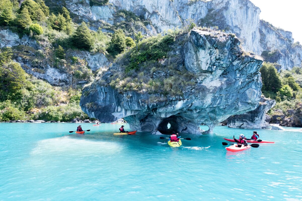
Puerto Río Tranquilo
Thanks to some extensive marketing Puerto Río Tranquilo has emerged as a tourist hub. The town is not particularly attractive, but is located close to some marble caves which draw tourists by the thousand meaning that, during peak times, finding accommodation and transport can be problematic; be sure to make advance reservations.
The sheer volume of tourists also makes hitchhiking tricky – in fact, Tranquilo and the road to Chile Chico are the most difficult sections for hitchhiking on the Carretera Austral – and public transport is scarce. However, while the town itself may be underwhelming, it is well located. Just across the lake is the lovely village of Puerto Sánchez, with caves at least as impressive as those of Puerto Río Tranquilo. Some 28km south is the entry point to the Ventisquero Leones. From Puerto Río Tranquilo, it is only 49km to the junction at Cruce El Maitén, where the Carretera Austral continues south towards Cochrane and east on one of the most important subsidiary roads along the spectacular south side of Lago General Carrera towards Chile Chico and into Argentina.
What to see and do in Puerto Río Tranquilo
Marble caves
The original attraction in Puerto Río Tranquilo is the network of marble caves. The glacial waters of Lago General Carrera have eroded the limestone walls surrounding this section of the lake over centuries to form unusual, Salvador Dali-esque caves. These structures appear almost to have melted into the water, supported by frozen-in-time lava-like columns which disappear into the watery base of the caves.
Some of the caves are large enough for small boats to enter. On sunny days the light reflects off the cave walls and from the relatively shallow pools at the bottom of the caves creating surreal ripple-like patterns along the walls while the water itself reflects in myriad shades of turquoise.
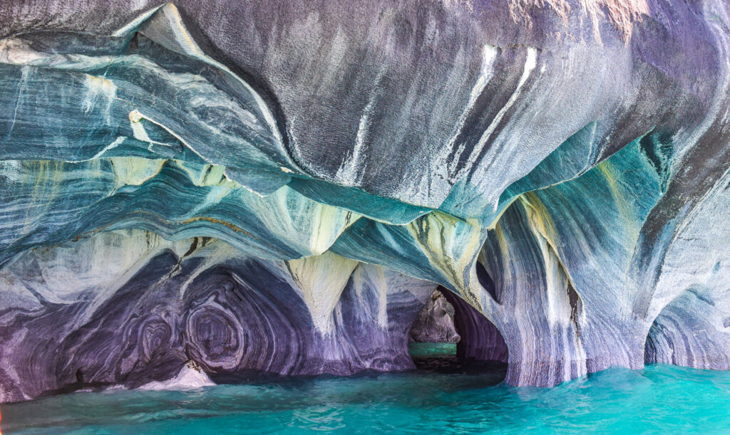
Countless operators offer trips to the caves and there is no need to book in advance. The journey typically takes around 2 hours including the ride to and from the caves, and boats leave from the shore of the lake next to the Carretera in the middle of the town; it can be rough and cold so be sure to take a windproof jacket.
It is possible to kayak to the caves (the same vendors of the boat trips also rent kayaks), but do consider the strength of the wind, particularly when attempting to return in the evening. The standard boats take approximately five to seven people and cost $15,000 per person.
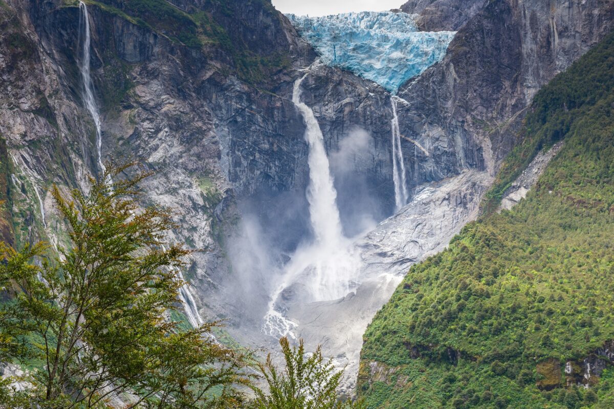
Ventisquero Exploradores
The second key attraction around Puerto Río Tranquilo is the relatively accessible glacier approximately halfway along the 51km road to Bahía Exploradores. A short trek up to a viewing platform permits views over the Ventisquero Exploradores, and tours are available to hike down to, and on to, the glacier itself. The hike to the viewing platform is well marked and not technical. However, people with limited mobility and young children may find it exhausting, and slippery. There is no public transport along this road, and few people live along it so hitchhiking is difficult.
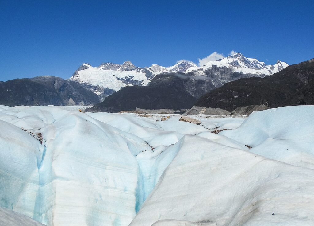
The glacier emerges from the Northern Ice Field, and as such is part of the Parque Nacional Laguna San Rafael, and thus accessible to all. A nominal fee was charged to those wishing to traverse the private property that leads to the viewing platform (belonging to the owners of the El Puesto hostel). However, in March 2015 Victor Osorio, the Minister of Bienes Nacionales, announced that they had restored free public access to the glacier. ‘We have realised an act of justice, to re-establish public access to an asset that belongs to all Chileans.’ The entry point is now managed by CONAF, who charge the same price as for the rest of Parque Nacional Laguna San Rafael.
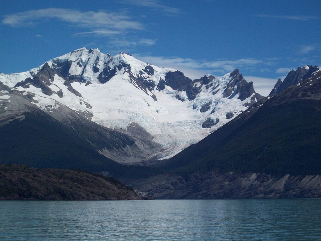
Parque Nacional Laguna San Rafael
This park is fast becoming a key tourist attraction for the entire Carretera Austral region, facilitated in part by the road connection from Puerto Río Tranquilo. Previously access was possible only from Puerto Chacabuco or Puerto Montt on more expensive boats travelling far greater distances or by charter plane. The national park extends as far south as Caleta Tortel but in practice the main access points are to Ventisquero San Rafael (by boat), Ventisquero Leones (trekking and boat), or Ventisquero Steffen near Caleta Tortel (trekking and boat).
Experienced trekkers can enter the park independently at other locations, and guides are available in Puerto Bertrand and Cochrane for multi-day hikes towards the ice field, but these are non-standard treks for experienced hikers and mountaineers. There are no formal, marked trails in the park authorised by CONAF.
Ventisquero San Rafael
The most common reason to enter the park is to visit the Ventisquero San Rafael, and this is only possible with a guided tour as a boat is required, and the park fee is included in the tour price. Flights over the glacier can be arranged by charter, with Patagonia Helitours or with Aires del Sur.
The boats travel down the Elefantes Canal and then through a relatively narrow channel into the laguna itself, at which point the glacier becomes visible. Initially it appears to be of modest size, until you realise the size of the laguna; from this distance it is possible to see up on to the ice field behind the glacier and appreciate the sheer magnitude of ice.
The Northern Ice Field is the smaller of the two, covering 4,200k² and extending 120km from north to south. As the boat approaches the snout of the glacier the icebergs become larger, and it is probable that you will see chunks of ice calving off the glacier.
The pressure caused by the sheer volume of ice squeezes the air bubbles out of the snow as it is subsumed into the glacier, and because compacted ice better absorbs light at the red end of the spectrum, the light reflected from the glacier appears surprisingly blue. Particularly on a sunny day the contrast of the bluish glacier, the ice field behind, the lake, icebergs and sky are simply mesmerising. The only sounds are the occasional bird and the groaning of the glacier as it inches forward, sometimes interrupted by the thunderous roar of chunks breaking off.
A trip to the Carretera Austral is incomplete without a visit to a glacier, where you can watch in real time the mechanism that shaped much of our planet, and the Ventisquero San Rafael is one of the more accessible glaciers in the region. Well worth a visit, or consider the Leones glacier slightly further south for a more isolated and strenuous trip.
Villa O’Higgins
The end, or beginning, of the Carretera Austral, sandwiched between lakes, glaciers and mountains, the border crossing to El Chaltén in Argentina is one of the lesser-known and yet most iconic crossings on the continent.
The picturesque region around Villa O’Higgins is rugged – dominated as it is by dramatic rivers and glaciers, but it is also relatively inaccessible. As such, despite the ample trekking options in this area, most visitors spend their time here planning their onward journey north or south. Villa O’Higgins is the last border crossing into Argentina along the Carretera Austral, for those without a vehicle. The border crossing is only open in the summer (1 November–30 April) and can only be used by pedestrians and cyclists. Information relating to this crossing is scarce and many believe it’s not actually possible to get into Argentina from here. For those with patience and budget available, it is possible to take a short but spectacular flight over the ice field here, but the weather is volatile and the prices are punchy.
What to see and do in Villa O’Higgins
Sightseeing and activities
Within Villa O’Higgins there are relatively few highlights. Besides some basic shopping in small stores, or visiting the museum, most activities are outside the village. Fly-fishing and birdwatching are popular activities, possible both with and without a guide. Trekking options relatively close to the town include to the Mirador Cerro Santiago, just 30 minutes (1km) from Villa O’Higgins on a well-marked trail, which overlooks the village, the native bush and the mountains in the background. The trail continues for another 40 minutes to a second viewpoint with stunning views of the surrounding mountains, rivers, lakes, bush and glaciers.
There are treks to the viewpoint of the Mosco glacier and the Río Mosco. The round-trip Mosco glacier trek takes 11 hours (10.2km), and is of medium difficulty. The Río Mosco trek takes 9 hours (8.6km) and is also of medium difficulty. Both treks are marked, but it is wise to use a guide to go to the Mosco glacier (see box, opposite).
The Padre Ronchi Museum is a small, quaint museum located in a restored chapel that was originally built under Father Ronchi’s supervision in 1977. Most of the exhibits have signs in Spanish about the history of Father Ronchi and the early settlers around Villa O’Higgins. His bedroom with some artefacts is at the back. The museum is, however, of limited interest to those not yet familiar with the history of Ronchi and his legendary status in the Aysén region.
Paso Río Mayer and Lago Christie
This is a pleasant, scenic detour for those with a high-clearance vehicle, beginning 6km north of Villa O’Higgins and passing a number of glaciers en route to the lake. A gravel road of 45km leads to the Argentine border at Río Mayer and on to Lago Christie. The road passes a small chapel built by Father Ronchi and still lovingly maintained. It incorporates an unusual roof-construction called canogas – interlocking hollowed-out tree trunks.
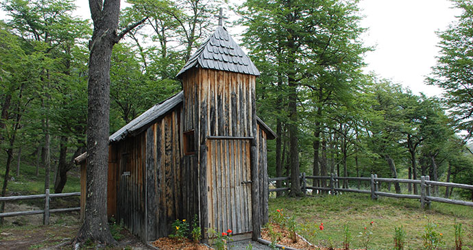 This small wooden chapel was built by Father Ronchi and is lovingly maintained to this day © Hugh Sinclair
The road continues to the Chilean border post where it is theoretically possible to cross into Argentina using the Paso Río Mayer. However, there is no vehicular bridge across the river on the Argentine side. Occasionally it might be possible to cross in a high-clearance 4×4 when the river is very low, ie: in winter. This section involves multiple river crossings. From the Chilean border control it is only 5km, as the condor flies, to Ruta 81 and the Argentine border control, a further 53km to the junction with the Ruta 35, and then 50km to the Ruta 40 at the Las Horquetas junction.
Ventisquero O’Higgins
Ventisquero O’Higgins can be seen either by boat or a several-day trek from Candelario Mancilla. Travellers are rewarded with a magnificent, up-close view of one of Patagonia’s largest glaciers. Upon approach, the boat passes floating icebergs, and the tongue of the glacier spills off the Southern Ice Field into the lake. The 100m-high jagged walls protrude out of the lake and the sounds of the ‘calving’ glacier resonate like thunder. The front face is about 3km wide, making it one of the biggest accessible glaciers in Patagonia. Lago O’Higgins reaches depths of 836m (the deepest point is close to the glacier), making it the deepest lake in the Americas.
Until 2020 the O’Higgins glacier was easily visited by taking the Robinson Crusoe boat and could be combined with going to/from Candelario Mancilla. Alas Robinson Crusoe was an early casualty of the pandemic, arguably not helped by local competitors with smaller boats. The boat was sold first, and now operates in Tierra del Fuego. The Robinson Crusoe tour operator closed, and the hotel was eventually sold, and continues to operate as Rumbo Sur Deep Patagonia Lodge. The glacier is now only possible to visit via an expensive charter boat and only when weather permits. Currently two boats serve the route between Villa O’Higgins and Candelario Mancilla – it remains to be seen whether there is sufficient demand post-pandemic to offer a scheduled detour to the glacier.
Related books
For more information, see our guide to The Carretera Austral:
Related articles
Attention adrenaline junkies!
From hot springs to glaciers, kayaking adventures to sleepy villages, the Chilean Carretera Austral is more than just an epic road trip.
Join MD Adrian Phillips on South America’s most challenging road.